Treasures of the Orient
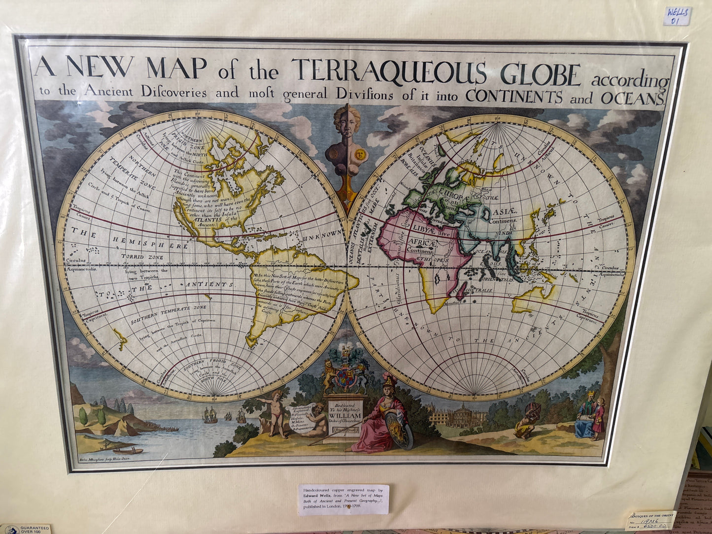
A New Map of the Terraqueous Globe - Wells 1700
A New Map of the Terraqueous Globe - Wells 1700
A New Map of the Terraqueous Globe
Drawn by: Edward Wells (Engraved by Benjamin Cole)
Published in: London
Year: 1700 (First Edition)
From: A New Sett of Maps both of Antient and Present Geography
Condition: Hand-coloured copperplate engraving; professionally matted.
An Educational Masterpiece of the English Baroque
This charming 1700 double-hemisphere map is one of the most celebrated works by the English scholar Edward Wells. Designed as an educational tool for his pupil, the young William, Duke of Gloucester (the heir to the British throne who tragically died the year this map was published), it seeks to reconcile "Ancient Discoveries" with the modern world of the 18th century.
Cartographic Highlights & Curiosities
Wells’ maps are prized for their "uncluttered" style and several famous geographical anomalies:
- California as an Island: One of the most visually striking features is the depiction of California as a massive, elongated island—a classic 18th-century cartographic error that remains highly sought after by collectors.
- The Legend of Atlantis: In the Western Hemisphere, a significant text block discusses the legendary island of Atlantis, reflecting the scholarly obsession of the time with connecting classical myths to the newly discovered Americas.
- Uncharted Lands: The map features a vastly incomplete "New Holland" (Australia) and a speculative coastline for the Northwest Passage, documenting the limits of British maritime knowledge at the turn of the century.
- Royal Dedication: The bottom vignette features a formal dedication to the Duke of Gloucester, accompanied by a view of Oxford, including the Sheldonian Theatre and Christ Church, where Wells taught.