Treasures of the Orient
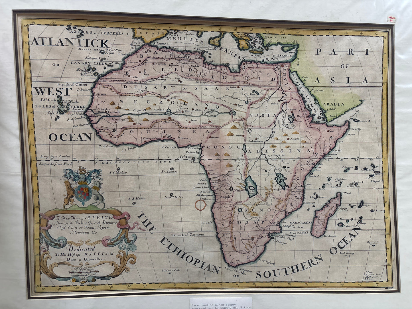
Map of Africa - Wells 1700
Map of Africa - Wells 1700
Wells’s Map of Africa (1700)
Title: A New Map of Africk Shewing its Present General Divisions, Chief Cities or Towns, Rivers, Mountains & c.
Cartographer: Edward Wells
Origin: Oxford / London, United Kingdom
Date: 1700
Technique: Copperplate engraving with original hand-colouring
The Narrative: Geography for a Future King
This map tells a story of royal education and the "Age of Enlightenment." Edward Wells, a mathematician and geographer at Oxford, designed this atlas specifically for his student, Prince William, Duke of Gloucester (the son of Queen Anne), to aid in his instruction on world affairs. Consequently, the map prioritizes clarity and elegance, presenting the vast and largely unmapped African continent in a way that was accessible to the English aristocracy.
It depicts a continent of mystery and colonial interest. While the coastlines are plotted with reasonable accuracy from centuries of maritime trade, the interior is filled with the speculative geography of the time—including the legendary "Mountains of the Moon" as the source of the Nile and the expansive but vaguely defined kingdoms of "Negroland," "Monomotapa," and "Abissina." It is a vibrant snapshot of how the world’s second-largest continent was perceived by European scholars at the dawn of the 1700s.
Chronicles of the Map
-
The Royal Dedication: The lower-left corner features a magnificent, oversized cartouche displaying the royal coat of arms and a formal dedication to Prince William. Tragically, the Prince died the same year this map was published, at the age of eleven.
-
Speculative Interior: The map illustrates the 18th-century lack of knowledge regarding the African interior, showing the Niger River flowing directly into the Atlantic and large, mythical mountain ranges bisecting the southern regions.
-
Maritime Naming: The surrounding waters are labeled with historic names such as "The Ethiopian or Southern Ocean," reflecting the archaic maritime terminology used by British sailors of the period.
-
Decorative Hand-Colouring: The vibrant pink and yellow washes used to distinguish the "General Divisions" make this map an exceptionally decorative piece for display.