


Treasures of the Orient
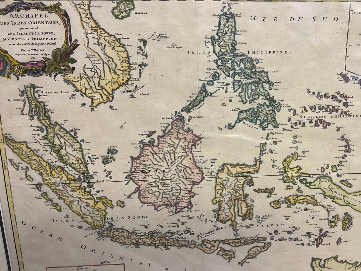
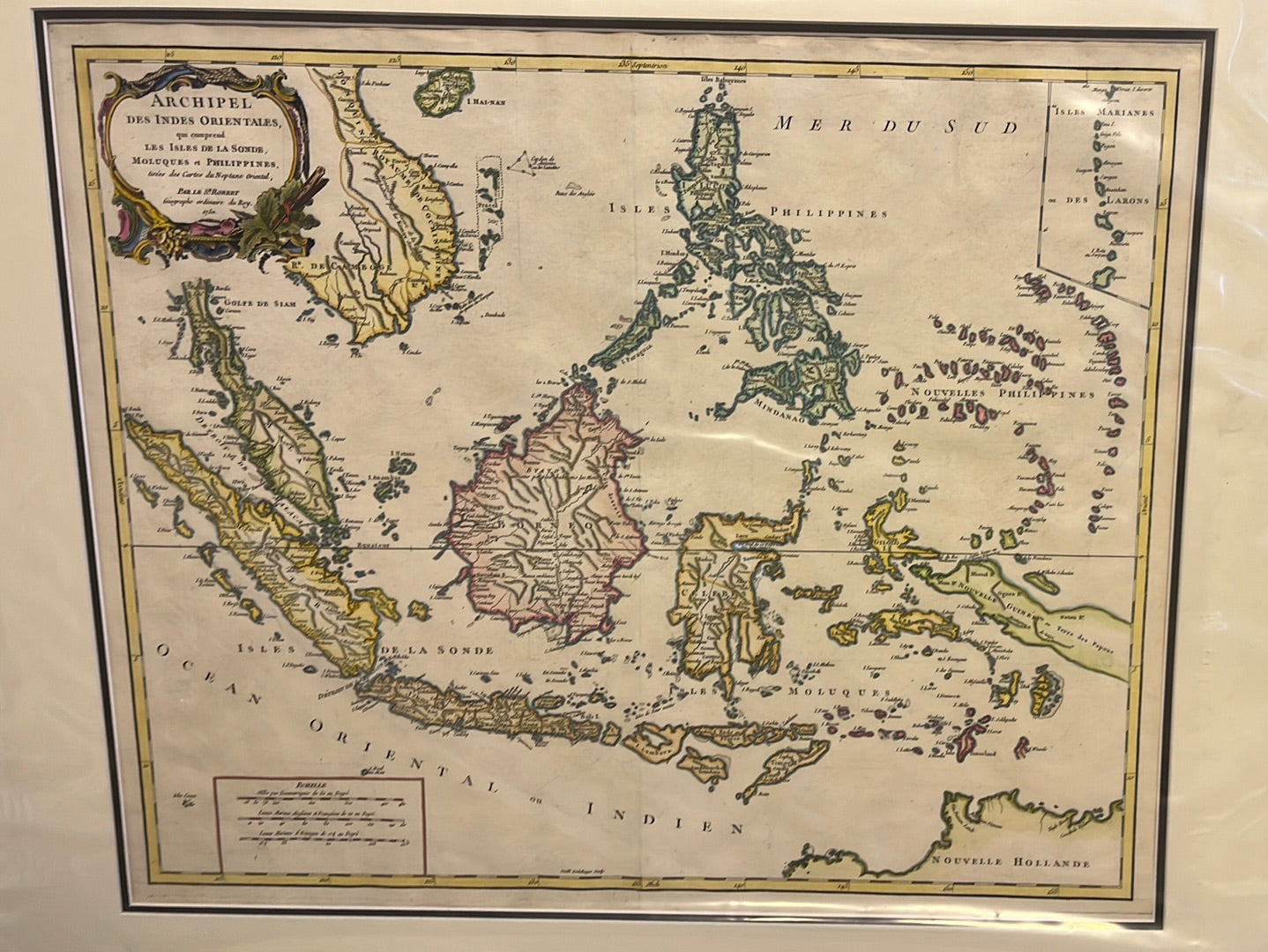
Archipel des Indes Orientales - Vaugondy 1750
Archipel des Indes Orientales - Vaugondy 1750
Archipel des Indes Orientales
Drawn by: Robert de Vaugondy (Gilles and Didier Robert de Vaugondy)
Location: Paris
Year: 1750 (First published in the Atlas Universel)
From: Atlas Universel (published c. 1752–1757)
Condition: Large antique 18th-century copperplate engraving; original hand-coloured outlines and a decorative title cartouche.
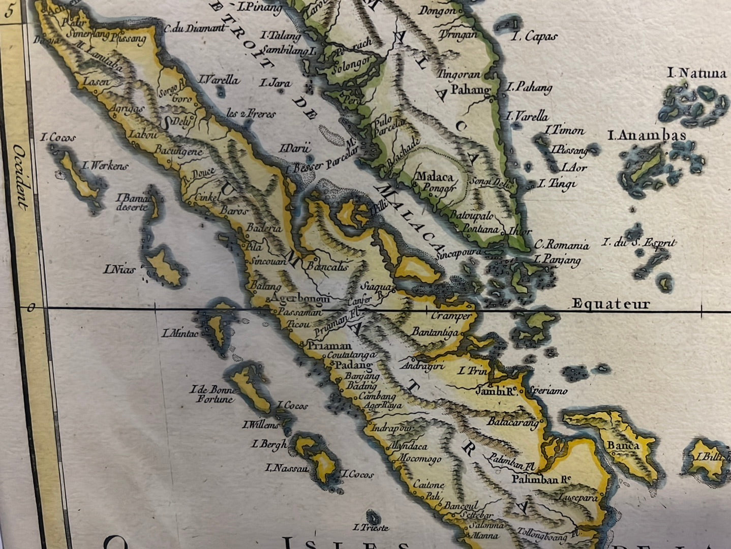
A Scientific Milestone of the French Enlightenment
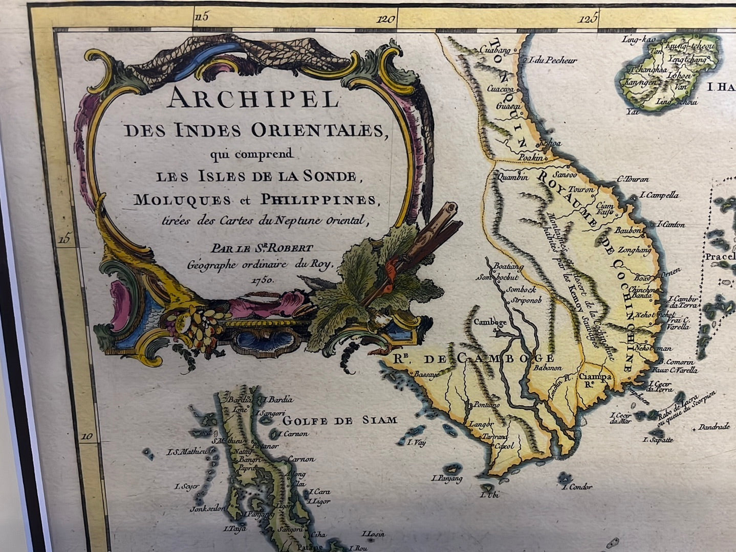
This 1750 map by the renowned father-son team of Gilles and Didier Robert de Vaugondy is a definitive record of Southeast Asia during the mid-18th century. Based on the rigorous surveys of the premier French geographer Jean-Baptiste d'Anville and nautical charts from the Neptune Oriental, this map reflects the transition of cartography into a scientific discipline, stripping away speculative myths for empirical data.
Southeast Asia
For collectors of regional history, this map is a vital artifact for several reasons:
- Singapore (Sincapoura): The island is clearly identified at the southern tip of the Malay Peninsula as Sincapoura. Its inclusion highlights the island’s long-standing recognition as a critical navigational waypoint on the route to China long before the colonial era of Raffles.
- Australian Coastline: Along the bottom edge, the map prominently features the northern coast of Nouvelle Hollande (Australia), documenting the Dutch maritime discoveries that were rewriting the global map in the 1700s.
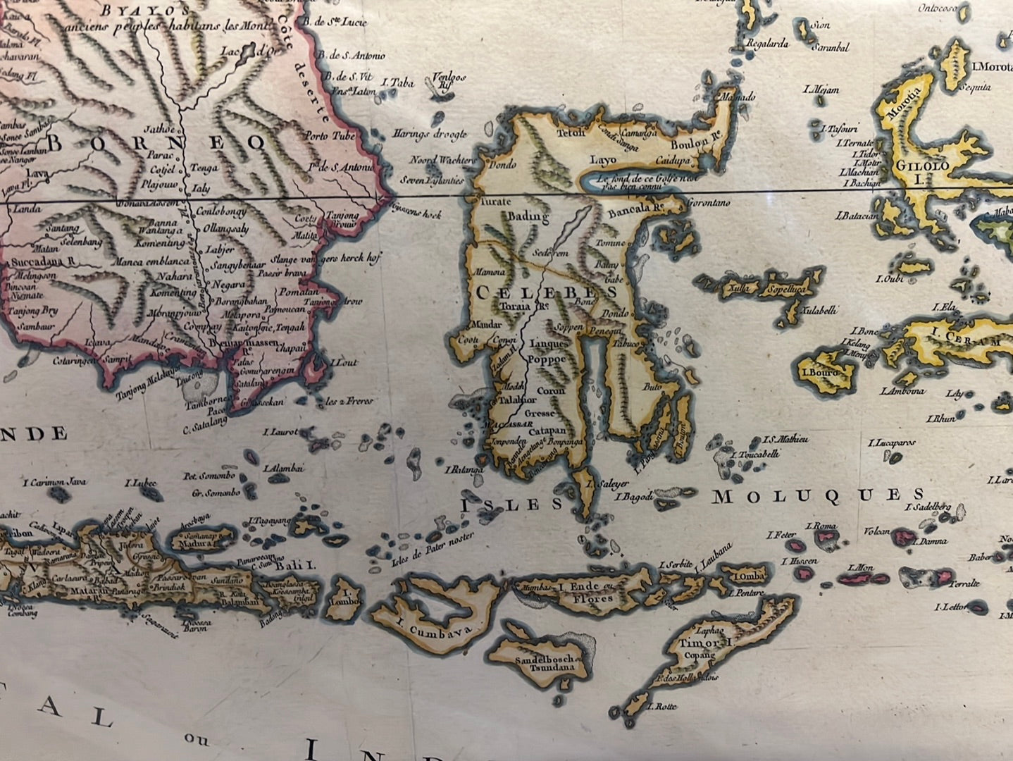
- Regional Scope: It provides an expansive view of the Philippine archipelago, the Moluccas (Spice Islands), Borneo, and the Indochina coast. A detailed inset in the upper right features the Mariana Islands (Isles Marianes), a strategic Spanish outpost in the Pacific.