Treasures of the Orient
Asia Concinnata Secundum - Lotter c. 1770
Asia Concinnata Secundum - Lotter c. 1770
Asia Concinnata Secundum
Drawn by: Guillaume de L'Isle (originally), Tobias Conrad Lotter (reissued)
Engraved by: Gustav Conrad Lotter
Published in: Augsburg
Year: c. 1770
Condition: Hand-colored copperplate engraving; professionally matted.
A Scientific Landmark of Enlightenment Cartography
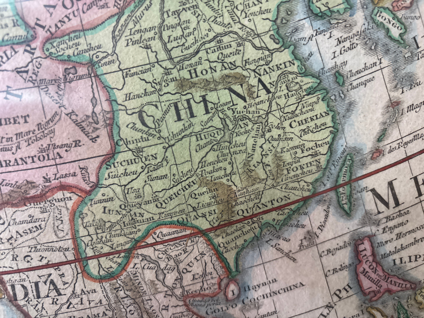
This 1770 map is a celebrated reissue of Guillaume de L'Isle’s influential map of Asia, published by the prominent German cartographer Tobias Conrad Lotter. De L'Isle was a pioneer of the "scientific" school of cartography, prioritizing empirical data from recent explorations over decorative myths, and this map represents his meticulously refined view of the continent.
Geographic Details and Enigmas
The map reflects the evolving European understanding of the Asian continent during the mid-18th century:
- Tartary & Siberia: Much of Central and Northern Asia is labeled as "Magna Tartaria" and "Tartaria Moscovitica," regions that were still being actively explored by Russian scientific missions.
- The East Indies & Oceania: To the south, the map encompasses the entire East Indian archipelago and includes the northern tip of New Guinea.
- The Northern Mystery: In the Northwest Pacific, the fictional "Terra de la Compagnie" is shown near Japan—a common cartographic error of the period. Interestingly, Japan itself is shown connected to the mainland by a speculative land bridge, while Korea is accurately depicted as a peninsula.
Artistic Flourishes
The map is anchored by a magnificent Baroque title cartouche in the upper left, featuring allegorical figures representing the varied cultures and commerce of Asia. The hand-applied wash coloring distinguishes the major empires and independent regions, creating a visually striking and intellectually significant historical record.