Treasures of the Orient
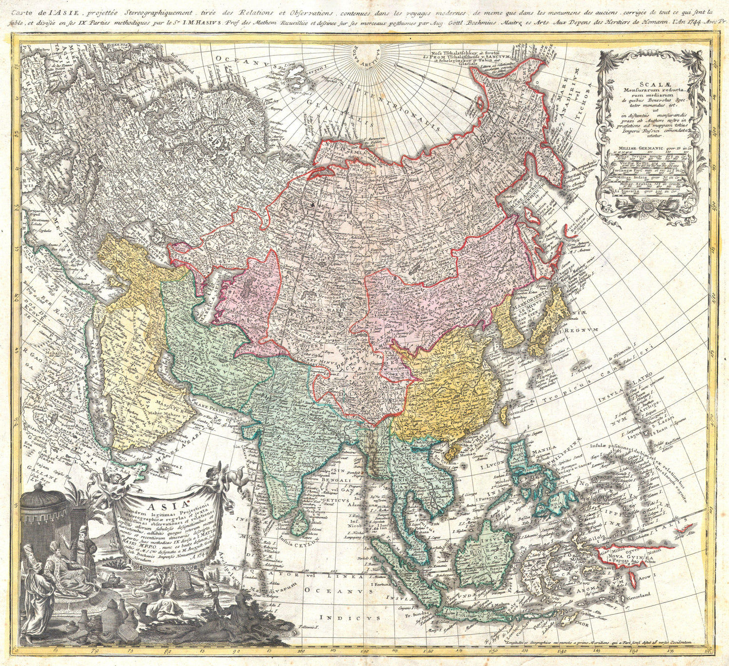
Asia - Homann Heirs 1744
Asia - Homann Heirs 1744
Asia Secundum Legitimas Projectionis Stereographicæ Regulas
Drawn by: Johann Matthias Hase (Hass)
Published by: Homann Heirs (Homännische Erben)
Location: Nuremberg
Year: 1744 (dated)
From: Maior Atlas Scholasticus or Atlas Compendiarius
Condition: Copperplate engraving with original hand-colouring.
A Scientific Landmark of Enlightenment Cartography
This 1744 map is a significant production by the Homann Heirs, the most influential German map-publishing firm of the 18th century. Drawn by the mathematician and cosmographer Johann Matthias Hase, the map is celebrated for its use of a stereographic projection, representing a shift toward the more empirical, scientific standards of the Enlightenment.
Geographic Details & Curiosities
The map captures a continent in the process of being "corrected" by modern survey work:
- Northern Discoveries: Kamchatka is reduced to a more accurate size compared to earlier 18th-century maps, and Siberia is meticulously detailed based on Russian surveys from the early 1730s.
- The Japanese Mystery: While China’s interior is well-documented via Jesuit sources, the North Pacific remains speculative. Hokkaido (Terra Eso) is shown distended and still attached to the Asian mainland, a common cartographic error of the period.
- The Southern Reaches: To the south, a partial coastline of "Nova Guniea" (New Guinea) is visible, marking the edge of European nautical knowledge at the time.
Artistic Flourishes
The map is anchored by a magnificent allegorical title cartouche in the lower left. It depicts an enthroned Asian monarch receiving offerings, accompanied by a lion and an elephant. In a curious twist typical of the era's decorative style, it also includes an incongruous American native with a feathered headdress—a symbol of the "exotic" often used interchangeably by European engravers.