Treasures of the Orient
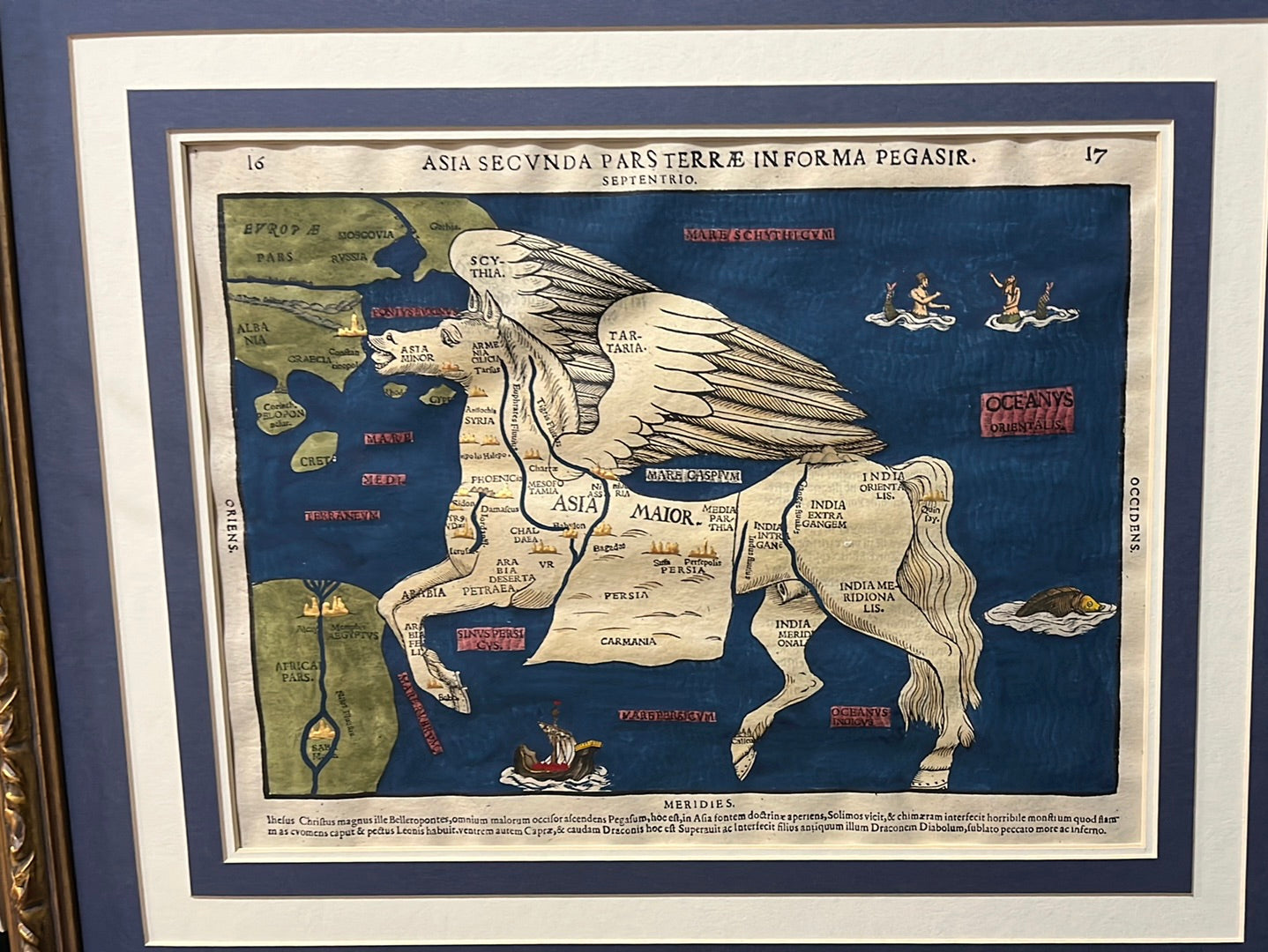
Asia Secvnda Pars Terræ In Forma Pegasir - Bünting 1581
Asia Secvnda Pars Terræ In Forma Pegasir - Bünting 1581
Bünting’s Map of Asia as Pegasus (c. 1581)
Title: Asia Secunda Pars Terrae in Forma Pegasir
Cartographer: Heinrich Bünting
Origin: Magdeburg, Germany
Date: First published c. 1581
Technique: Woodcut with vibrant hand-colouring
The Narrative: The Winged Continent
This map tells one of the most imaginative stories in the history of mapmaking. Rather than aiming for navigational accuracy, Heinrich Bünting—a Protestant pastor and theologian—sought to make geography accessible and memorable by rendering the continents in symbolic shapes. In this famous plate, the vast continent of Asia is transformed into the mythical winged horse, Pegasus.
The horse’s head represents Asia Minor (modern Turkey), its wings encompass the sweeping plains of Scythia and Tartary, and its forelegs extend into the Arabian Peninsula. The hindquarters and tail represent the "East Indies" and India, while the body contains the great empires of Persia and Mesopotamia. It is a masterpiece of the late Renaissance, blending early geographic knowledge with the artistic whimsy of the 16th century.
Chronicles of the Map
-
The Figure of Pegasus: The mythical horse is depicted mid-stride across the "Oceanus Orientalis" (Indian/Pacific Ocean), with its wings outstretched toward the north.
-
Biblical and Classical Geography: The map identifies key historical regions such as Chaldea, Babylon, and Arabia Petraea, reflecting the cartographer's focus on the lands of the Bible.
-
Renaissance Artistry: The surrounding seas are populated with charming maritime details, including a Galleon in the Red Sea and whimsical merfolk and sea monsters in the distant eastern oceans.
-
Hand-Coloured Detail: This specific example features deep, rich hand-colouring, particularly the striking blue of the surrounding oceans, which highlights the bold woodcut lines of the Pegasus figure.