Treasures of the Orient
Australia and East Indies - Johnson 1867
Australia and East Indies - Johnson 1867
Johnson’s Map of Australia and Southeast Asia (1867)
Title: Johnson's Australia and East Indies
Cartographer: A.J. Johnson
Origin: New York, United States
Date: 1867
Technique: Steel engraving with original hand-colouring
The Narrative: The Victorian View of the Orient and Oceania
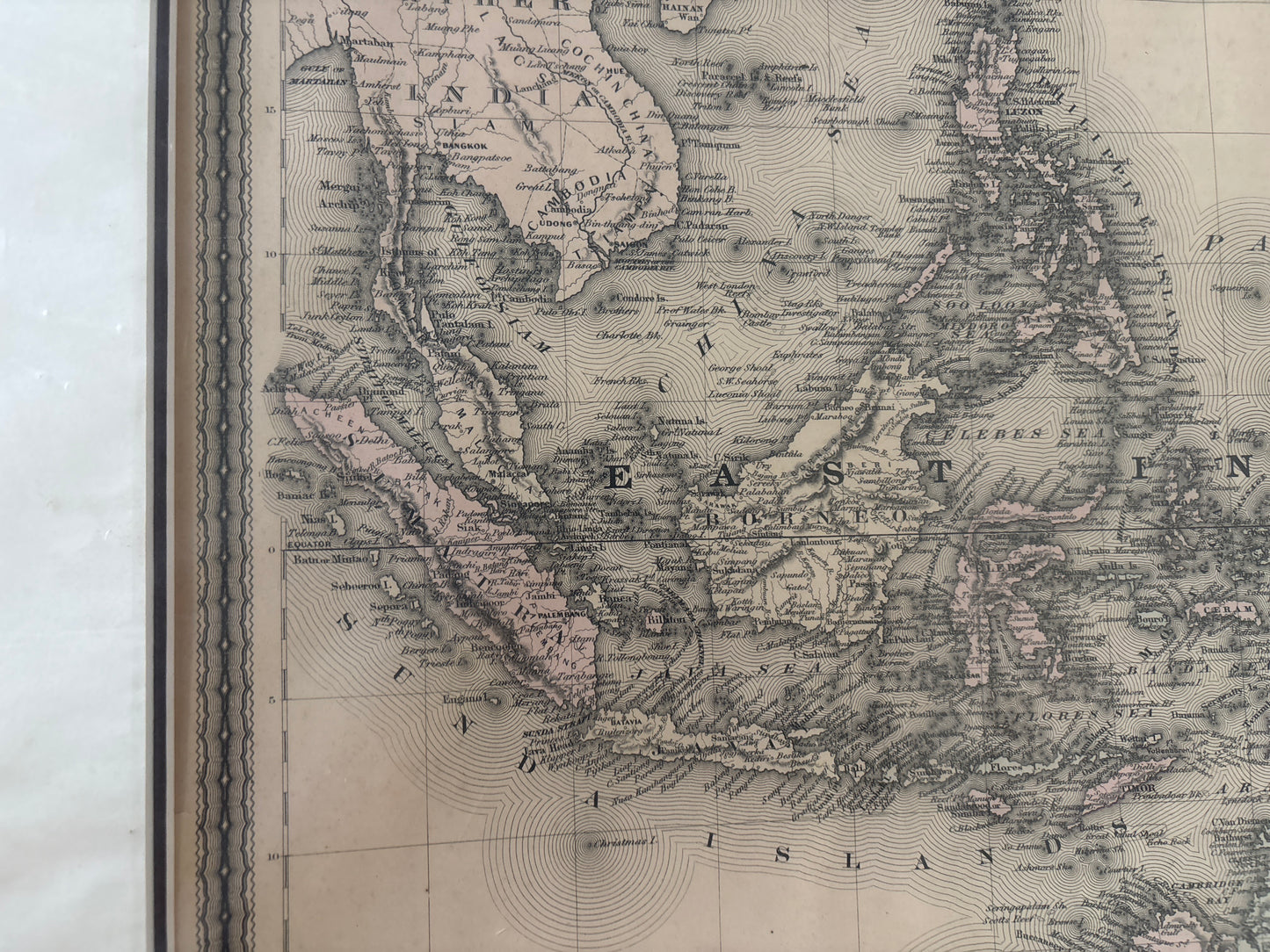
This map tells the story of the mid-19th-century fascination with the vast maritime and colonial landscapes of the Pacific and Southeast Asia. Published in New York by the prolific firm of Alvin J. Johnson, this chart bridges the gap between the established European empires in the East Indies (modern Indonesia and the Philippines) and the rapidly developing British colonies in Australia and New Zealand.
It captures a world in transition. In the north, it details the intricate archipelagos of the Philippines, Borneo, and the Spice Islands, which were the historical prizes of global trade. In the south, it illustrates an Australian continent whose interior was only just beginning to be understood by Western surveyors, marked by the distinctive pastel-colored colonial boundaries of the era.
Chronicles of the Map
-
Intercontinental Scope: This sheet is unique for its ability to show the geographical relationship between the Southeast Asian mainland (including Siam and Cochin China) and the oceanic territories of the South Pacific.
-
Emerging Australia: The map displays the early colonial divisions of Queensland, New South Wales, Victoria, South Australia, and West Australia, providing a snapshot of the continent during its Victorian-era expansion.
-
New Zealand Inset: A detailed inset in the lower-left corner focuses on New Zealand, meticulously plotting the North and South Islands (labeled New Ulster and New Munster).
-
Decorative Border: The map is framed by Johnson’s signature "fretwork" border, a classic decorative element that makes this edition highly recognizable to serious collectors.
-
Detailed Maritime Data: Beyond landmasses, the map includes countless island names and nautical labels, reflecting the high-resolution data available to American publishers in the late 1860s.