Treasures of the Orient
A Chart of the Seas between the Straits of Banca and Pt. Timon - Herbert 1758
A Chart of the Seas between the Straits of Banca and Pt. Timon - Herbert 1758
A Chart of the Seas between the Straits of Banca and Pt. Timon
Drawn/Published by: William Herbert
Location: London
Year: 1758
From: A New Directory for the East-Indies
Condition: Original hand-coloured copper engraving; professionally matted.
A Rare 18th-Century British Marine Chart
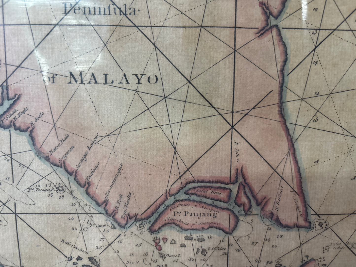
This significant 1758 sea chart by William Herbert is a prime example of mid-Georgian hydrography. Published specifically for the East India trade, it covers the critical maritime corridor between the Straits of Bangka (Banca) and Pulau Tioman (Pt. Timon), focusing on the eastern approaches to the Straits of Malacca.
Singapore : "Isle de Jatana"
This chart is highly prized by collectors of Singaporeana for its unique labeling of the island. It identifies Singapore as Isle de Jatana ou de Saincapour.
- Historical Toponymy: "Jatana" refers to Ujong Tanah (Land’s End), the traditional Malay name for the tip of the peninsula. The dual labeling reflects a period where European mariners were still reconciling local knowledge with established Western names.
- Strategic Detail: The map shows the island long before its 1819 founding, positioned at the heart of a treacherous network of reefs and islands that British captains had to navigate to reach China.
Navigational Features
As a functional "Working" chart, the map is filled with:
- Soundings & Hazards: Meticulous depth measurements and sandbank outlines throughout the Riau and Lingga Archipelagos.
- Rhumb Lines: Extensive loxodromic lines radiating from compass roses, used by navigators to plot their bearings across the South China Sea.
- Coastal Profiles: Small panoramic views at the bottom of the sheet provide visual "landfall" cues for sailors approaching the straits.