Treasures of the Orient
Batavia map - Prevost 1750
Batavia map - Prevost 1750
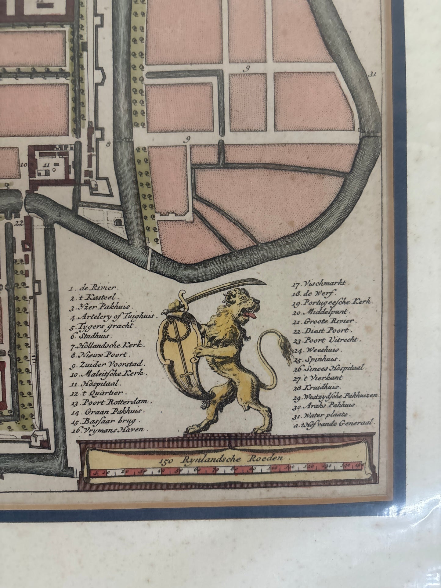
Rare Hand-Coloured Map of Batavia (1750)
Title: Batavia: zo als het was in den Jaare 1731 (Batavia as it was in the year 1731)
Cartographer: After Abbé Prévost
Origin: Paris, France
Date: 1750
Technique: Hand-coloured copperplate engraving
The Narrative: The "Queen of the East" at its Zenith
This meticulously detailed plan offers a rare look at Batavia (modern-day Jakarta) during its height as the headquarters of the Dutch East India Company (VOC) in Asia. Based on surveys from 1731, this map captures the city’s iconic Dutch-style canal system and fortified walls, which earned it the title "Queen of the East". It was published in Paris for Prévost’s influential Histoire Générale Des Voyages, a monumental work that documented the era’s global maritime explorations.
Chronicles of the Map
-
Strategic Fortifications: The map prominently features the Kasteel (Batavia Castle), the formidable star-shaped citadel that served as the nerve center for Dutch military and commercial power in the region.
-
Urban Planning: The grid-like layout of canals and streets illustrates the Dutch effort to recreate an Amsterdam-style city in the tropics.
-
Detailed Key: A comprehensive legend in the lower right, flanked by a regal lion rampant, identifies 32 critical locations, including the Portuguese Church, the Hospital, and various markets.
-
Maritime Life: The harbor area shows the long pier extending into the sea, with VOC ships anchored in the roads, highlighting the city’s status as a premier global port.