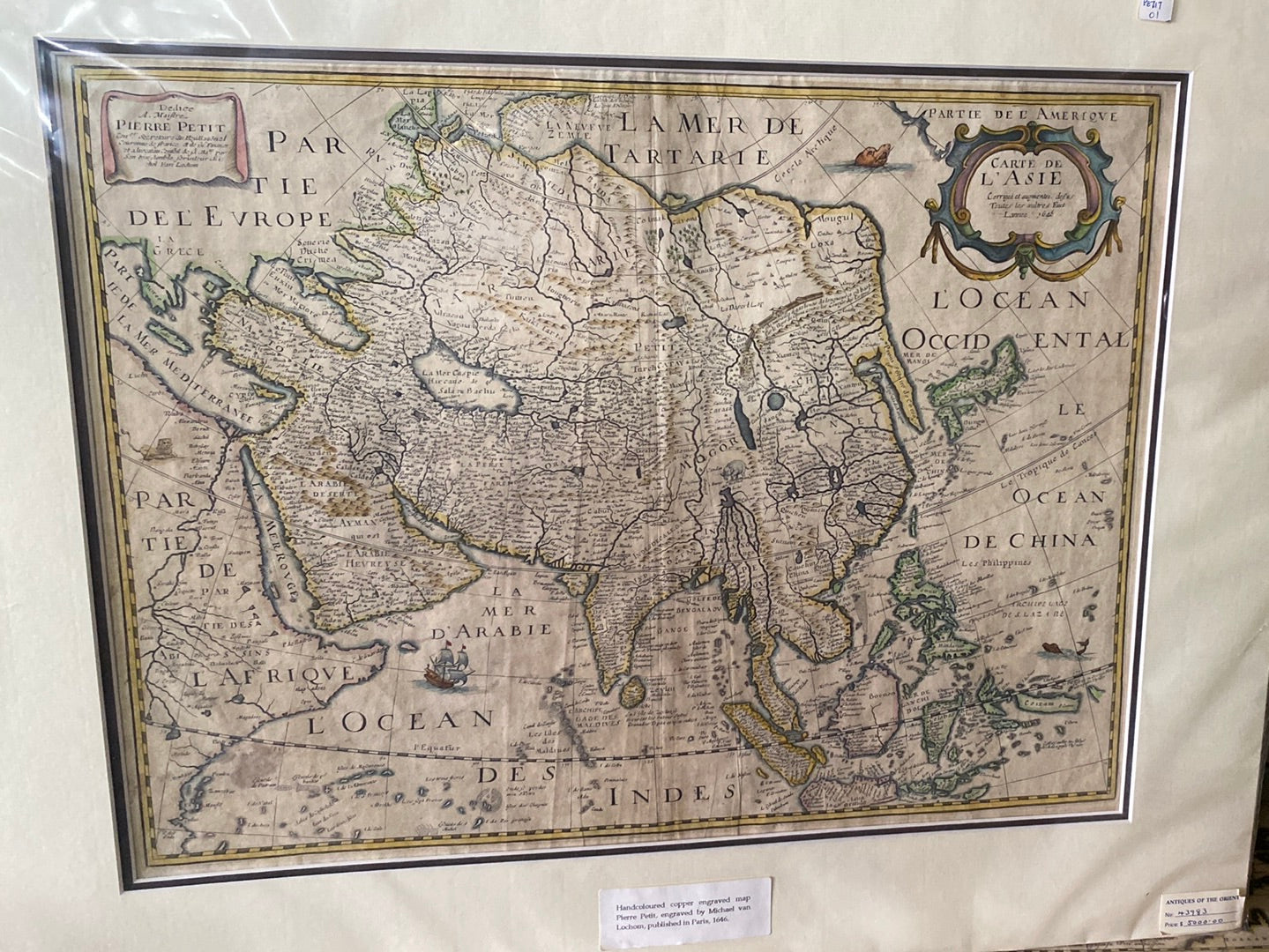

Treasures of the Orient
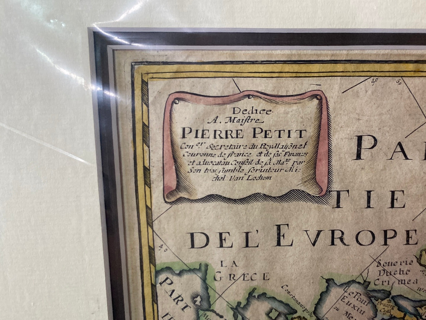
Carte de L’Asie - 1640 Van Lochom
Carte de L’Asie - 1640 Van Lochom
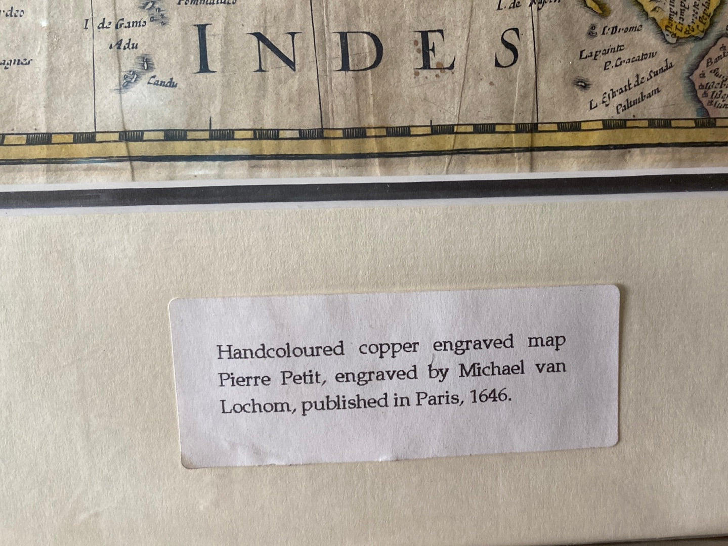
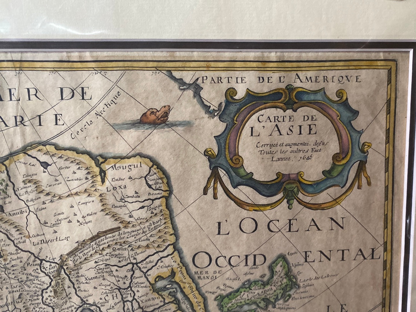
Carte de L’Asie
Drawn/Published by: Michel van Lochom (possibly collaborating with Petrus Bertius)
Location: Paris
Year: 1640
Condition: Rare 17th-century copperplate engraving; original hand-colouring.
A Rare Snapshot of 17th-Century French Cartography
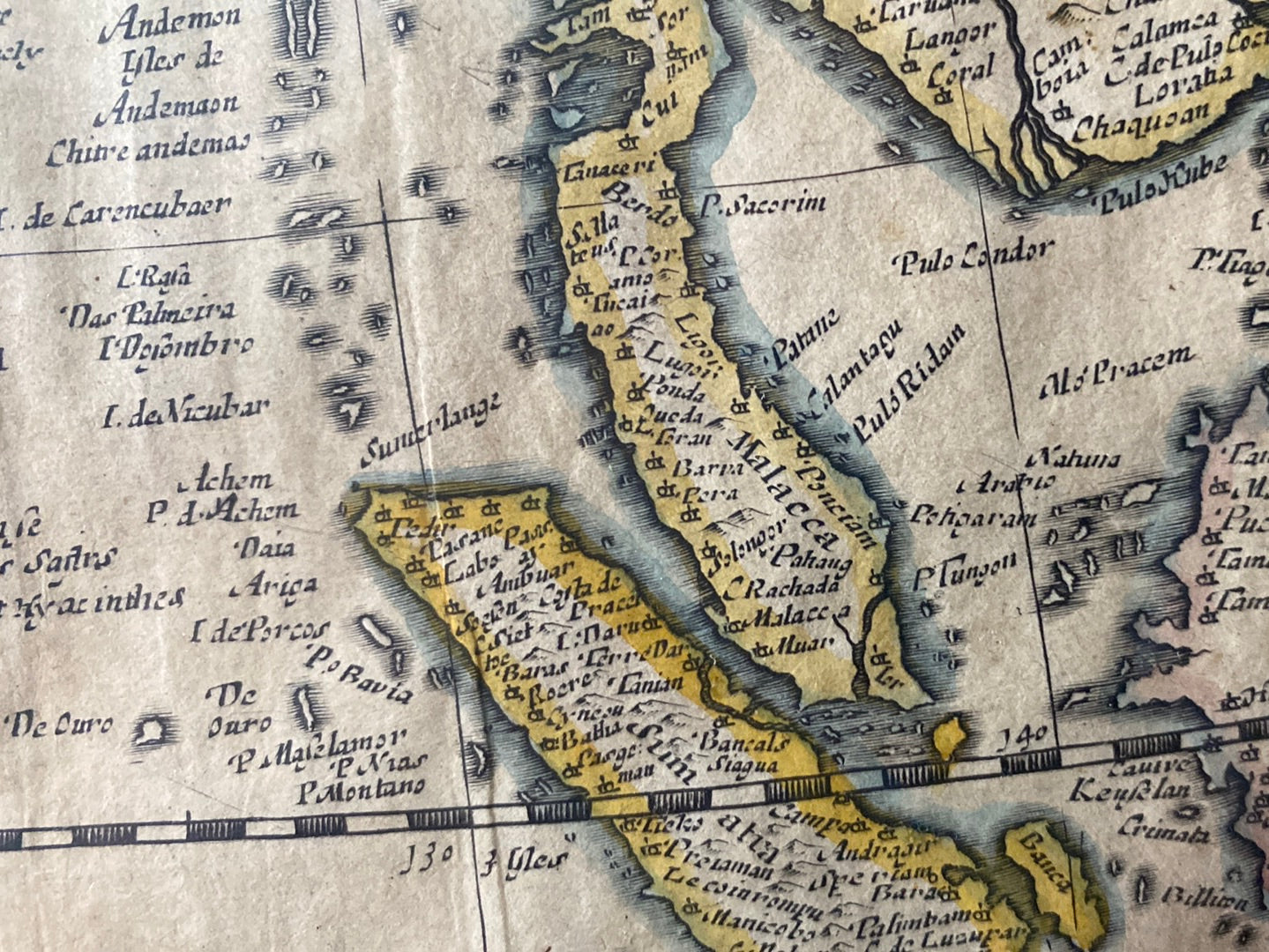
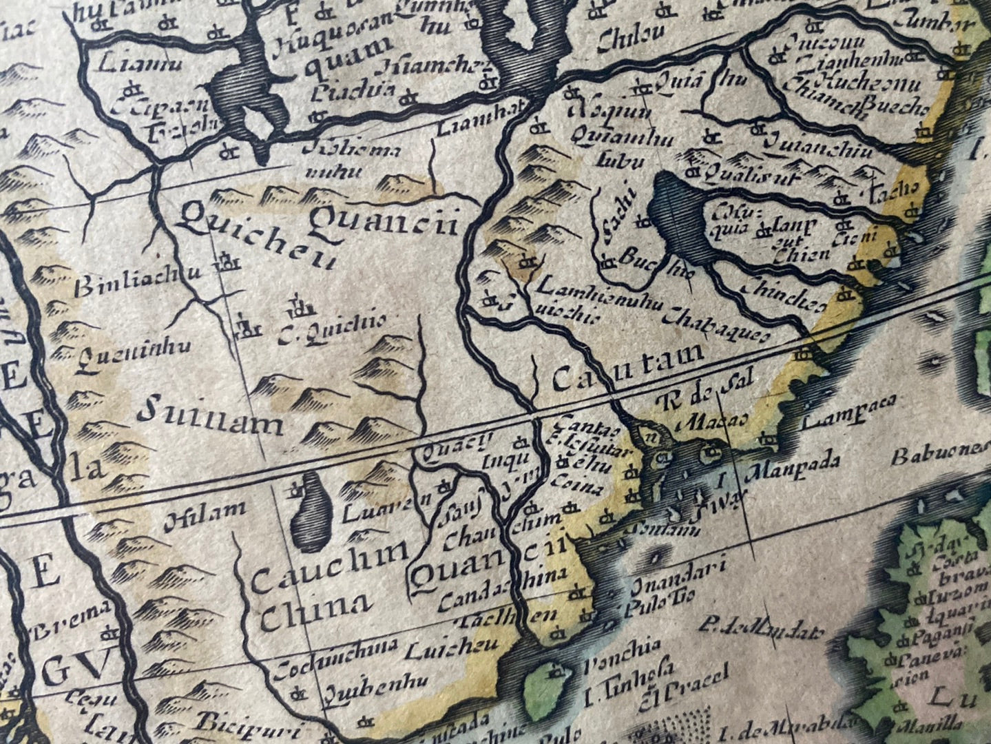
This 1640 map by Michel van Lochom, the engraver and printer to the King of France, is a significant example of early French efforts to document the Asian continent. Unlike the dominant Dutch maps of the era, Van Lochom’s work offers a distinct perspective, reflecting the geographical knowledge circulating in Paris during the reign of Louis XIII.
Geographic Detail and Anomalies
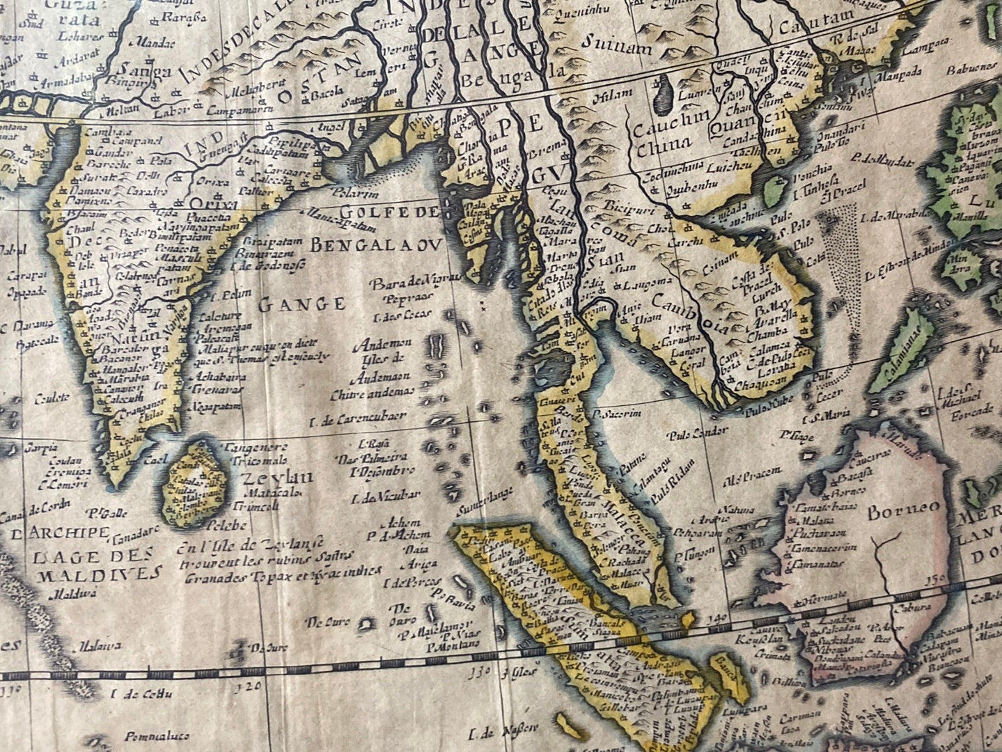
The map provides a well-researched overview of Asia as understood in the early modern period, featuring:
- Southeast Asian States: It accurately depicts several historically significant Malay states, including Kedah, Kelantan, Patani, Perak, Pahang, and Johor.
- The Selangor Curiosity: Most strikingly, the map includes Selangor—a region widely believed to have been formally established over a century later in 1766. Its presence here suggests thriving pre-colonial settlements that were recognized by European cartographers long before official statehood.
- Continental Outline: The rendering of the continent follows the standard geographical models of the mid-17th century, capturing the major empires and maritime networks of the era.
Artistic Flourishes
Typical of high-quality maps from this period, the Carte de L’Asie is adorned with ornate embellishments, including sailing vessels and sea creatures that illustrate the era's adventurous spirit of exploration.