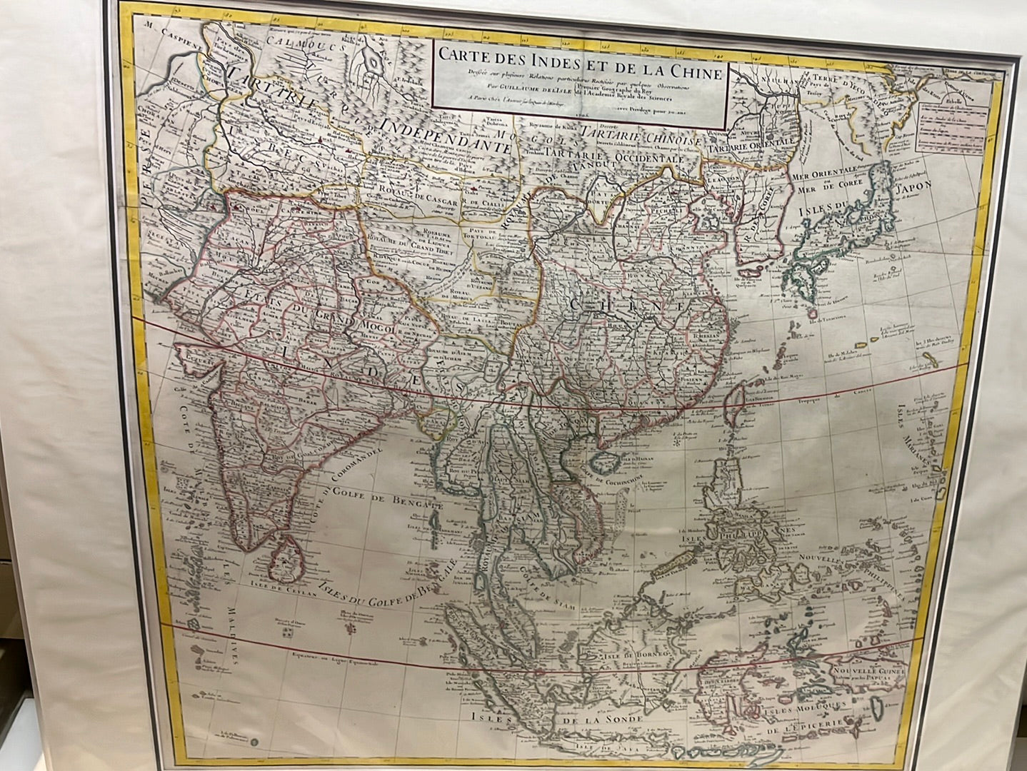

Treasures of the Orient
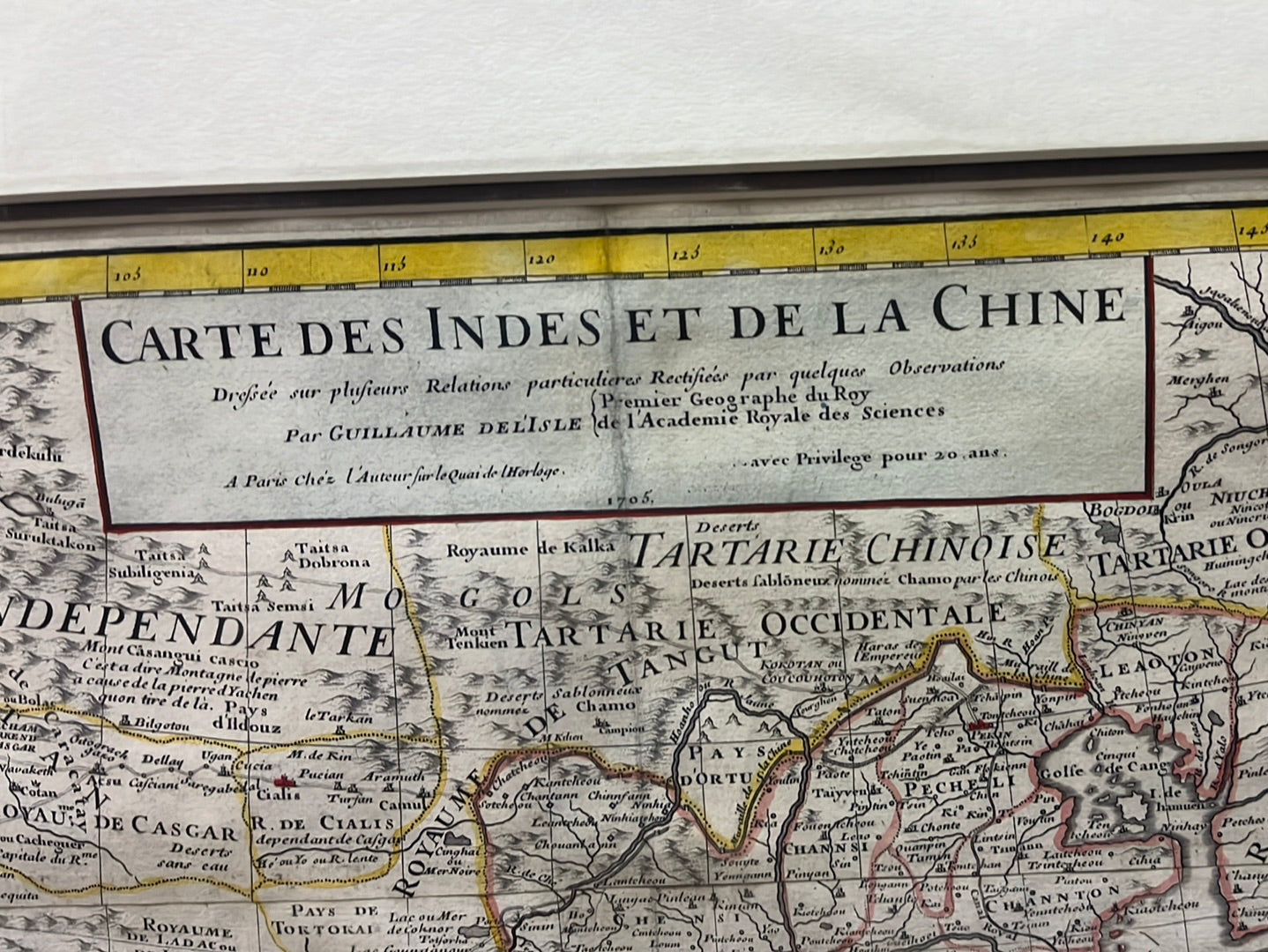
Carte Des Indes et de la Chine - de l'Isle 1705
Carte Des Indes et de la Chine - de l'Isle 1705
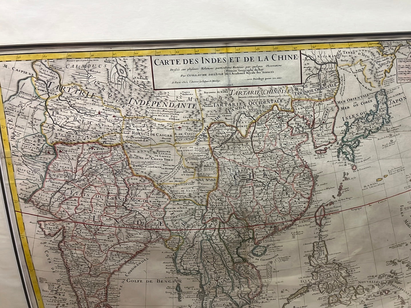
Title: Carte des Indes et de la Chine
Cartographer: Guillaume Delisle (de l'Isle)
Published: Paris, 1705
Technique: Copperplate engraving with original hand-coloring
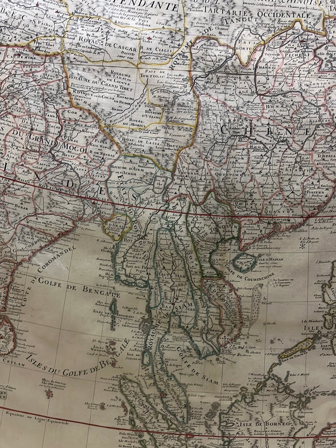
Description: This landmark map by the "Premier Géographe du Roi," Guillaume Delisle, represented a significant leap forward in the scientific accuracy of Asian cartography. Eschewing the decorative myths of earlier eras, Delisle used the latest reports from Jesuit missionaries and travelers to produce a more precise geographical record.
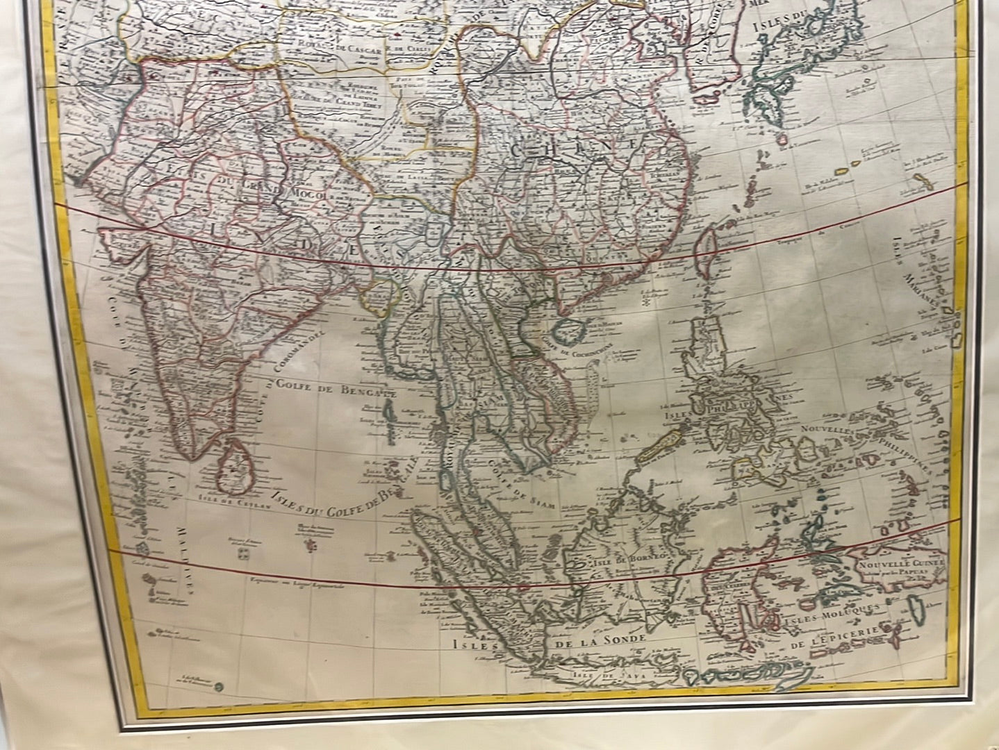
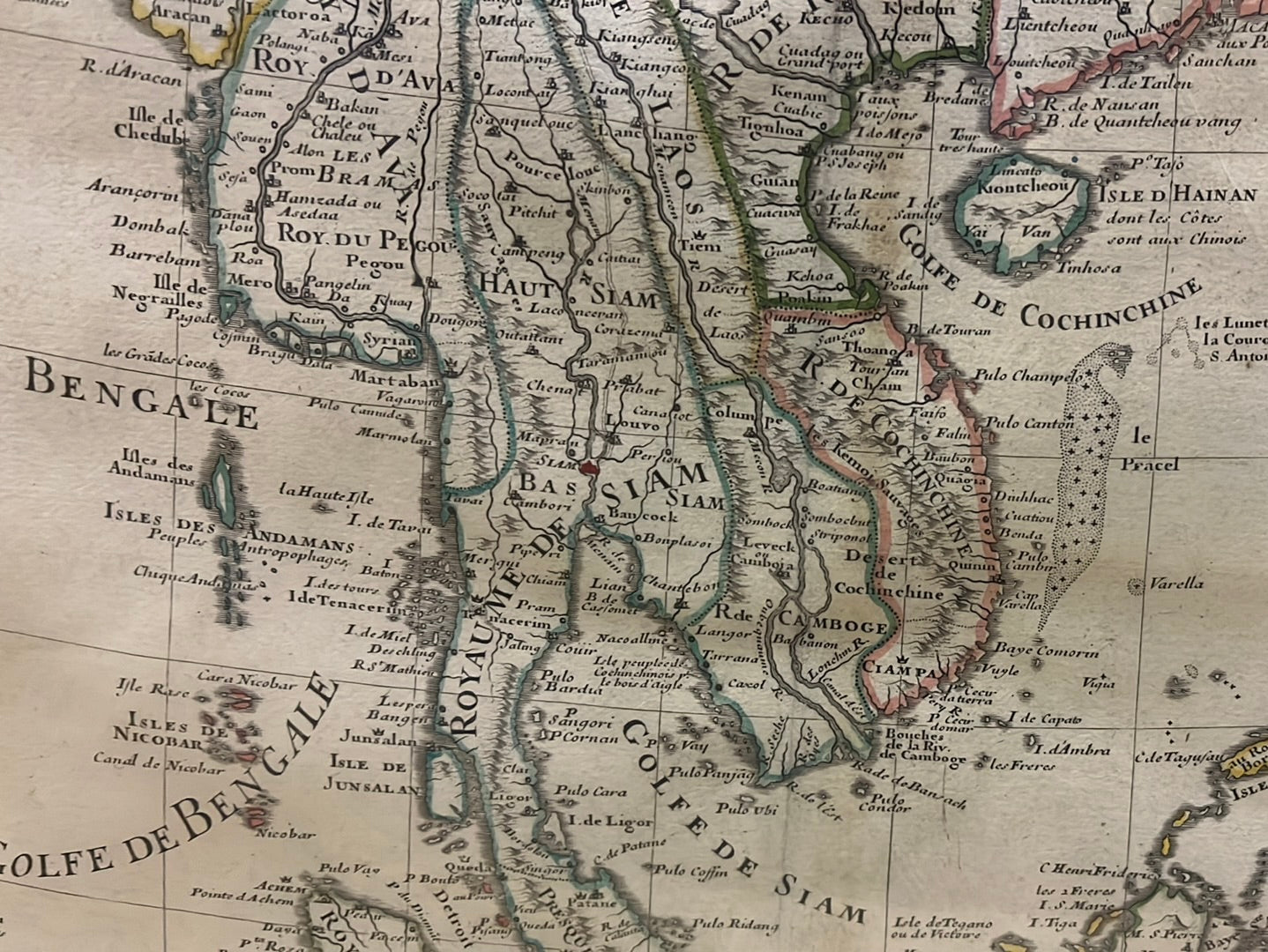
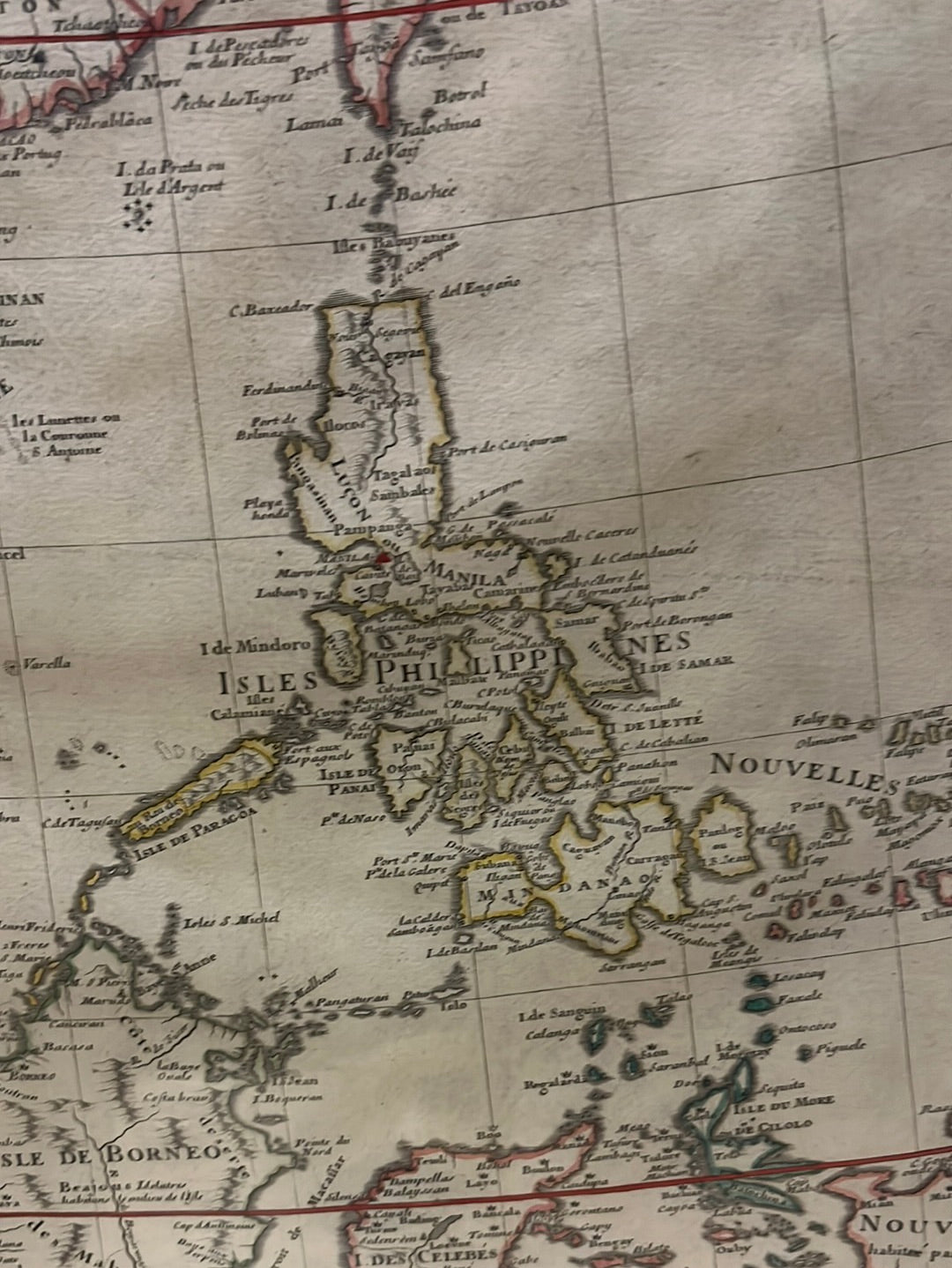
The map provides an expansive view of the continent, including:
-
The Indian Subcontinent: Labeled as "Etats du Grand Mogol," showing the height of the Mughal Empire's reach.
-
Southeast Asia: Detailed renderings of the "Royaume de Siam," the Malay Peninsula, and the vast archipelago of the "Isles de la Sonde" (including Sumatra, Borneo, and Java).
-
East Asia: A remarkably accurate depiction of "Chine," "Coree" (Korea shown as a peninsula), and "Japon".
-
Maritime Geography: Detailed charting of the "Golfe de Bengale" and the "Mer de la Chine," essential for the burgeoning trade routes of the various East India Companies.
-
Authenticity: Original 18th-century copperplate engraving.
-
Scientific Significance: Delisle was the first to use astronomical observations to fix longitudes, making this one of the most reliable maps of its time.
-
Visual Appeal: Features a clean, sophisticated aesthetic with delicate hand-colored borders and a simple, elegant title cartouche.