Treasures of the Orient
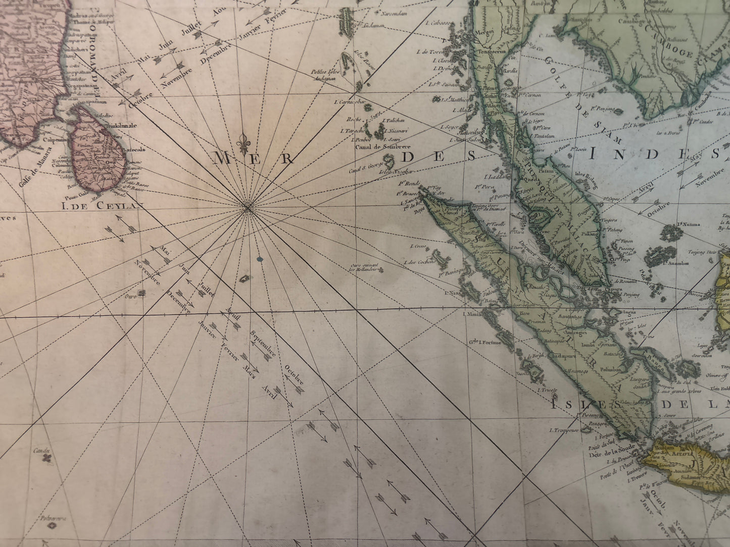
Carte Hydro-Geo-Graphique des Indes Orientales (Map of Asia) - Lattré 1771
Carte Hydro-Geo-Graphique des Indes Orientales (Map of Asia) - Lattré 1771
Regular price
$4,200.00 SGD
Regular price
Sale price
$4,200.00 SGD
Unit price
per
Carte Hydro-Geo-Graphique des Indes Orientales
Drawn by: Rigobert Bonne (Hydrographer to the King of France)
Published by: Jean Lattré
Location: Paris
Year: 1771
From: Originally published in Bonne's Atlas Moderne (or Atlas Geographique)
Condition: Hand-coloured copperplate engraving; typically issued as a four-sheet composite set.
A Significant 18th-Century Scientific Survey
This large-scale map is a premier example of Enlightenment-era hydrography. Created by Rigobert Bonne, who was tasked with producing the most detailed and accurate nautical charts for the French Crown, it represents a departure from earlier decorative maps in favor of scientific precision.
Geographic and Maritime Detail
- Regional Scope: The map provides an expansive view of South and Southeast Asia, covering everything from the Arabian Sea to the Philippines.
- Navigational Data: As a hydrographic chart, it is densely packed with rhumb lines, depth soundings, and directional arrows indicating prevailing trade winds and monsoons to assist mariners.
- Singapore and the Straits: While Singapore itself is shown but not labeled, the Strait of Singapore (Detroit de Sincapour) is explicitly marked, alongside Malacca and Johor, highlighting the area's established status as a critical maritime bottleneck.
- Design: It is anchored by a formal ornamental title cartouche and features extensive explanatory text in the upper right regarding wind patterns and navigational measurements.