Treasures of the Orient
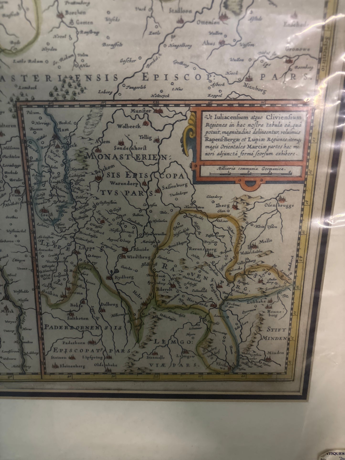
Ducatus Iuliacensis, Cliviensis, Montensis - Visscher c.1633
Ducatus Iuliacensis, Cliviensis, Montensis - Visscher c.1633
Ducatus Iuliacensis, Cliviensis, Montensis
Drawn by: Nicolaes Jansz Visscher (1618–1679)
Published in: Amsterdam
Year: c. 1633/1640
From: Atlas Contractus or issued as a separate sheet
Condition: Copperplate engraving.
A Detailed View of the Lower Rhine Duchies
This highly detailed 17th-century map by Nicolaes Jansz Visscher depicts the strategic duchies of Jülich, Cleves, and Berg, alongside the counties of Mark and Ravensberg. At the time of its publication, these territories were of immense political importance, being the subject of the protracted Jülich-Cleves succession dispute which helped trigger the Thirty Years' War.
Cartographic Precision and Artistry
The map is a prime example of the high standards of the Dutch Golden Age of cartography. Visscher was renowned for the accuracy and depth of his work, often improving upon earlier surveys by mapmakers like Mercator and Hondius.
The Rhine Heartland: The river Rhine is the central focal point, shown winding through the various duchies and archbishoprics with remarkable precision. Notable cities such as Düsseldorf, Essen, Cologne (Coln), and Bonn are clearly identified.
- Geographic Focus: The map covers the area between the Meuse and the Rhine, extending north toward the Zuiderzee and east into Westphalia.
- Inscriptions and Insets: The map features multiple decorative elements, including a formal title cartouche in the upper left and a detailed inset map in the lower right, which provides a more focused view of specific regional boundaries.
The Visscher Legacy
Nicolaes Jansz Visscher was a prominent member of a celebrated family of Amsterdam mapmakers and engravers. His work is characterized by fine ornamentation and a commitment to documenting the evolving political landscape of Europe. This map remains a significant record for collectors of German regional history and nautical-era Dutch cartography, capturing a pivotal region during one of its most turbulent historical periods.