Treasures of the Orient
East India Islands - Lizars c.1831
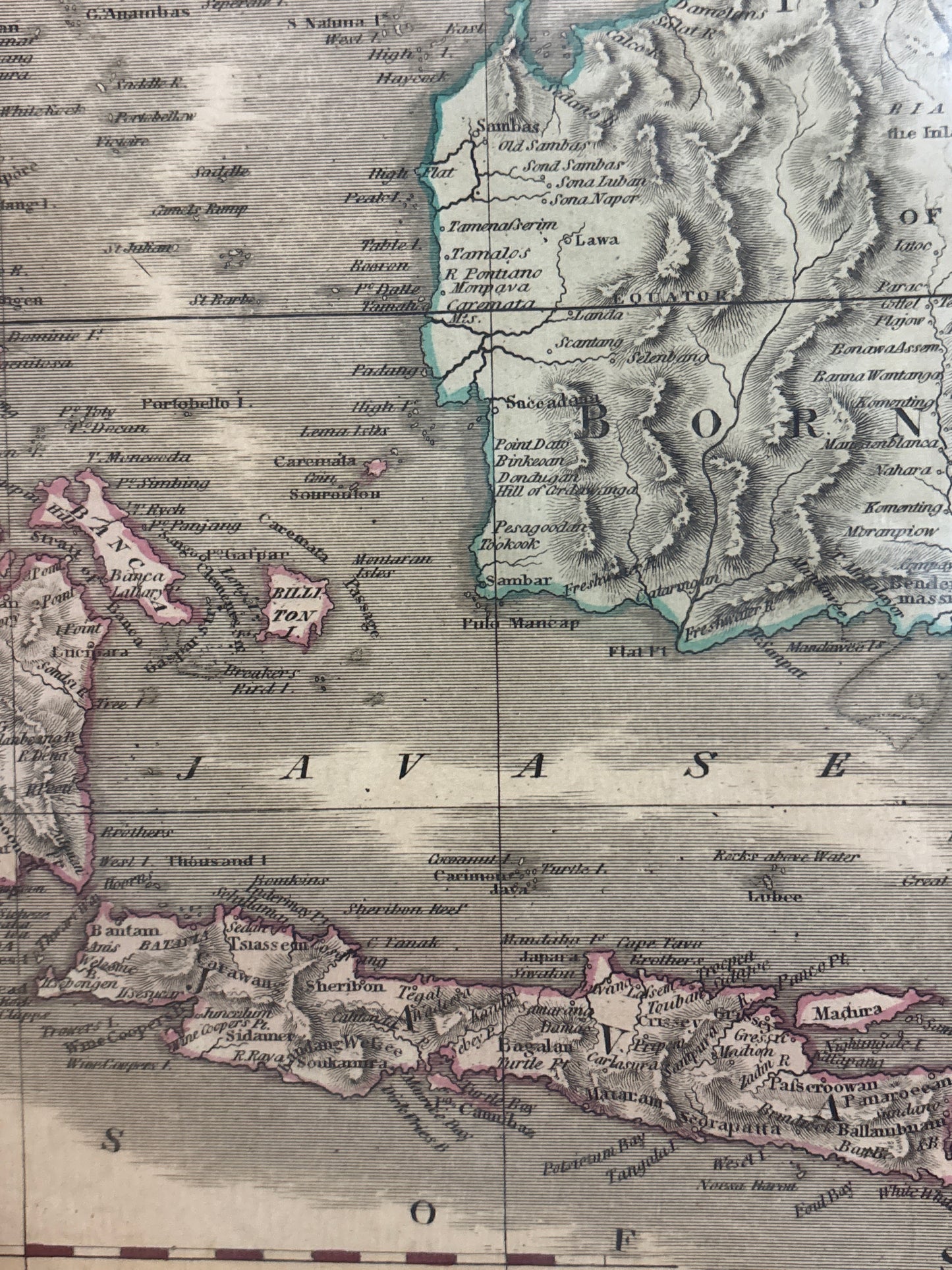
East India Islands - Lizars c.1831
Title: East India Islands
Cartographer: William Home Lizars (after Daniel Lizars)
Published: Edinburgh, c. 1831–1842
Technique: Copperplate engraving with original outline hand-coloring
Description: A crisp and highly detailed early 19th-century map of the Southeast Asian archipelago, published in Edinburgh by the renowned Lizars firm. The map spans from the Malay Peninsula and Sumatra in the west, across Java, Borneo, and the Philippines, to New Guinea and the northern tip of Australia in the southeast.
The piece is a classic example of the "Edinburgh School" of cartography, which was celebrated for its clean, precise engraving style and scientific accuracy over purely decorative elements. It shows political boundaries highlighted in delicate original outline color, with mountain ranges represented by fine hachuring. Notably, "Sincapore" is marked on the tip of the peninsula, along with key maritime routes, sounding depths, and colonial outposts. This plate (numbered LI in the upper right) was issued in Lizars' Edinburgh Geographical General Atlas.
-
Authenticity: Genuine 19th-century copperplate engraving.
-
Key Detail: Features the signature plate number "LI" in the upper right margin.
-
Regional Interest: Highly detailed mapping of the Spice Islands, Java, and the Malay Peninsula, making it very popular with collectors in Singapore and Malaysia.