
Treasures of the Orient
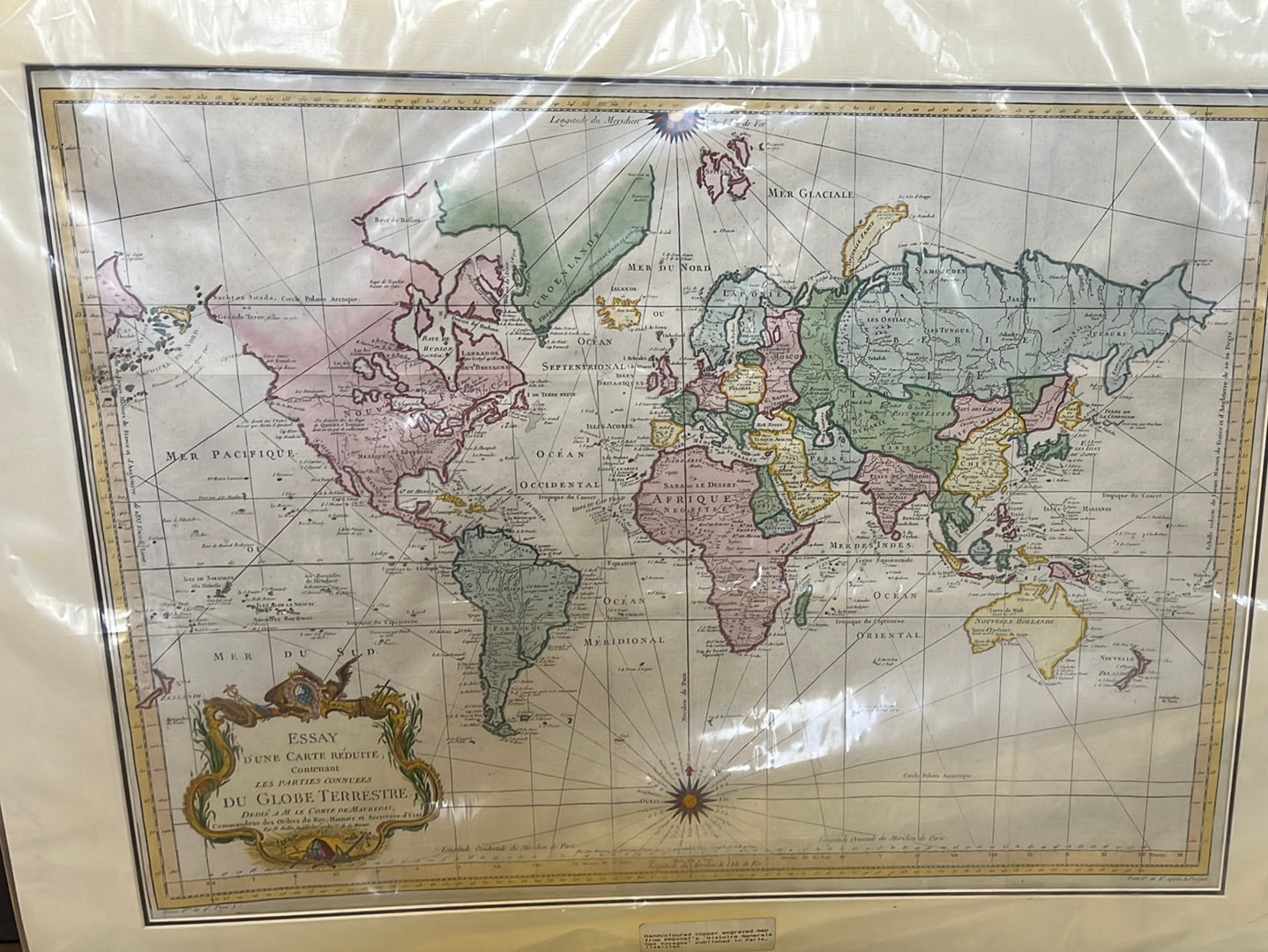
Essay d'une Carte Reduite - Bellin c. 1748
Essay d'une Carte Reduite - Bellin c. 1748
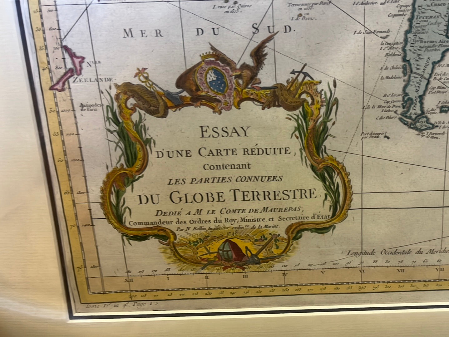
Title: Essay d’une Carte Réduite, Contenant Les Parties Connues du Globe Terrestre
Cartographer: Jacques-Nicolas Bellin
Published: Paris, c. 1748–1749
Technique: Copperplate engraving with original hand-coloring
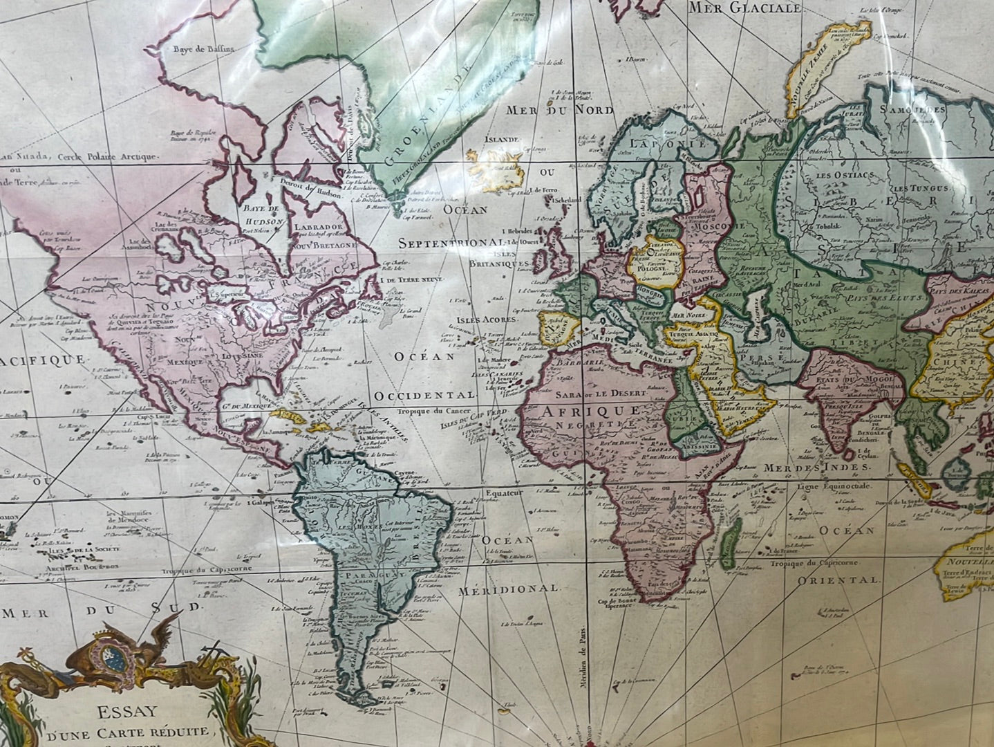
Description: This magnificent world map is a landmark of mid-18th-century cartography. Dedicated to the Comte de Maurepas, it provides a fascinating snapshot of the world before the famous voyages of Captain Cook. Notably, it depicts the "Sea of the West" in North America (an imagined inland sea) and shows Australia (Nouvelle Hollande) still partially connected to New Guinea.
The map is a "Carte Réduite," a term used for nautical charts intended for use at sea, and it uses the Mercator Projection, which was the gold standard for navigators. Originally published in Prévost’s influential Histoire Générale des Voyages, this map is celebrated for its elegant copperplate work and its clean, professional layout. The elaborate title cartouche in the lower left, decorated with shells, flora, and nautical motifs, is a classic example of French Rococo design.
-
Authenticity: Genuine 18th-century copperplate engraving.
-
Geographical Highlights: "Nouvelle Hollande" (Australia) and "Terre de Diemen" (Tasmania) are shown with unfinished coastlines.
-
Paris Meridian ised as its prime meridian (0° longitude), rather than the Greenwich Meridian
- Dimensions: Large format (approx. 50cm x 70cm).