Treasures of the Orient
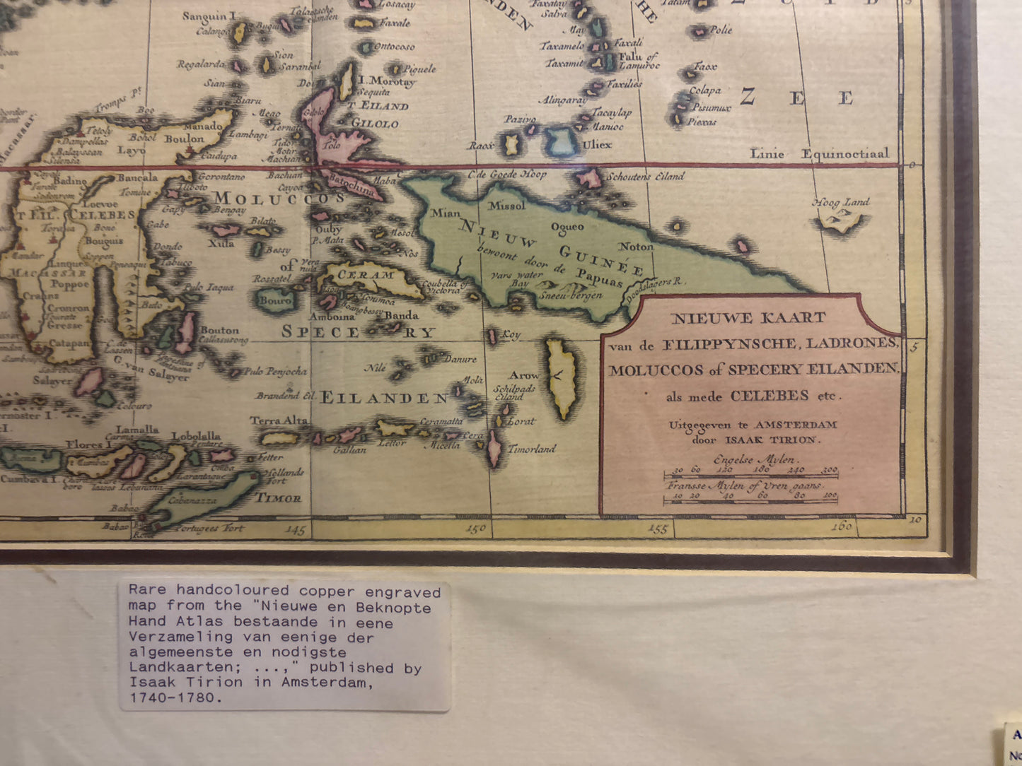
Filippynsche (Map of the Philippines and part of Southeast Asia) - Tirion 1744
Filippynsche (Map of the Philippines and part of Southeast Asia) - Tirion 1744
Nieuwe Kaart van de Filippynsche...
Drawn/Published by: Isaak Tirion (1705–1765)
Location: Amsterdam
Year: 1744 (dated)
From: Nieuwe Hand-Atlas, bestaande in eene Verzameling van eenige naauwkeurige Landkaarten...
Condition: Hand-colored copperplate engraving; professionally matted.
A Detailed Survey of the Dutch East India Company's Interests
This 1744 map is a significant production by Isaak Tirion, a successful Dutch publisher based in Amsterdam. It provides an extensive view of Southeast Asia at a time when the region was a central focus of European maritime commerce. The map is widely recognized for its clean Dutch engraving style and its focus on the primary island chains that defined the global spice trade.
Geographic and Historical Scope
The map meticulously charts several high-interest regions of the era:
- The Philippines: The archipelago is shown with impressive detail, including numerous inland cities and major coastal landmarks.
- The Spice Islands: The map features the Moluccas and Banda Islands, which were the world's primary source of cloves and nutmeg.
- Regional Neighbors: It covers a vast area from Borneo and Celebes (Sulawesi) in the west to New Guinea and the Ladrones (Mariana Islands) in the east.
- Navigational Detail: As a functional tool for merchants and scholars, the map identifies soundings, maritime tracks, and the intricate river systems of the larger islands.