


Treasures of the Orient
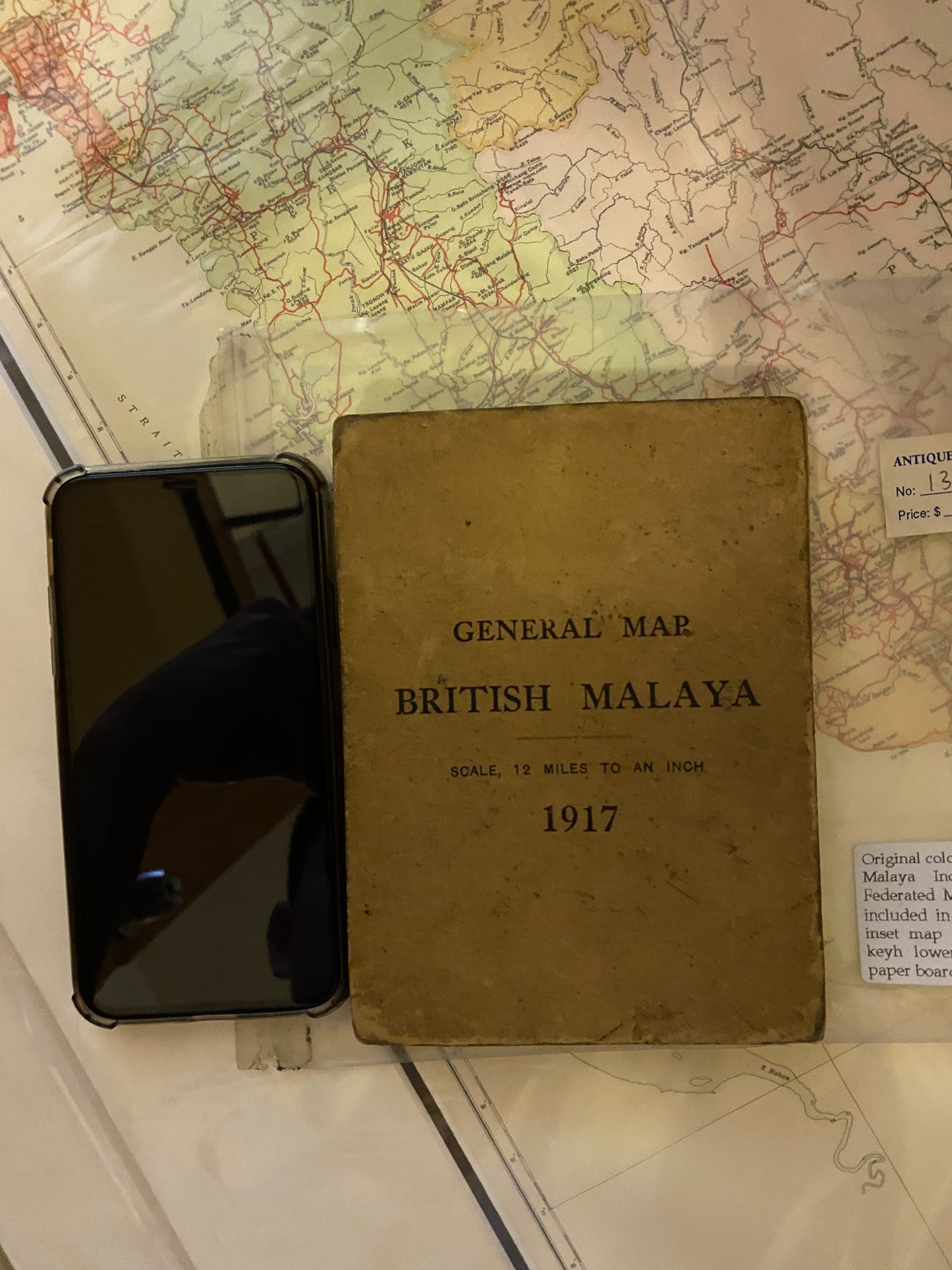
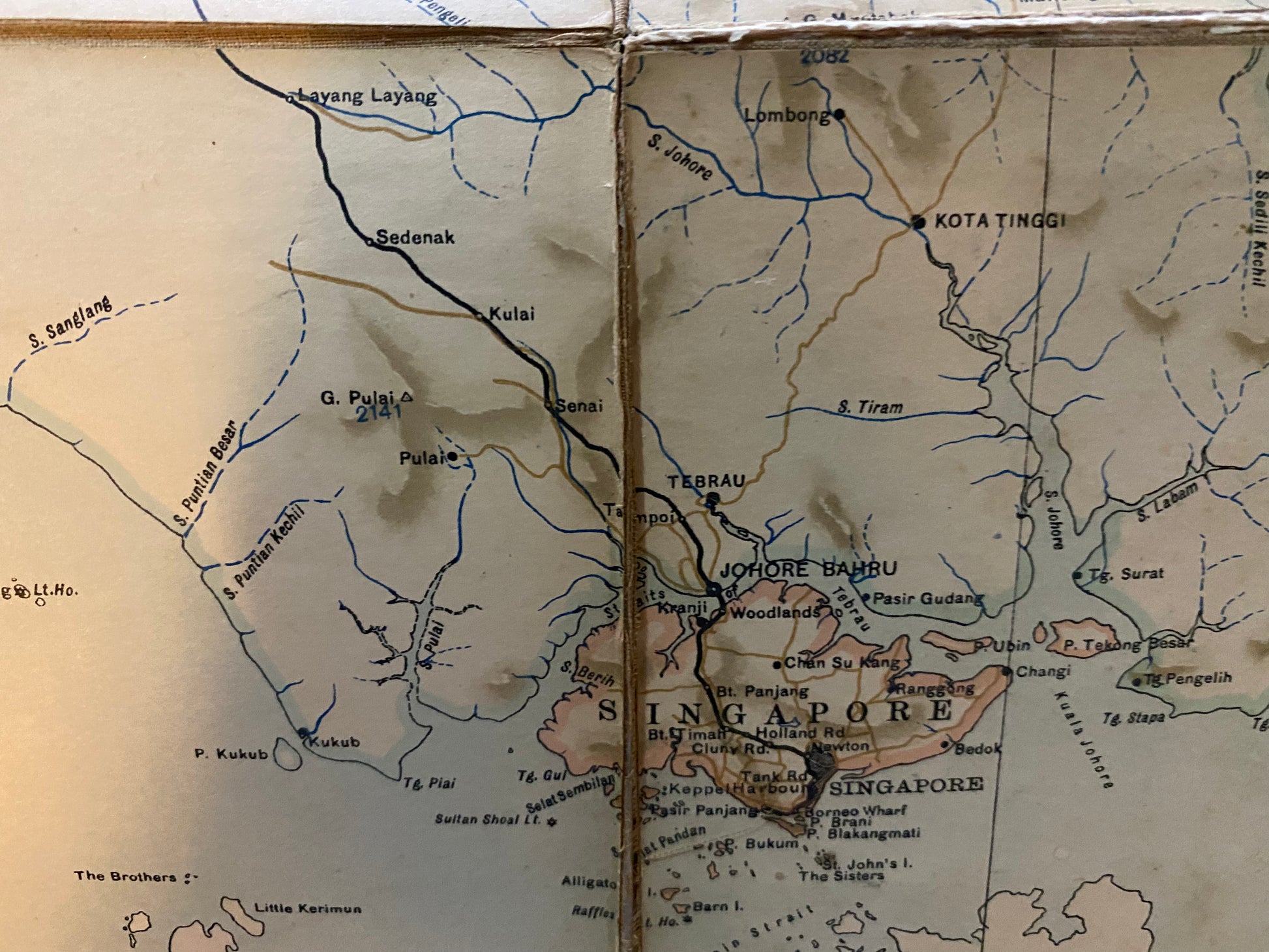
General Map British Malaya - 1917
General Map British Malaya - 1917
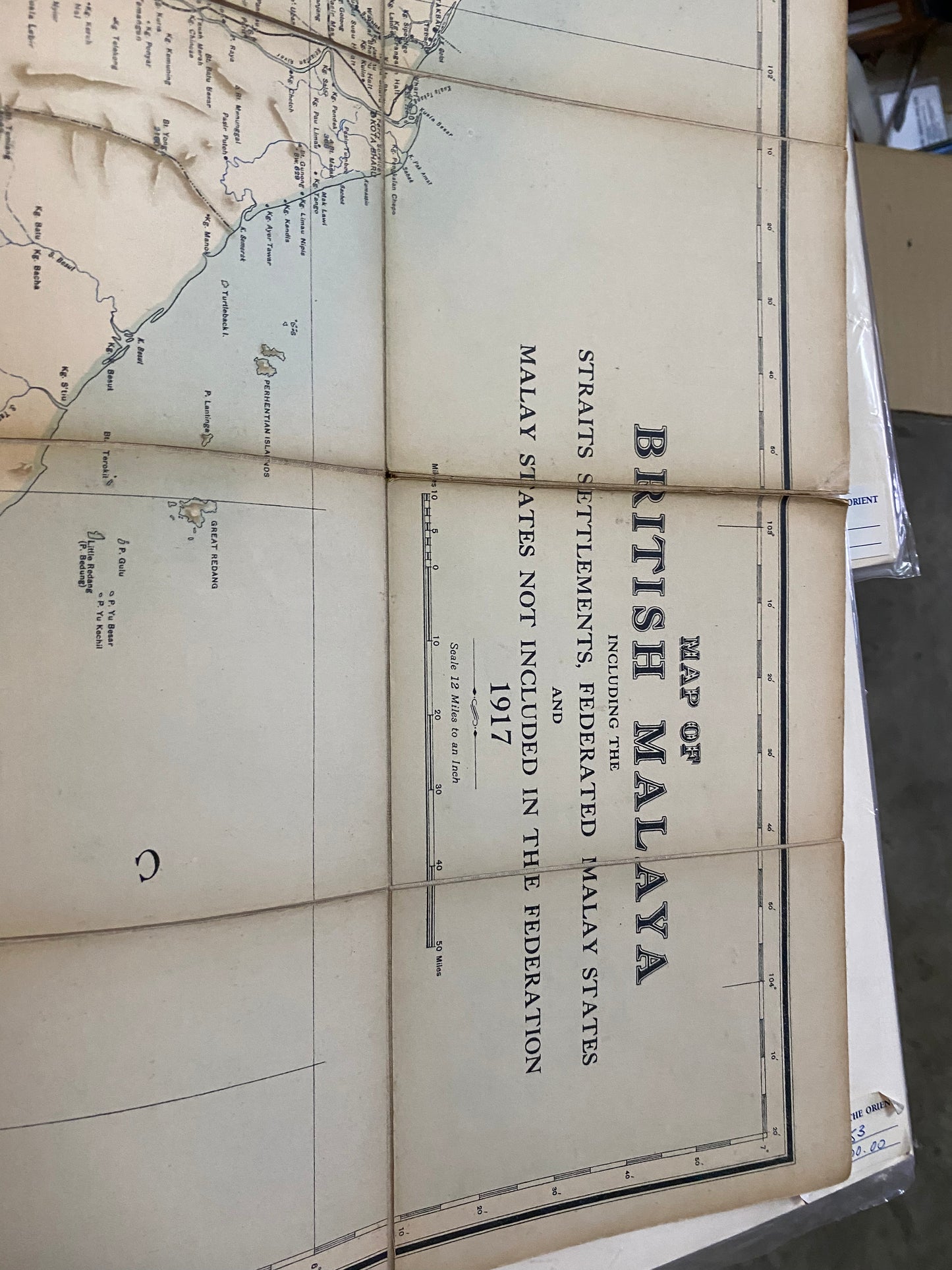
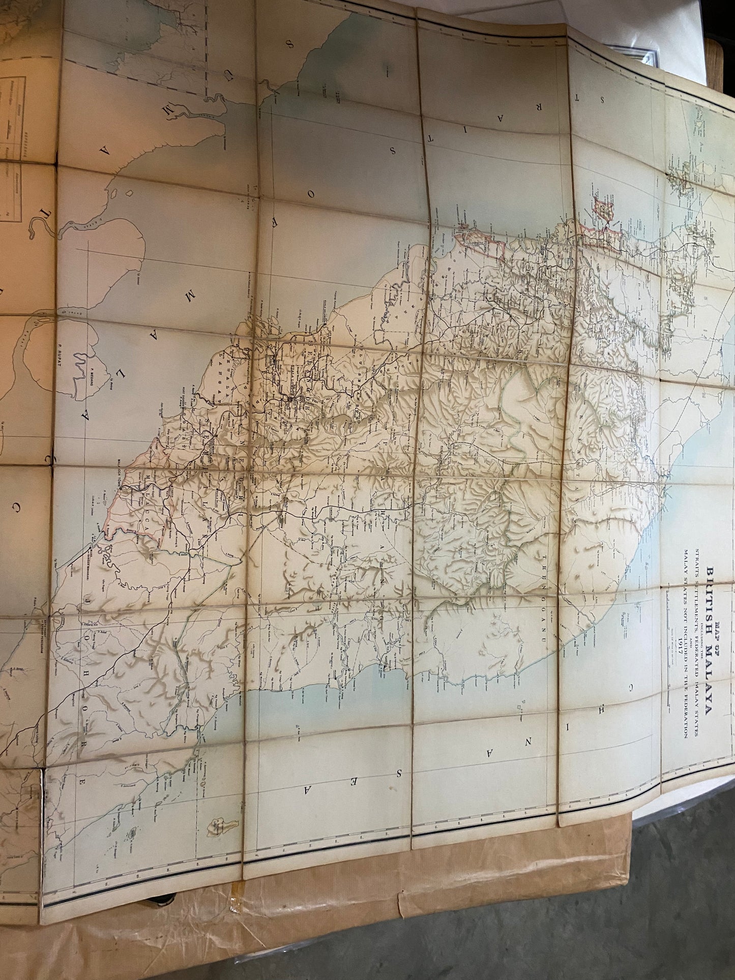
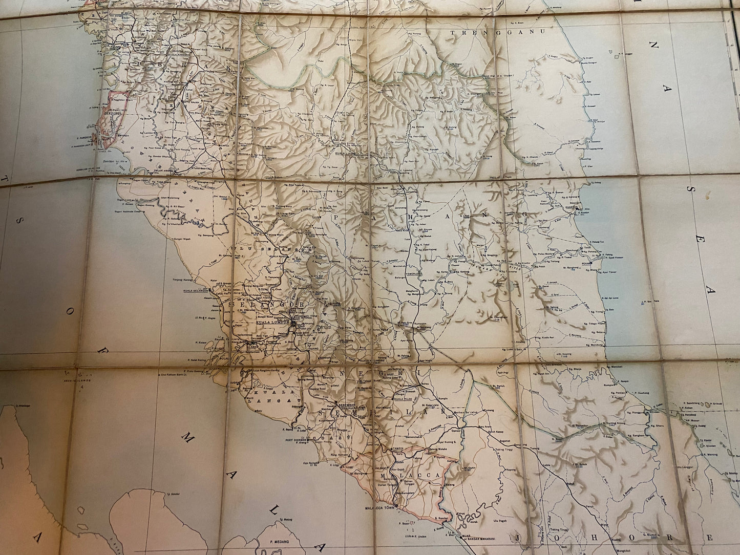
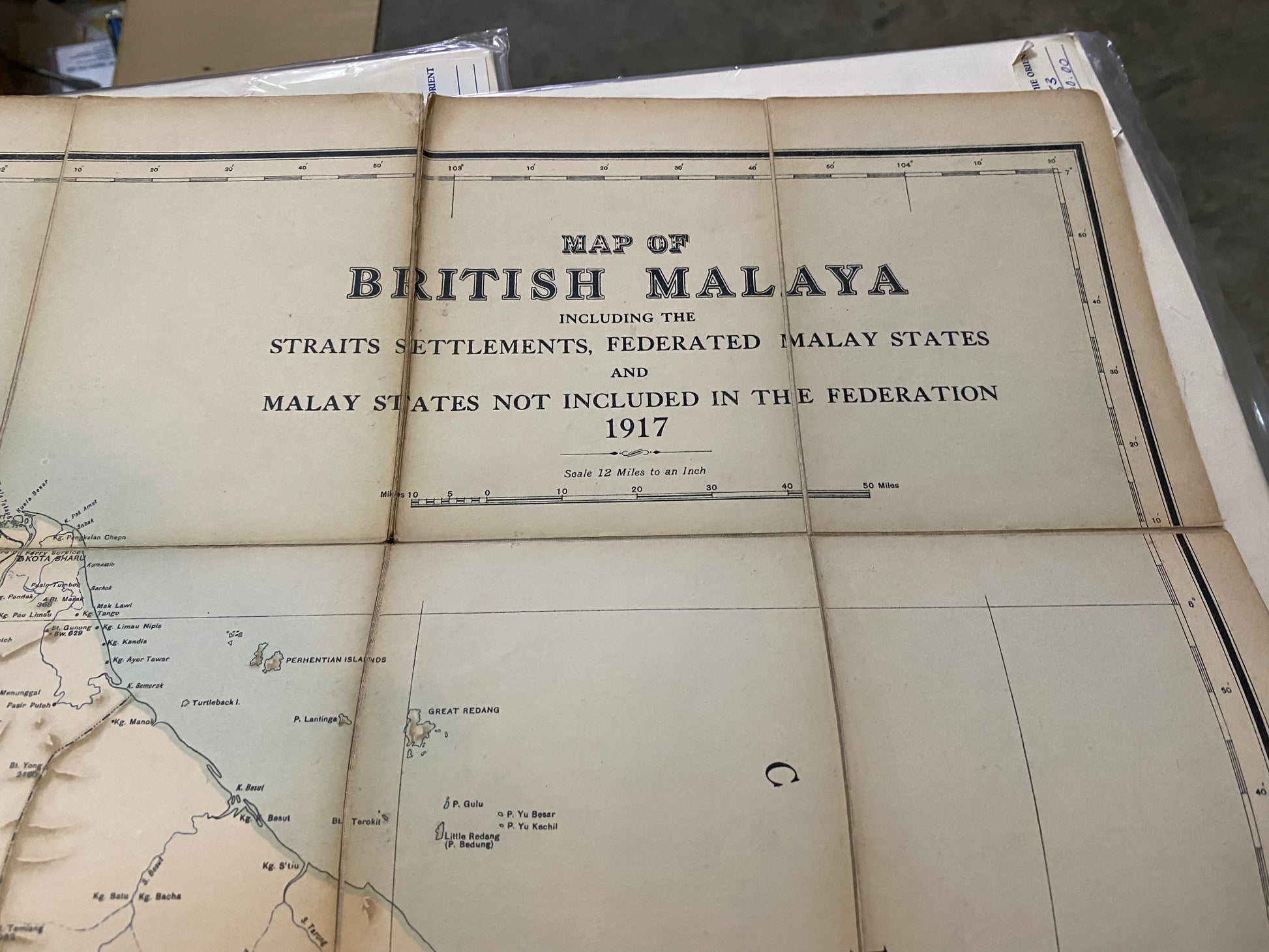
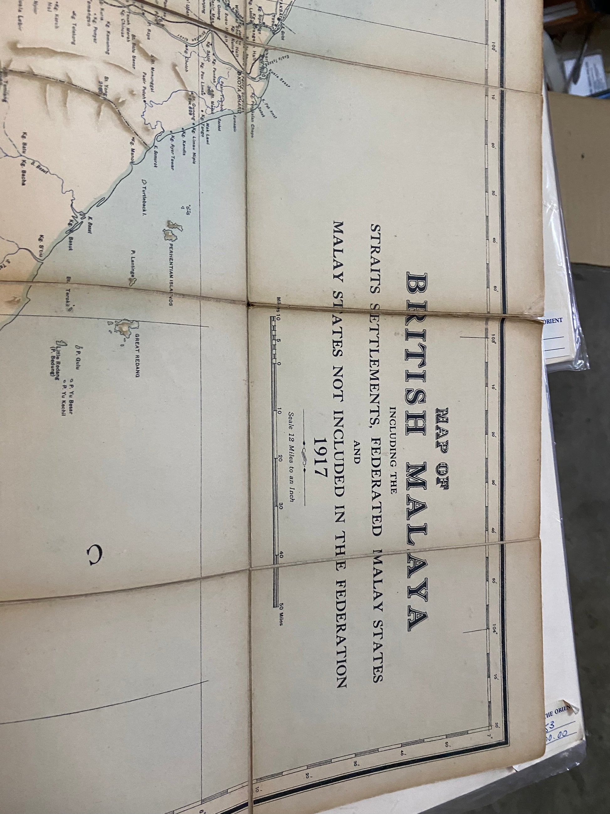
Title: General Map of British Malaya
Cartographer: Survey Department, Federated Malay States (F.M.S.)
Published: Kuala Lumpur/London, 1917
Technique: Color lithograph, linen-backed and folding into original paper board covers
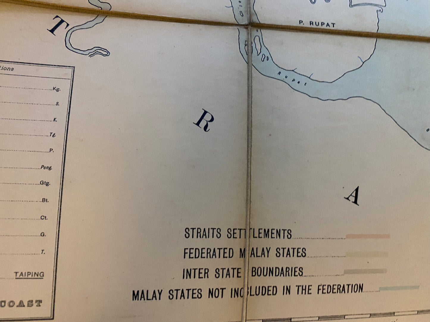
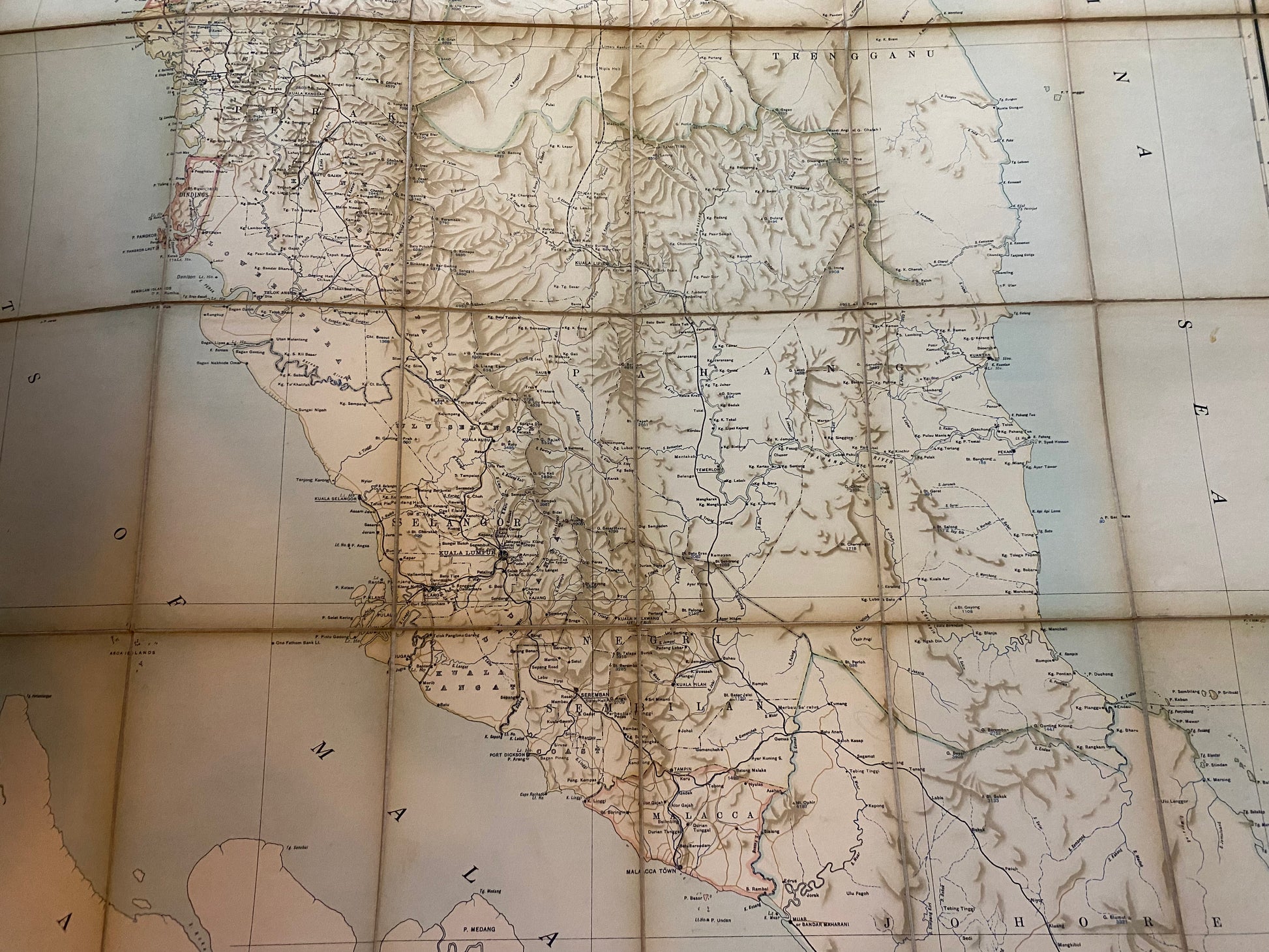
Description: This 1917 general map is a definitive record of British Malaya during a period of rapid economic expansion. Unlike the technical geological maps of the same era, this "General Map" was designed for administrative and commercial utility. It clearly delineates the Federated Malay States (Perak, Selangor, Negri Sembilan, and Pahang), the Unfederated Malay States (Johore, Kedah, Perlis, Kelantan, and Trengganu), and the Straits Settlements (including Singapore, Malacca, and Penang).
The map is highly detailed, highlighting the extensive railway network that fueled the rubber and tin industries, as well as telegraph lines, roads, and district boundaries. This specific example is the "folding" version, backed with linen for durability—a common format for colonial officials and travelers of the time. The cover carries the authoritative imprint of the F.M.S. Survey Department, reflecting the high cartographic standards of the British colonial administration.
-
Authenticity: Original 1917 government-issued folding map.
-
Format: Linen-backed sectional map with original tan board covers.
-
Scale: 12 Miles to an Inch.
-
Key Feature: Comprehensive snapshot of the peninsula just before the post-WWI economic boom.