Treasures of the Orient
Georgetown - c.1920s-1930s
Georgetown - c.1920s-1930s
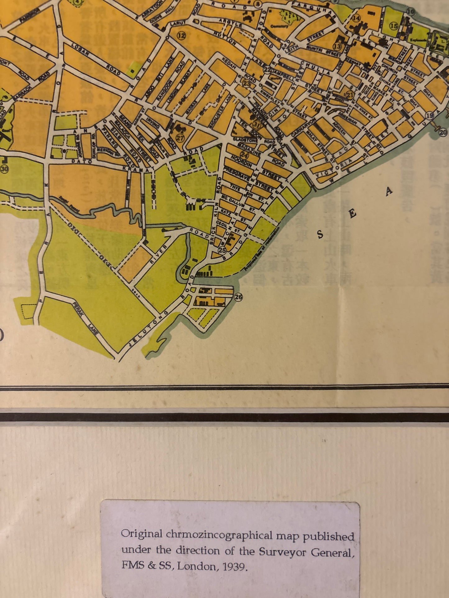
Title: Plan of George Town (Penang)
Publisher: Published by Permission of the Surveyor-General, F.M.S. & S.S. (Federated Malay States & Straits Settlements)
Circa: 1920s – 1930s
Technique: Lithograph with spot coloring
Description: A crisp and highly functional colonial-era street plan of George Town, Penang. This map was issued during a period of significant urban growth and reflects the administrative precision of the British Surveyor-General's Office.
The plan focuses on the historic core of George Town, showing the grid-like street layout that has since earned the city its UNESCO World Heritage status. It provides a unique "snapshot" of the city’s social and commercial life just before World War II.
Key Features:
-
The "Reference" List: A detailed index on the right identifies 31 key locations, including iconic landmarks like Fort Cornwallis, the E. & O. Hotel, and Swettenham Pier.
-
"Fun and Frolic": Item #31 on the reference list is particularly charming, referring to the "Fun and Frolic" amusement park (part of the New World Park history), a popular leisure destination of the era.
-
Colonial Infrastructure: The map marks the "Electric Tramway Office" (#30), a reminder of Penang’s early modern transport system.
-
Verso (Reverse): Interestingly, this map features Chinese text on the reverse. In this era, it was common for maps to be used as bilingual guides or printed on existing stock to save resources during periods of paper shortage.