Treasures of the Orient
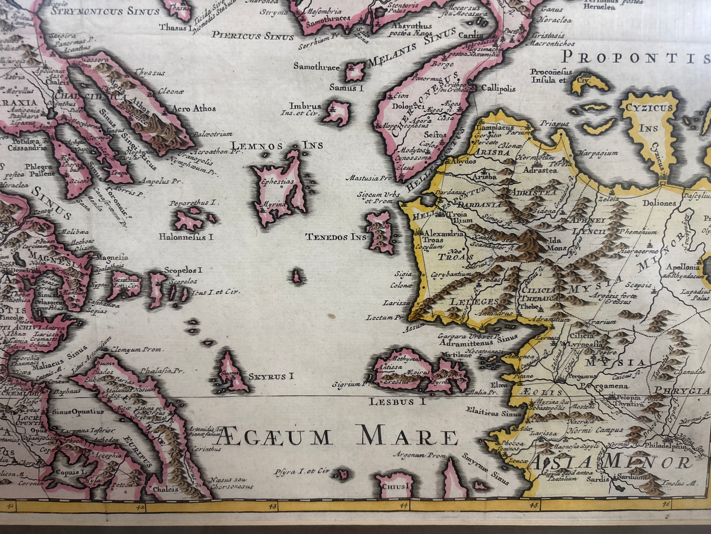
Græciæ Pars Septentrionalis - Delisle c.1700
Græciæ Pars Septentrionalis - Delisle c.1700
Delisle’s Map of Northern Greece and the Balkans (c. 1700–1740)
Title: Græciæ Pars Septentrionalis
Cartographer: Guillaume Delisle (Auctore Guillelmo Delisle)
Origin: Paris, France
Date: c. 1700–1740
Technique: Copperplate engraving with original hand-colouring
The Narrative: Scientific Cartography of the Classical World
This map tells the story of the transition from the decorative "Golden Age" of Dutch mapmaking to the more rigorous, scientific approach of the French school. Guillaume Delisle, who was eventually named Premier Géographe du Roi to Louis XIV, was renowned for his insistence on using only the most up-to-date and accurate geographical data. This map presents a detailed view of Northern Greece and the surrounding regions, including Macedonia, Thracia, Thessalia, and Illyris, at a level of topographical precision that was groundbreaking for the early 18th century.
It serves as an essential bridge between the classical past and Enlightenment science. While the map meticulously labels ancient sites and provinces mentioned in classical literature, it does so within a scientifically measured geographic framework. For the 18th-century scholar, it provided a definitive visual guide to the terrain that shaped the history of the Macedonian Empire and the northern frontiers of the Roman world.
Chronicles of the Map
-
The Delisle Pedigree: As a work by Guillaume Delisle, this map carries the prestige of the man who revolutionized modern cartography by correcting many of the long-standing geographic errors that had persisted since antiquity.
-
Topographical Detail: The map is notable for its dense and accurate rendering of the mountainous terrain of the Balkans, featuring meticulously engraved mountain ranges like the Alps of the north and the jagged peaks of central Greece.
-
Maritime Precision: The coastlines of the Ionian, Aegean, and Euxine (Black) Seas are plotted with great care, highlighting the strategic importance of the maritime corridors between Europe and Asia.
-
Baroque Aesthetic: Despite its scientific leanings, the map retains a classic Baroque elegance, with a clean, well-proportioned layout and professional hand-colouring used to distinguish the various provinces and regional boundaries.