Treasures of the Orient
Great Pacific Ocean - Pérouse 1798
Great Pacific Ocean - Pérouse 1798
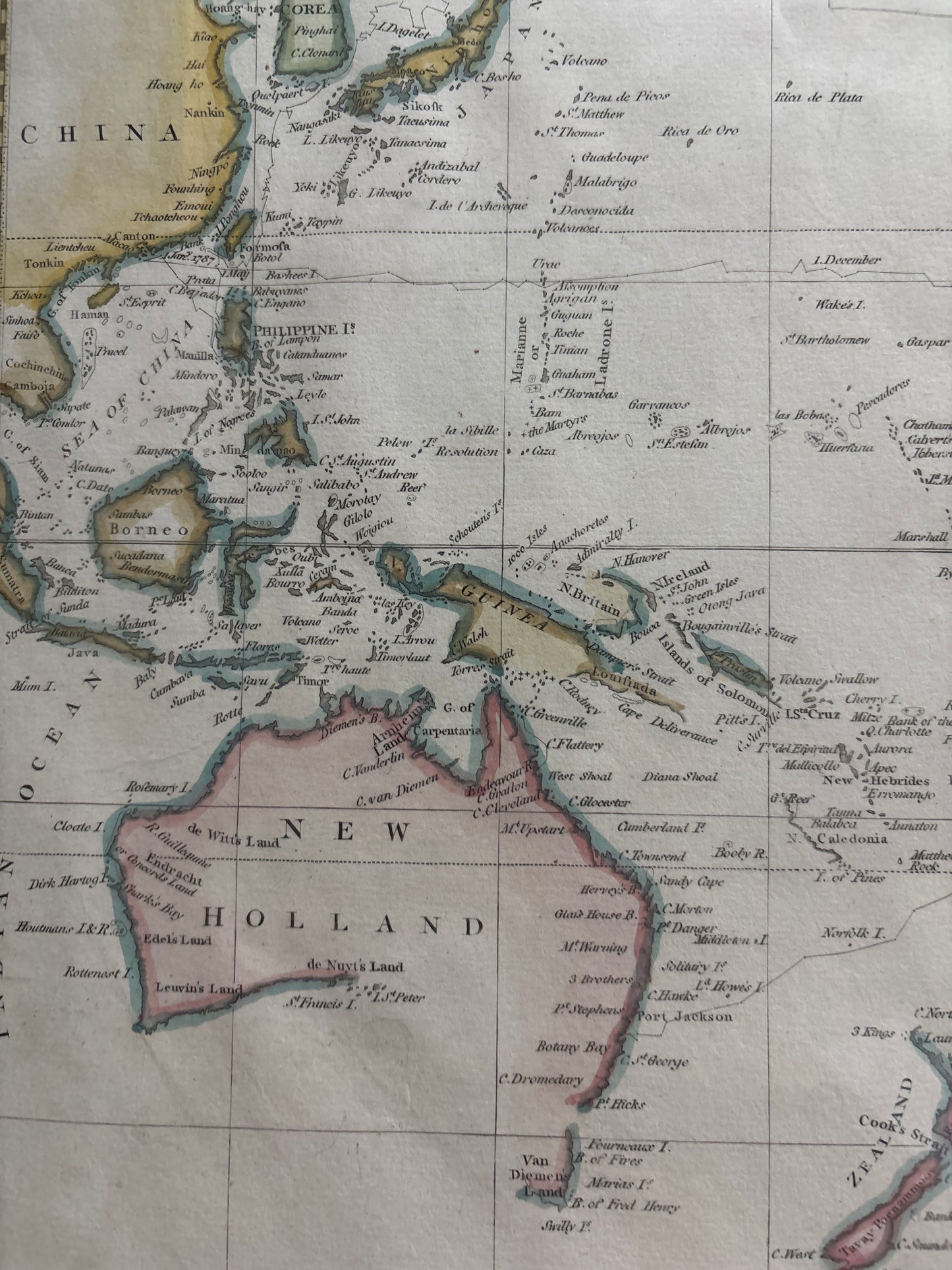
Chart of the Great Pacific Ocean (1798)
Title: Chart of the Great Pacific Ocean or South Sea, To Illustrate the Voyage of Discovery, made by the Boussole and Astrolabe, in the Years 1785, 86, 87 & 88.
Origin: London, United Kingdom.
Date: Published Nov. 1st, 1798.
Technique: Copperplate engraving with original hand-colouring.
The Final Voyage of La Pérouse
This map tells the story of one of the great mysteries of maritime exploration: the La Pérouse expedition. Commissioned by King Louis XVI to rival the discoveries of Captain Cook, Jean-François de Galaup, comte de La Pérouse, set sail with two ships, the Boussole and the Astrolabe. This chart traces their extensive path across the Pacific, from the coasts of North America and China to the shores of New Holland (Australia). Shortly after leaving Botany Bay in 1788, the entire expedition vanished, and it was not until years later that their journals—dispatched earlier in the journey—were published in London and Paris, allowing this map to be created.
It captures a Pacific Ocean that was still being defined by European powers. The map includes early sightings of the Hawaiian Islands (labeled Sandwich Isles), the intricate archipelagos of the South Seas, and the challenging coastlines of the Pacific Northwest. It is a monument to the "Age of Enlightenment" and the dangerous, high-stakes quest for geographic knowledge that often cost explorers their lives.
Chronicles of the Map
-
A Global Canvas: The map provides a massive, sweeping view of the world’s largest ocean, stretching from the Bering Strait in the north to the Southern Ocean, and from the East Indies to South America.
-
New Holland & New Zealand: The rendering of New Holland (Australia) and New Zealand reflects the most advanced nautical data available at the time, showing the progress made since the initial Dutch discoveries.
-
Maritime Routes: Faint lines across the vast blue expanse indicate the specific tracks taken by the Boussole and Astrolabe, marking the coordinates of their soundings and sightings.
-
North American Frontier: The map offers a fascinating look at the colonial boundaries of the late 1700s, labeling Louisiana, New Mexico, and the "United States" just after their independence.