Treasures of the Orient
Map of Southern & Mid-Greece - Wells 1700
Map of Southern & Mid-Greece - Wells 1700
Wells’s Map of Southern & Mid-Greece (1700)
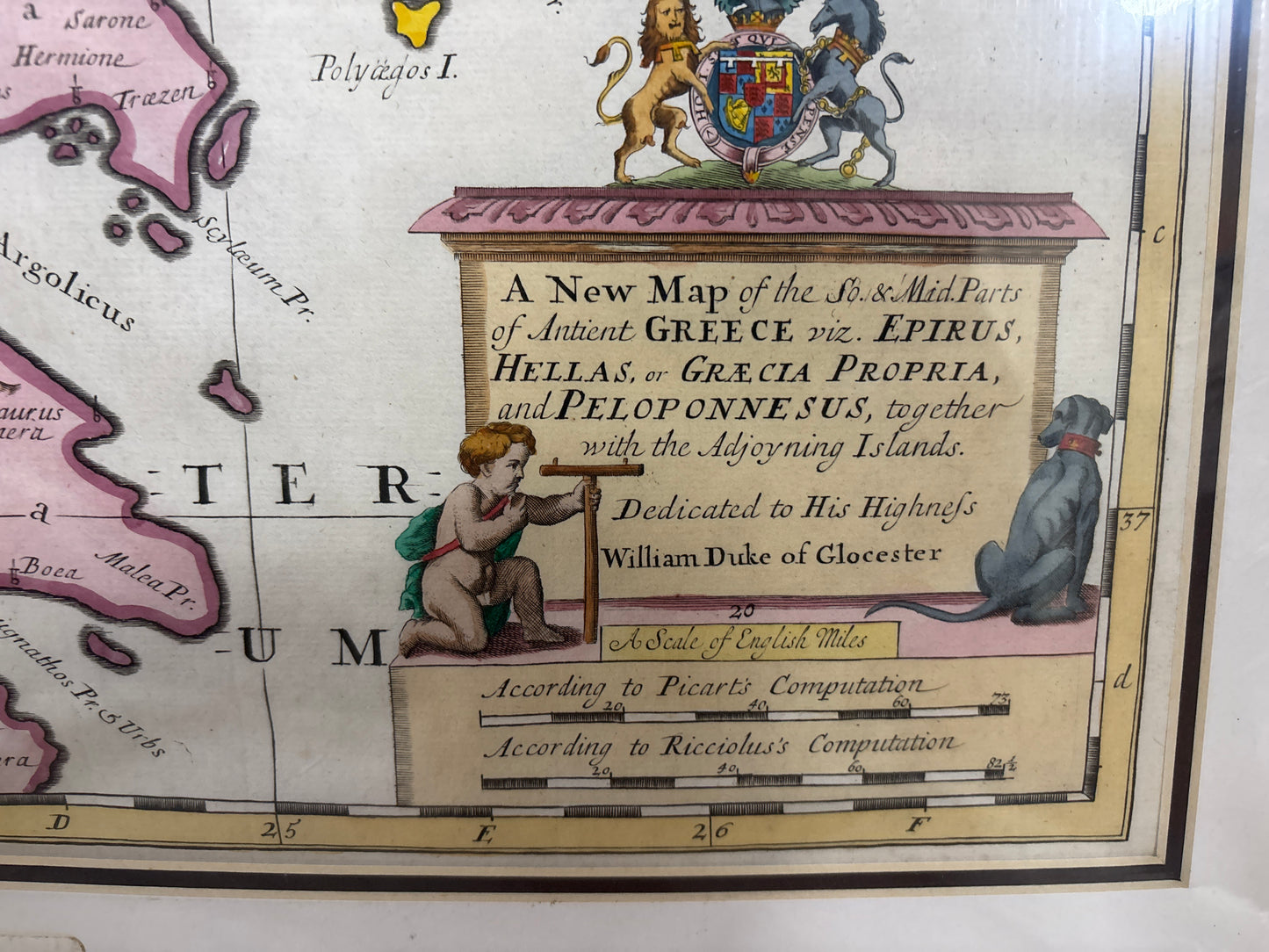
Title: A New Map of the S. & Mid. Parts of Antient Greece, viz. Epirus, Hellas or Græcia Propria, and Peloponnesus, together with the Adjoining Islands.
Cartographer: Edward Wells
Origin: Oxford / London, United Kingdom
Date: 1700
Technique: Copperplate engraving with original hand-colouring
The Narrative: The Heart of the Classical World
This map tells the story of the geographical foundation of Western history. Focused on the central and southern regions of Ancient Greece, it covers the lands of the most famous city-states, including Athens, Sparta, and Thebes. Designed for the education of Prince William, Duke of Gloucester, the map emphasizes the historical divisions of Hellas (Central Greece), the Peloponnesus, and Epirus.
For a student of the 1700s, this map was a visual companion to the works of Thucydides and Herodotus. It traces the rugged coastline of the Ionian and Aegean Seas, plotting the mountain ranges and plains that once dictated the movements of ancient hoplite armies and the boundaries of rival leagues. It is a scholarly reconstruction that brings the "Golden Age" of Greece into a clear, Enlightenment-era perspective.
Chronicles of the Map
-
The Royal Seal & Dedication: The lower-right corner features a charming, ornate cartouche dedicated to Prince William. It includes the royal coat of arms and a playful illustration of a young student (perhaps representing the Prince himself) using a surveyor’s tool, accompanied by a loyal dog.
-
Provincial Detail: The map is divided into iconic ancient regions such as Attica, Boeotia, Arcadia, and Laconia, each enhanced with distinct hand-colouring to highlight the political geography of antiquity.
-
The "Floating" Islands: Significant islands like Euboea (highlighted in green) and the Ionian islands of Cephalonia and Zacynthus are rendered with great care, emphasizing their strategic roles in Greek maritime history.
-
Oxford Scholasticism: As with other Wells maps, it features the dual distance scales based on the calculations of Picart and Riccioli, reflecting the academic rigor of the University of Oxford.