Treasures of the Orient
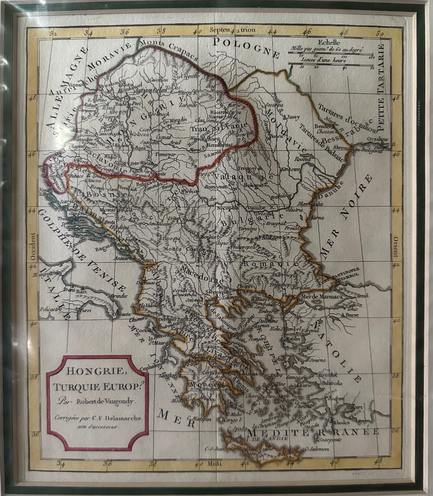
Hongrie Turquie Europ - Delamarche c.1790
Hongrie Turquie Europ - Delamarche c.1790
Title: Hongrie, Turquie Europ
Cartographers: Gilles Robert de Vaugondy & Charles François Delamarche
Published: Paris, c. 1790–1800
Technique: Copperplate engraving with original hand-coloring
Description: A detailed and historically rich map of South-Eastern Europe and the Balkans, capturing the region during a period of significant geopolitical flux. The map covers a vast territory including the Kingdom of Hungary, Transylvania, Croatia, and the extensive European territories of the Ottoman Empire (Turkey in Europe), stretching down through Greece to the Morea (Peloponnese).
Originally drafted by the prestigious royal cartographer Gilles Robert de Vaugondy, this specific edition was updated and "corrected" by his successor, Charles François Delamarche. It features the characteristic clarity of the French school, with meticulous attention to mountain ranges, river systems like the Danube, and provincial borders. The sophisticated pink-bordered title cartouche is a hallmark of the Vaugondy-Delamarche transition period.
-
Authenticity: Genuine late 18th-century copperplate engraving.
-
Key Regions: Includes detailed depictions of Macedonia, Romania, Bulgaria, and the Greek Isles.
-
Dimensions: Standard quarto size, ideal for framing.