Treasures of the Orient
Partie de l'Inde et Ile de Ceylan - Vandermaelen, 1825
Partie de l'Inde et Ile de Ceylan - Vandermaelen, 1825
Title: Partie de l'Inde et Ile de Ceylan (Sheet No. 108)
Cartographer: Philippe Vandermaelen (1795–1869)
Published: Brussels, 1825
Technique: Lithograph with original hand-coloring
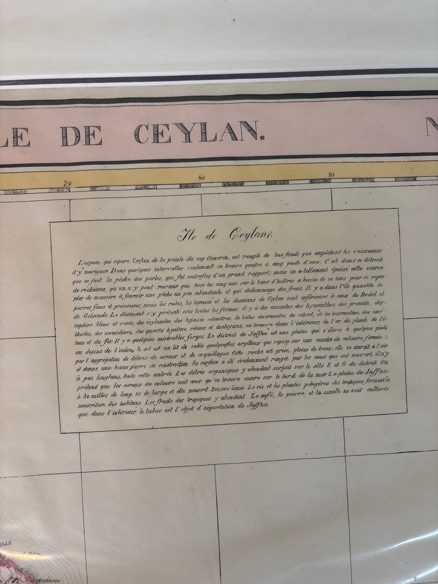
Description: A superb, large-scale map detailing Southern India and the island of Ceylon (Sri Lanka). Vandermaelen's work is celebrated by historians for being the first atlas to apply a consistent scale (1:1,641,836) to the entire globe. This specific sheet provides an exceptional level of detail for the Coromandel Coast and the rugged interior of Ceylon.
Key Features:
-
Scientific Accuracy: Unlike earlier decorative maps, this piece focuses on "Enlightenment" precision, showcasing the actual topographical data gathered by colonial surveys of the early 19th century.
-
Extensive Descriptive Text: Features two large blocks of French text. The upper block provides a detailed historical and geographical overview of Ceylon, while the lower block details its natural resources and climate.
-
Early Lithography: As one of the earliest successful uses of lithography in atlas production, the lines are softer and more fluid than traditional copperplate engravings.