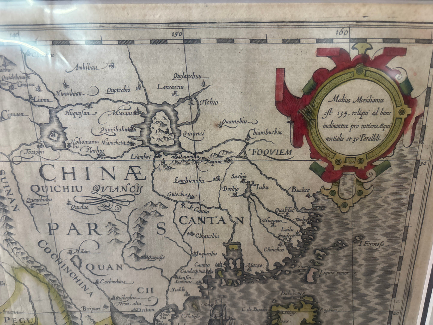
Treasures of the Orient
India Orientalis (The East Indies) - Hondius 1606
India Orientalis (The East Indies) - Hondius 1606
India Orientalis (The East Indies)
Drawn by: Jodocus Hondius the Elder (1563–1612)
Published in: Amsterdam
Year: 1606
From: The Mercator-Hondius Atlas
Condition: Excellent copperplate engraving with vibrant period hand-colouring; professionally matted.
A Foundational Masterpiece of the Dutch Golden Age
This spectacular 1606 engraving by the celebrated cartographer Jodocus Hondius is one of the most significant and sought-after maps of the East Indies ever produced. It represents the exact moment when Amsterdam seized the crown of world cartography from Antwerp, providing the European public with its first truly detailed look at the territories of the burgeoning Dutch East India Company (VOC).
The "Modernization" of Mercator
When Hondius purchased the original copper plates of the legendary Gerard Mercator in 1604, he realized the geography of Asia was vastly outdated. This India Orientalis was one of the landmark "New Maps" he created to replace Mercator’s 16th-century work. It incorporated the secret nautical data brought back by Dutch explorers like Cornelis de Houtman, effectively revealing the "Spice Islands" to the Western world for the first time.
Rarity & Cartographic Highlights
Original impressions of this map from the early 17th century are increasingly difficult to source in such pristine condition. For the serious collector, it features several critical historical details:
- The First Detailed Philippines: One of the earliest accurate depictions of the Philippine archipelago, shown alongside a remarkably detailed Luzon and the track of the Spanish Galleons.
- The Mythical Lake Chiamai: A famous cartographic "ghost," this massive lake was believed to be the common source of the Mekong and Ganges—a myth that persisted for over a century based on this influential model.
- A Pre-Colonial Crossroads: The map captures the strategic importance of Malacca, Canton, and the Singapore Strait long before the era of modern colonization, illustrating the region as a vibrant network of local kingdoms and maritime trade.
- Artistic Grandeur: Adorned with a magnificent title cartouche, an ornate compass rose, a ferocious sea monster, and a traditional Chinese junk, the map is as much a work of High Renaissance art as it is a scientific document.
Investment Value
As a cornerstone of Asian cartography, the Hondius India Orientalis has a proven track record of value appreciation. It is an essential acquisition for any museum-grade collection, representing the birth of the Dutch maritime empire and the dawn of modern global trade.