Treasures of the Orient
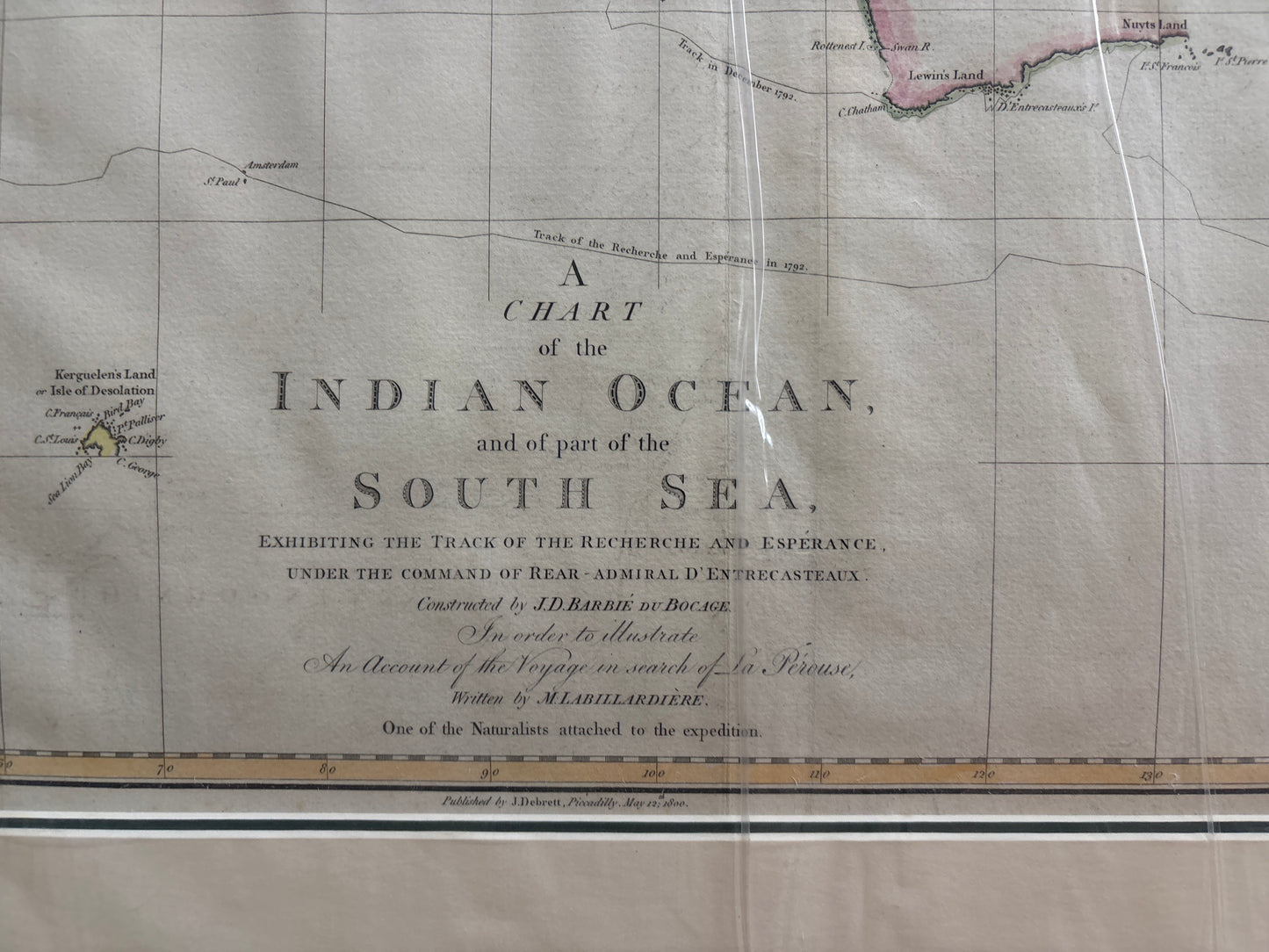
Indian Ocean - Bocage 1800
Indian Ocean - Bocage 1800
Barbié du Bocage’s Chart of the D’Entrecasteaux Voyage (1800)
Title: A Chart of the Indian Ocean, and of part of the South Sea, Exhibiting the Track of the Recherche and Esperance...
Cartographer: Constructed by Jean-Denis Barbié du Bocage (based on Labillardière’s data)
Origin: London, United Kingdom (originally published in Paris, this is the definitive English edition)
Date: 1800
Technique: Copperplate engraving with professional hand-colouring
The Narrative: The Grand Search for La Pérouse
This map tells the story of one of the great humanitarian missions of the maritime world. In 1791, with the La Pérouse expedition missing for three years, the French government dispatched Rear-Admiral Bruny d’Entrecasteaux on a critical rescue and exploration voyage with two ships, the Recherche and the Esperance. This chart, meticulously constructed from the voyage’s scientific logs, illustrates their precise tracks from Cape Town across the entire Indian Ocean and into the complex waters of Oceania.
This chart is a monument to Enlightenment-era navigation. While d’Entrecasteaux did not find La Pérouse, the expedition (which included the famed naturalist Jacques Labillardière, referenced in the title) made foundational discoveries in Tasmania (Van Diemen's Land), the coasts of New Holland (Australia), and the complex island chains of the South Sea, including New Zealand. It is a dynamic document of discovery and a record of French resolve.
Chronicles of the Map
-
The "Recherche" and "Esperance" Tracks: The sheet is covered in complex, intersecting thin lines that trace the exact navigational paths of the two French frigates, making this a functional chart rather than just a descriptive map.
-
Labillardière’s Contribution: The chart was created specifically to accompany the English edition of Labillardière's An Account of the Voyage in search of La Pérouse, cementing its reputation for scientific rigor.
-
Barbié du Bocage Pedigree: Jean-Denis Barbié du Bocage was the premier French chartmaker of his generation, ensuring this map set the new standard for Pacific hydrography at the dawn of the 19th century.
-
Focus on Key Hotspots: While providing a massive overview, the chart features dense detail on the most vital navigation points of the era, including the passage around the Cape of Good Hope, the intricate geography of the East Indies, and the challenging coasts of Southern Australia.