Treasures of the Orient
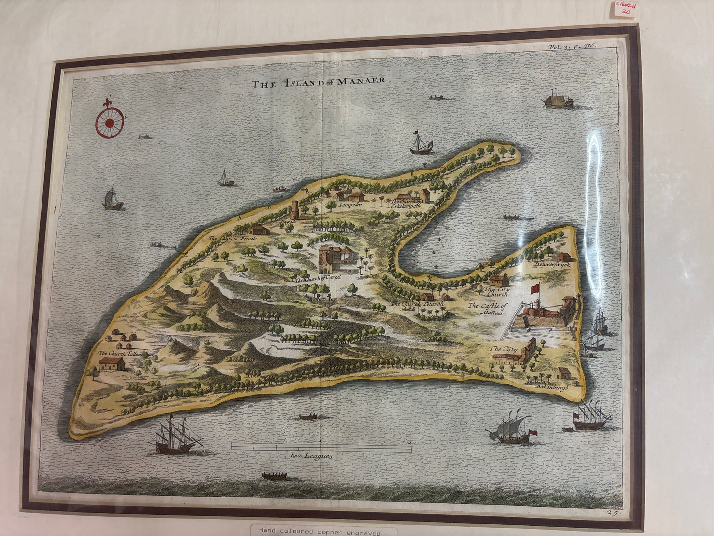
Island of Manaer - Churchill c.1704
Island of Manaer - Churchill c.1704
Title: The Island of Manaer
Cartographer: After Philippus Baldaeus / Published by Awnsham & John Churchill
Published: London, c. 1704–1744
Technique: Copperplate engraving with hand-coloring
Description: A charming and detailed 18th-century bird's-eye view of Mannar Island, a strategic land bridge between mainland Sri Lanka and India. This map is a significant historical record from the era of Dutch colonial expansion, illustrating the island's transition from Portuguese to Dutch control.
The view is oriented with the "Castle of Manaer" prominently featured on the right side, showcasing the colonial fortifications that guarded the narrow pearl-rich waters of the Palk Strait.
Key Features:
-
Ecclesiastical History: The map meticulously labels various churches across the island, such as "The Church Tallemana" and "The Church of Carel," reflecting the missionary activities of the period.
-
Maritime Activity: The surrounding waters are dotted with several 18th-century sailing vessels, including larger European men-of-war and smaller local craft.
-
Strategic Fortifications: Detailed rendering of "The Castle of Manaer" and "Bakenburgh," providing insight into the military architecture used to protect the VOC's interests in the pearl fishery.
-
Decorative Elements: Features an elegant 16-point compass rose in the upper-left corner and a scale of "two Leagues" at the bottom.