Treasures of the Orient
Isles Philippines - Bellin c.1748
Isles Philippines - Bellin c.1748
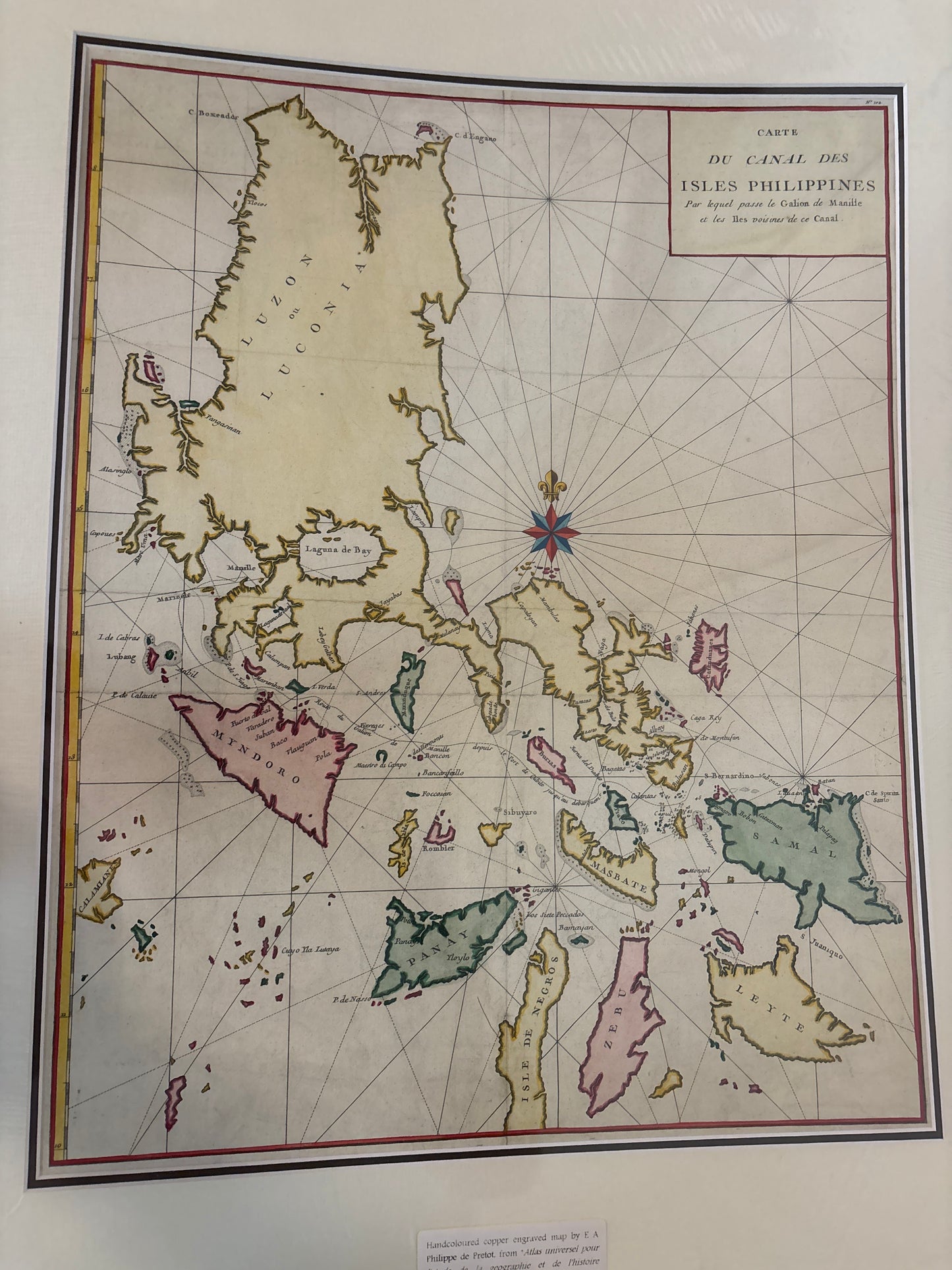
Title: Carte du Canal des Isles Philippines par lequel passe le Galion de Manille (Map of the Channel of the Philippine Islands through which the Manila Galleon passes)
Cartographer: After Jacques-Nicolas Bellin / Published by F.A. de Prévost (Abbé Prévost)
Published: From Histoire Générale des Voyages, c. 1748–1750
Technique: Copperplate engraving with hand-coloring
Description: A specialized maritime chart showing the northern and central Philippines, including Luzon (Luconia), Mindoro, Panay, and Samar. The map was designed to illustrate the treacherous but essential navigation route used by the Spanish Treasure Galleons as they entered the archipelago from the Pacific Ocean.
Key Features:
-
The Galleon Route: The title explicitly mentions the "Galion de Manille," highlighting the map's focus on the economic and maritime lifeline of the Spanish East Indies.
-
Hydrographic Detail: The sea is filled with rhumb lines and soundings, particularly around the narrow straits, reflecting the high-stakes navigation required to avoid shipwrecks in these coral-heavy waters.
-
Toponymy: Features early French spellings of major islands, such as "Mindozo" and "Zebu" (Cebu).
-
Compass Rose: A vibrant 16-point compass rose with a fleur-de-lis north indicator serves as the central decorative element.