Treasures of the Orient
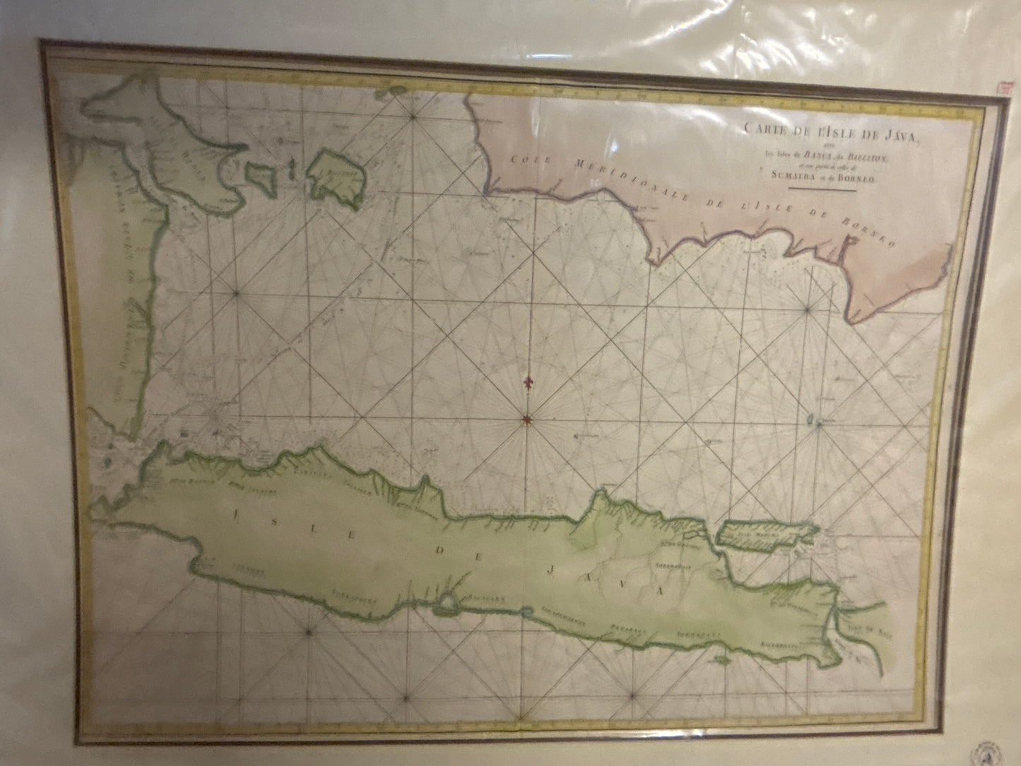
Map of Java - Bellin c. 1750
Map of Java - Bellin c. 1750
Carte de l’Isle de Java, les Isles de Banca, de Billiton...
Drawn/Published by: Jacques-Nicolas Bellin
Engraved by: Jacob van der Schley
Location: Paris / The Hague
Year: c. 1750
From: Histoire Générale des Voyages by Abbé Prévost
Condition: Hand-coloured copperplate engraving; professionally framed.
A Masterpiece of 18th-Century French Hydrography
This elegant 1750 nautical chart by Jacques-Nicolas Bellin, the premier hydrographer to the French King, provides a detailed survey of Java and the strategic islands of the Java Sea. As a professional marine chart, it was designed to guide the merchant fleets of the French and Dutch East India Companies through some of the most critical maritime crossroads in the world.
Geographic and Navigational Details
Island Coverage: The map focuses on the full length of Java, meticulously detailing its northern coastline and the various Dutch VOC administrative districts.
Strategic Straits: It captures the vital sea lanes around Banca (Bangka) and Billiton (Belitung), as well as the southern tip of Borneo and the eastern reaches of Sumatra.
Nautical Precision: Characteristic of Bellin’s hydrographic work, the sea is crisscrossed with rhumb lines (loxodromes) radiating from central compass roses, assisting mariners in plotting courses between the islands.
Artistic Style: The map features the clean, scientific lines of the French school, enhanced by a decorative title cartouche and subtle hand-colouring that highlights the coastal boundaries and interior mountain ranges.