Treasures of the Orient
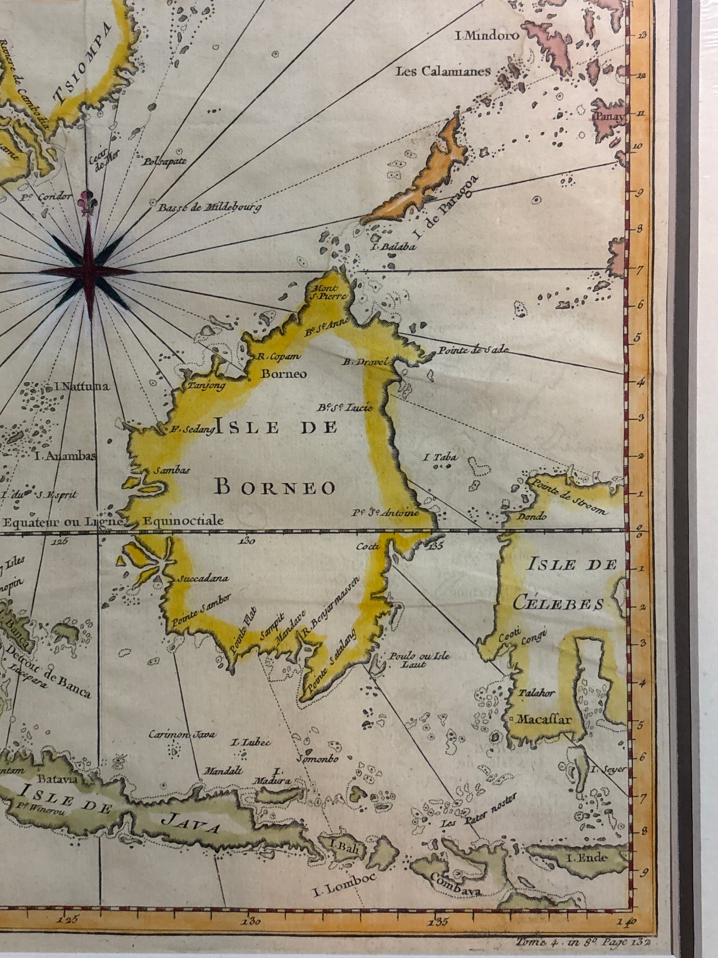
Java, Sumatra, Borneo - Bellin c.1748
Java, Sumatra, Borneo - Bellin c.1748
Title: Carte des Isles de Java, Sumatra, Borneo & les Detroits de la Sonde, Malaca et Banca
Cartographer: Jacques-Nicolas Bellin
Published: Paris, c. 1748–1764
Technique: Copperplate engraving with original hand-coloring
Description: This finely engraved map provides a detailed view of the heart of the East Indies, focusing on the Malay Peninsula, Sumatra, Java, and Borneo. It was produced by Jacques-Nicolas Bellin, the official hydrographer to the French King and the Dépôt des cartes et plans de la Marine.
The map is centered on a striking compass rose with radiating rhumb lines, characteristic of seafaring charts intended for navigation. It meticulously labels key maritime features, including:
-
The Straits of Malacca and Sunda: Critical chokepoints for the spice trade.
-
Singapore: Identified as "Sincapoure" at the southern tip of the peninsula.
-
Colonial Outposts: Including Batavia (Jakarta) on Java and various ports along the "Presqu'isle de Malaye."
The map is adorned with a beautiful Rococo-style decorative cartouche in the lower-left corner, featuring floral motifs and elegant scrollwork. The vibrant original hand-coloring highlights the coastline of the islands, making the geography pop against the sea.
-
Authenticity: Original 18th-century copperplate engraving.
-
Historical Significance: A prime record of French maritime interests and geographical knowledge in Southeast Asia during the mid-1700s.
-
Technique: Exceptional detail in the lettering and maritime soundings.