Treasures of the Orient
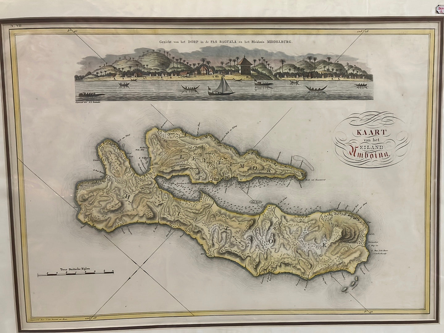
Kaart van het Eiland Amboina - van den Bosch 1818
Kaart van het Eiland Amboina - van den Bosch 1818
Van den Bosch’s Map and View of Amboina (1818)
Title: Kaart van het Eiland Amboina
Cartographer: Johannes van den Bosch
Origin: Amsterdam, Netherlands
Date: 1818
Technique: Copperplate engraving with professional hand-colouring
Defending the Spice Monopoly
This map tells the story of the Dutch East Indies during a period of intense colonial consolidation. Johannes van den Bosch, who would later become the Governor-General of the Dutch East Indies, created this work to provide a precise military and geographic overview of Amboina, the world’s primary source of cloves.
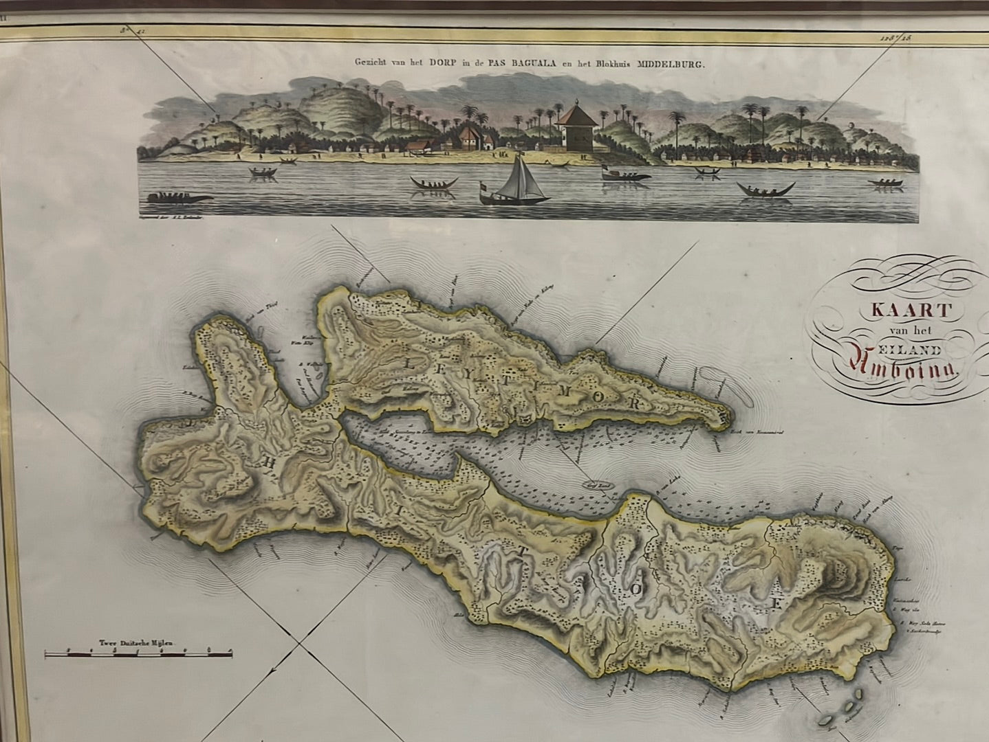
The composition serves a dual purpose: the lower section is a detailed topographical map showing the rugged terrain of the Hitoe and Leytimor peninsulas, while the top features a panoramic "profile" view of the coast at Pas Baguala. It captures the island not just as a lush tropical paradise, but as a strategic fortress guarded by the Middelburg blockhouse, which is clearly visible in the coastal profile.
Chronicles of the Map
-
The Van den Bosch Legacy: Johannes van den Bosch was a pivotal figure in Indonesian history, known for his administrative reforms; this early cartographic work showcases his technical background as a military engineer.
-
Dual-Format Design: This sheet is highly prized for combining a scientific, birds-eye map with an artistic coastal view, showing traditional local vessels alongside the colonial architecture of the Dutch outposts.
-
Topographical Detail: The map meticulously plots the "folding" mountain ranges of Ambon, illustrating why the island’s natural geography provided such a formidable defense for the clove trade.