Treasures of the Orient
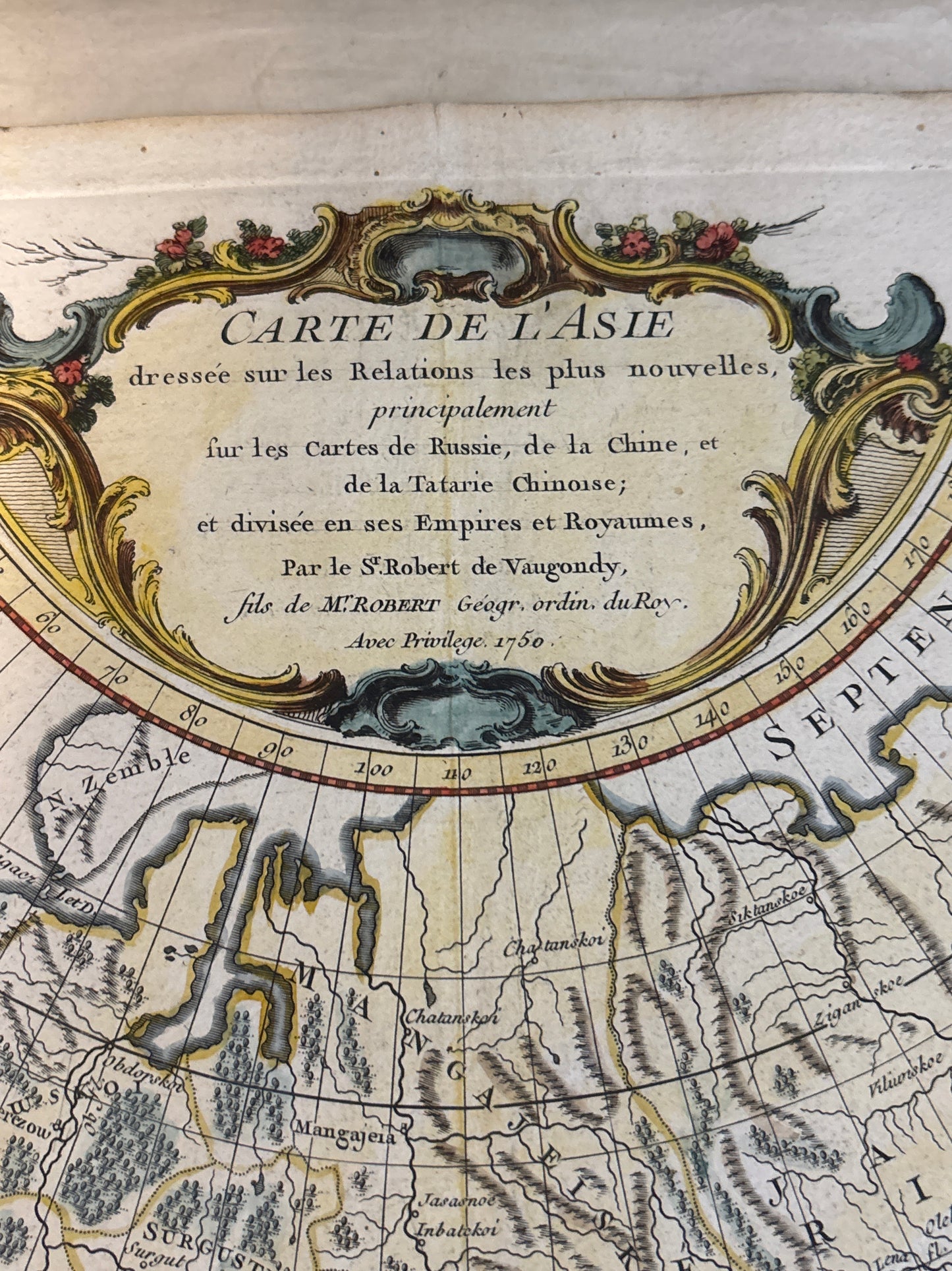
Carte de l’Asie - Vaugondy 1750
Carte de l’Asie - Vaugondy 1750
Carte de l’Asie
Drawn/Engraved by: Robert de Vaugondy (engraved by Guillaume Delahaye)
Location: Paris
Year: 1750
From: Atlas Universel
Condition: Large antique 18th-century atlas map on thick paper with original hand-coloured outlines and a decorative title cartouche, unmatted and loose.
A Scientific Landmark of Enlightenment Cartography
This 1750 engraving by the renowned French cartographer Robert de Vaugondy is a definitive record of the Asian continent during the mid-18th century. It represents a significant shift from decorative "Age of Discovery" maps toward the more empirical, scientific standards of the Enlightenment, being based on the latest relations from Russia, China, and Chinese Tartary.
Geographic Details and Contemporary Knowledge
The map captures a continent as understood by the premier French hydrographers of the period, featuring:
- Regional Precision: Detailed depictions of the Mughal Empire, the Oirat Kingdom, and the principal states of Central and Southern Asia.
Northern Discoveries: It incorporates updated geographical information for Russia and Siberia, reflecting the extensive survey work conducted during the early 18th century. - East Asian Coastlines: The map provides a well-defined view of the Philippines, Japan, and Korea, correcting many of the cartographic anomalies seen in 17th-century works.
- Artistic Merit: The piece is anchored by a magnificent decorative title cartouche at the top center, typical of the elegant aesthetic that made French mapmaking the global gold standard of the era.