Treasures of the Orient
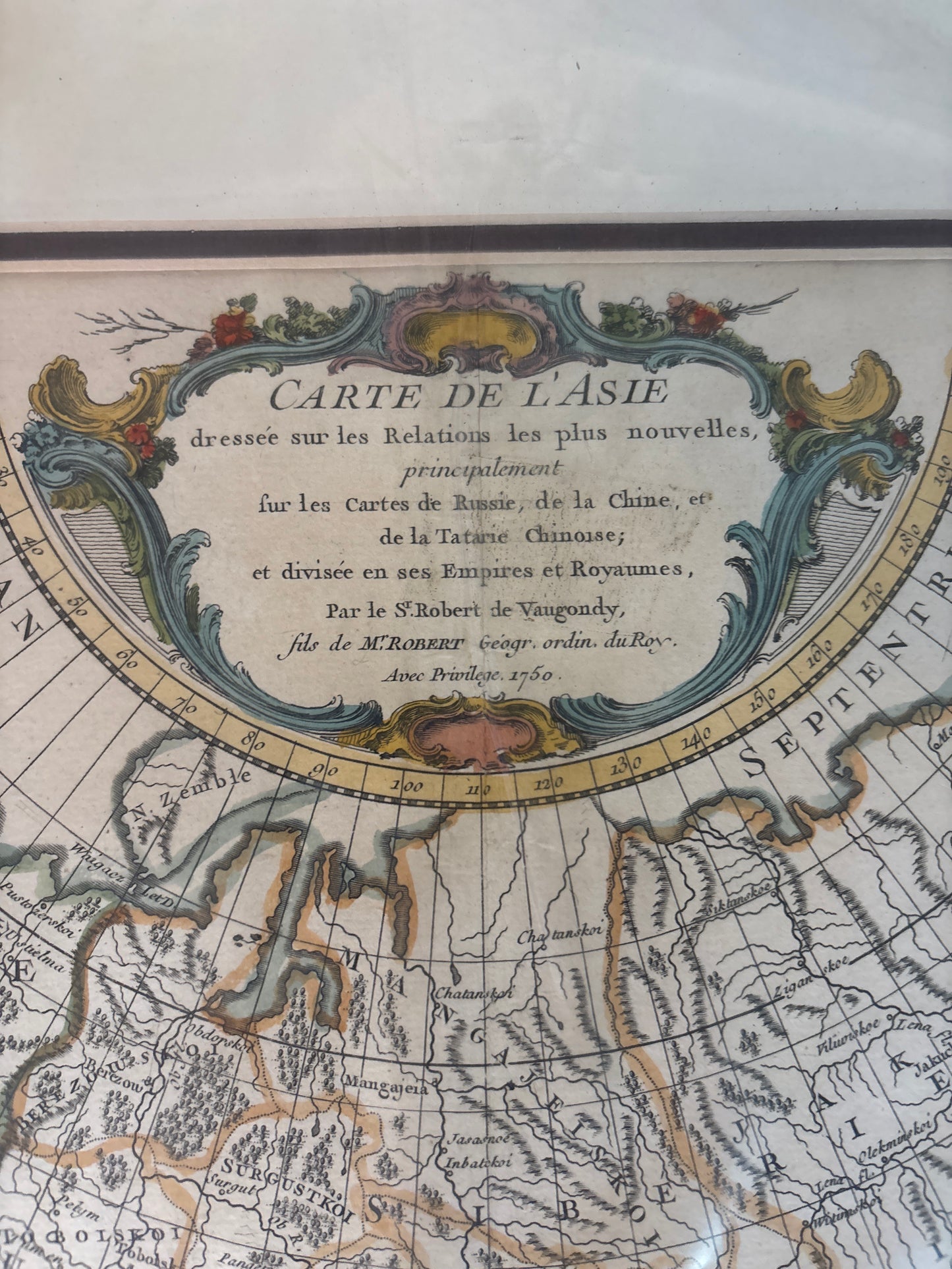
Carte de l’Asie - Vaugondy 1750
Carte de l’Asie - Vaugondy 1750
Carte de l’Asie
Drawn by: Gilles and Didier Robert de Vaugondy
Engraved by: Guillaume Delahaye
Location: Paris
Year: 1750 (Dated on map)
From: Atlas Universel (First published in 1757)
Condition: Fine copperplate engraving with original hand-coloured outlines; features a large decorative title cartouche, professionally matted.
A Scientific Landmark of Enlightenment Cartography
This 1750 engraving is one of the most important mid-18th-century surveys of the Asian continent. The Vaugondys were famous for their scientific approach, moving away from the purely decorative "age of discovery" maps toward charts based on verifiable data. This map is specifically noted for being based on the latest Russian and Jesuit surveys of the time.
Geographic Details and Contemporary Knowledge
The map reflects the peak of French geographical intelligence before the major colonial shifts of the late 1700s:
- Northeast Asia: This is one of the first maps to provide a more accurate (though still partially speculative) rendering of the northeast coast of Asia, based on recent Russian discoveries.
- "Mer de Corée": Notably, the sea between Japan and Korea is labeled as the "Sea of Korea" (Mer de Corée), an identification that is still a subject of historical discussion today.
- Continental Divisions: It meticulously outlines the Mughal Empire, Chinese Tartary, and the Southeast Asian kingdoms, using a clear, clean engraving style that became the gold standard for European atlases.