Treasures of the Orient
Malac - Mannevillette 1775
Malac - Mannevillette 1775
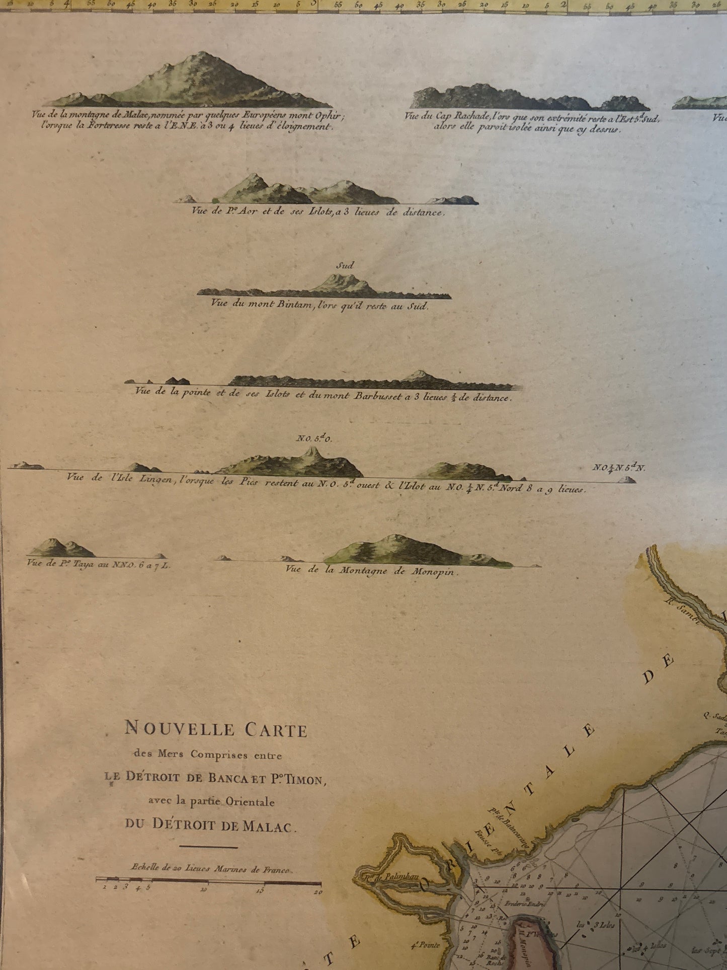
Title: Nouvelle Carte des Mers Comprises entre le Détroit de Banca et P. Timon, avec la partie Orientale du Détroit de Malac
Cartographer: After Jean-Baptiste d'Après de Mannevillette
Published: Paris, c. 1775
Technique: Copperplate engraving with original hand-coloring
Description: This expansive maritime chart covers the critical sea lanes between Sumatra, the Malay Peninsula, and the island of Banca (Bangka). It was a primary tool for the French East India Company, part of the celebrated Le Neptune Oriental, which reformed navigation in the East by providing unprecedented accuracy in charting shoals, soundings, and currents.
The map is densely packed with navigational data, including:
-
The Malay Peninsula: Labeled as the "Presqu'Isle de Malaye," showing the eastern coastline and the approach to the Straits of Malacca.
-
Sumatra & Banca: Detailed charting of the "Détroit de Banca," a vital passage for the spice trade.
-
Pulo Timon (Pulau Tioman): A critical navigational landmark for ships heading toward the South China Sea.
-
Coastal Profiles: The upper-left portion of the sheet features ten distinct topographical "views" or silhouetted coastal profiles. These were essential for 18th-century mariners to identify landfalls from the deck of a ship.
-
Rhumb Lines: An intricate web of rhumb lines radiates across the water, assisting navigators in plotting their compass headings.
-
Authenticity: Original 18th-century copperplate engraving.
-
Hydrographic Precision: Represents the peak of French maritime science, favored by captains for its reliability in the dangerous waters of the archipelago.
-
Visual Appeal: The combination of detailed maritime charting and the charming coastal silhouettes makes this one of the most decorative and informative charts of the region.