Treasures of the Orient
Universalis Tabula Iuxta Ptolemaeum - Mercator c. 1695
Universalis Tabula Iuxta Ptolemaeum - Mercator c. 1695
Universalis Tabula Iuxta Ptolemaeum
Drawn/Engraved by: Gerard Mercator (after Claudius Ptolemy)
Location: Leiden (published by François Halma)
Year: 1695–1704
From: Tabulae geographicae Cl. Ptolemaei
Condition: Hand-colored copperplate engraving; identifies the four elements in decorative corner cartouches.
A Masterpiece of Scientific Archeology
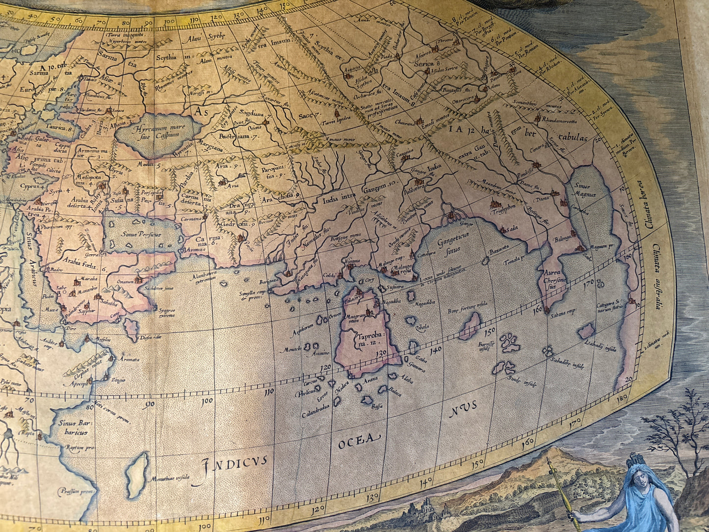
This spectacular map represents the culmination of Gerard Mercator's lifelong ambition: to produce a definitive, "restored" version of the ancient geographer Claudius Ptolemy's 2nd-century world view. Mercator personally engraved the plates to strip away centuries of accumulated errors, offering an authentic portrait of how the Greeks and Romans perceived the "Ecumene" (the inhabited world).
The 1695 Leiden Edition
While first published in 1578 with a plain strapwork border, this specific Leiden edition marks a major aesthetic shift. The plates were reworked by Jan van Vianen for publisher François Halma, replacing the original border with a magnificent frieze of allegorical figures representing the Four Elements:
Fire (Top Left): Zeus/Jupiter riding an eagle amidst flames.
Air (Top Right): Hera/Juno reclining on clouds with her peacock.
Water (Bottom Left): Neptune/Poseidon with his trident and sea-horses.
Earth (Bottom Right): Gaia/Cybele surrounded by flora and fauna.
Geographic Curiosities
True to Ptolemaic tradition, the map features a massively exaggerated Taprobana (modern Sri Lanka) and a land-locked Indian Ocean. It depicts only the northern portion of Africa, with the Nile shown originating from the mythical "Mountains of the Moon".