Treasures of the Orient
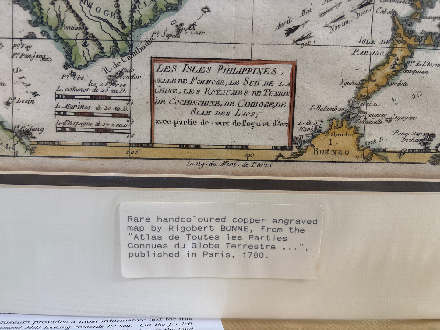
Les Isles Philippines - Bonne 1780
Les Isles Philippines - Bonne 1780
Les Isles Philippines, le Sud de la Chine, et les Royaumes de Tunkin, Cochinchine, Camboge, Siam, et des Laos
Drawn by: Rigobert Bonne (Royal Hydrographer to the King of France)
Published in: Geneva
Year: 1780
From: Atlas de toutes les parties connues du Globe Terrestre (Raynal's Histoire des deux Indes)
Condition: Hand-coloured copper engraving; includes inset map of Guam.
A Comprehensive View of Enlightenment Southeast Asia
This 1780 map by Rigobert Bonne, one of the most prolific French cartographers of the late 18th century, offers a detailed scientific survey of the maritime and mainland kingdoms of Southeast Asia. Produced during his tenure as the Premier Hydrographer of the French Navy, the map reflects the high standards of accuracy that defined the French school of cartography.
Geographic and Maritime Detail
The map is a vital record of regional geopolitics and trade routes just before the 19th-century colonial shifts:
- The Philippines & Nautical Tracks: The archipelago is shown with remarkable detail for the era, including the Bernardino Strait and the nautical tracks between Manila and the Vietnamese coast.
- Mainland Kingdoms: It provides a clear layout of the kingdoms of Siam (Thailand), Tonkin, and Cochinchine (Vietnam), tracing the major river systems of the Mekong and Chao Phraya.
- Singapore : At the bottom left, the tip of the Malay Peninsula clearly identifies I. Sincapour (Singapore). Its inclusion marks the island’s long-standing status as a critical waypoint on the route to China.
- The Guam Inset: A notable feature is the inset map in the upper right detailing the Island of Guam, a strategic Spanish outpost in the Pacific.