Treasures of the Orient
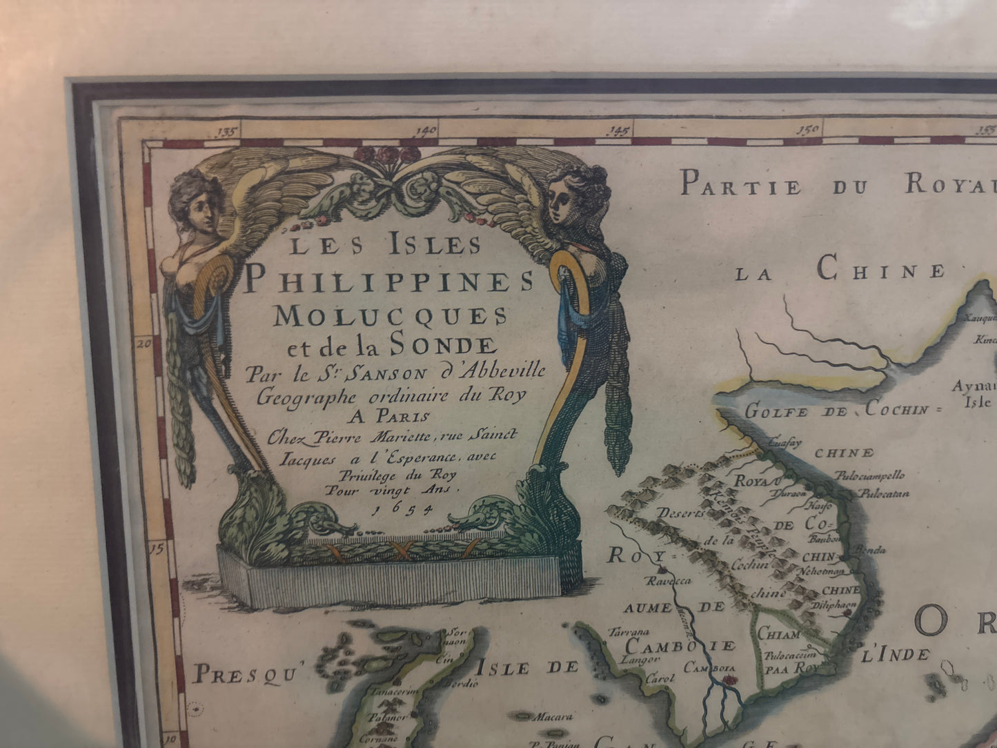
Les Isles Philippines Molucques et de la Sonde - Sanson 1654
Les Isles Philippines Molucques et de la Sonde - Sanson 1654
Title: Les Isles Philippines, Molucques et de la Sonde
Cartographer: Nicolas Sanson d’Abbeville
Published: Paris, 1654 (First Edition)
Technique: Copperplate engraving with original hand-coloring
Description: An exquisite and highly influential mid-17th-century map of the East Indies and Southeast Asia. This map encompasses the Philippines, the Indonesian archipelago (including the Sunda Islands and the Spice Islands/Moluccas), the Malay Peninsula, and the northern coast of Australia (labeled "Terre d'Endracht" and "Terre de Witt").
Nicolas Sanson was the royal geographer to King Louis XIII and is credited with shifting the center of the map-making world from Antwerp and Amsterdam to Paris. This map is celebrated for its scientific approach, moving away from the decorative "monsters and myths" of earlier eras in favor of the most recent Dutch and Spanish maritime data. The title is housed in a sophisticated architectural stone-work cartouche, a signature of Sanson's elegant style.
-
Authenticity: Genuine 17th-century copperplate engraving.
-
Geographical Interest: Notable for its early depiction of the northern Australian coastline and the detailed layout of the "Spice Islands," which were the most valuable real estate in the world at the time.
-
Historical Significance: One of the earliest maps to provide a relatively modern and recognizable shape to the Philippine archipelago.