Treasures of the Orient
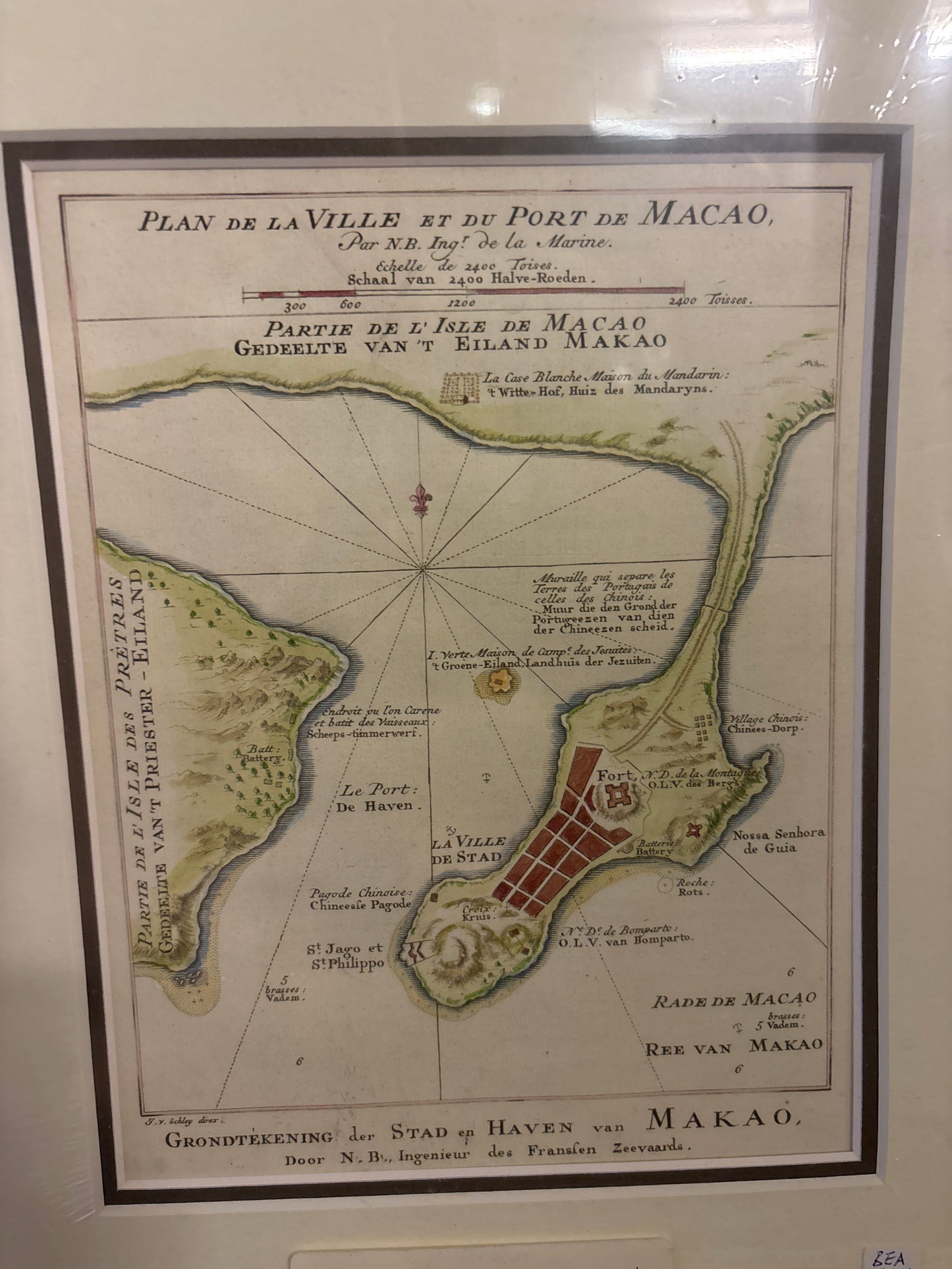
Plan of the City and Port of Macau - Bellin c. 1748
Plan of the City and Port of Macau - Bellin c. 1748
Title: Plan de la Ville et du Port de Macao (Plan of the City and Port of Macau)
Cartographer: Jacques-Nicolas Bellin (1703–1772)
Engraver: Jakob van der Schley (1715–1779)
Published: Paris/Amsterdam, c. 1748–1764
Technique: Copperplate engraving with hand-coloring
Description: This fine 18th-century plan is one of the most famous and detailed early depictions of the Portuguese enclave of Macau. Created by Jacques-Nicolas Bellin, the official hydrographer to the French King, this map was published in several important works, including the Histoire Générale des Voyages by Abbé Prévost.
The map provides an intricate look at the urban structure and defenses of Macau during the mid-1700s. It features a dual-language title in French and Dutch (Grondtekening der Stad en Haven van Makao), catering to the two major European maritime powers of the era.
Key Historical Details:
-
Fortifications: The plan clearly marks major defensive sites, including Fortaleza do Monte (Notre Dame de la Montagne) and the southern batteries of São Tiago and Bomparto.
-
Urban Divide: A notable feature is the depiction of the wall separating the Portuguese colonial city from the neighboring Chinese village, illustrating the unique social and political geography of the peninsula.
-
Topography: Relief is shown pictorially, highlighting the hilly terrain that defined Macau's strategic importance as a gateway to trade with Guangzhou (Canton).