Treasures of the Orient
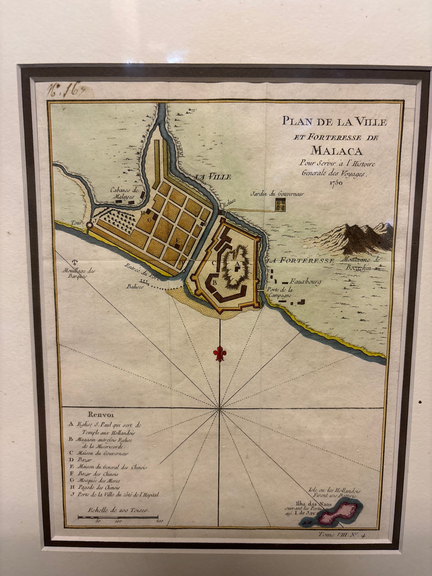
Plan de la Ville et Forteresse de Malaca - Bellin 1750
Plan de la Ville et Forteresse de Malaca - Bellin 1750
Plan de la Ville et Forteresse de Malaca
Drawn/Published by: Jacques-Nicolas Bellin
Engraved by: Jakob van der Schley
Published in: Paris / The Hague
Year: 1750
From: Histoire Générale des Voyages by Abbé Prévost
Condition: Hand-coloured copperplate engraving; professionally matted.
A Definitive Plan of the "Gibraltar of the East"
This fine 1750 plan by Jacques-Nicolas Bellin, the premier hydrographer to the King of France, provides a detailed architectural and strategic record of Malacca during the period of Dutch rule. As a vital pivot point for trade between the Indian Ocean and the South China Sea, Malacca was one of the most heavily fortified and contested ports in the world.
Key Features and Landmarks
The map is renowned for its precision in documenting the city’s layout and defensive structures. The "Renvoi" (Legend) identifies critical sites:
- Eglise S. Paul (A): The historic St. Paul's Church, used by the Dutch as a burial ground and lookout.
- La Forteresse: A detailed rendering of the famous Portuguese-built fortress, A Famosa, which the Dutch significantly reinforced.
- The Chinese & Malay Quarters: The map clearly distinguishes the "Bazar des Chinois" and the "Cabanes des Malais," illustrating the multicultural urban fabric of the 18th-century port.
- Government House (C): The residence of the Dutch Governor located within the safety of the fortress walls.
Cartographic Style
Bellin’s style is a hallmark of French Enlightenment cartography—clean, scientific, and focused on functional detail. The addition of the compass rose and the scale in "Toises" (a pre-revolutionary French unit of length) underscores its origin as a professional navigational and historical tool.