Treasures of the Orient
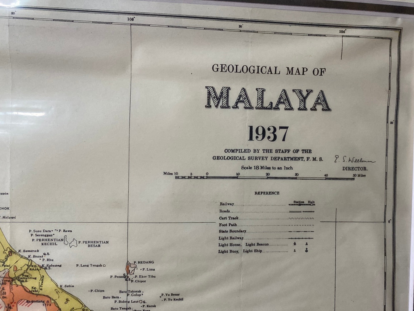
Malaya - 1937
Malaya - 1937
Title: Geological Map of Malaya, 1937
Cartographer: Compiled by the Staff of the Geological Survey Department, Federated Malay States (F.M.S.)
Published: Survey Department, Federated Malay States, 1937
Technique: Chromolithograph (Color-printed map)
Description: A comprehensive and visually vibrant geological survey of the Malay Peninsula on the eve of the Second World War. This map provides a detailed scientific breakdown of the region’s complex mineral landscape, utilizing a sophisticated color-coding system to identify various rock formations—ranging from Quaternary alluvium to Paleozoic granites.
Produced by the Geological Survey Department of the F.M.S., this map was a vital tool for the colonial administration’s mining and resource management sectors, particularly in the identification of tin-rich areas. It features the entire peninsula from the Siamese border down to Singapore, including an inset of the Langkawi Islands in the lower left. The map is meticulously detailed, showing state and international boundaries, railway lines, and major river systems, reflecting the high standard of the Federated Malay States Survey Department.
-
Authenticity: Original 1937 government-issued scientific survey.
-
Key Detail: Features the signature of the Director of the Geological Survey, E.S. Willbourn, in the top right.
-
Dimensions: Approximately 84cm x 61cm (Large format).