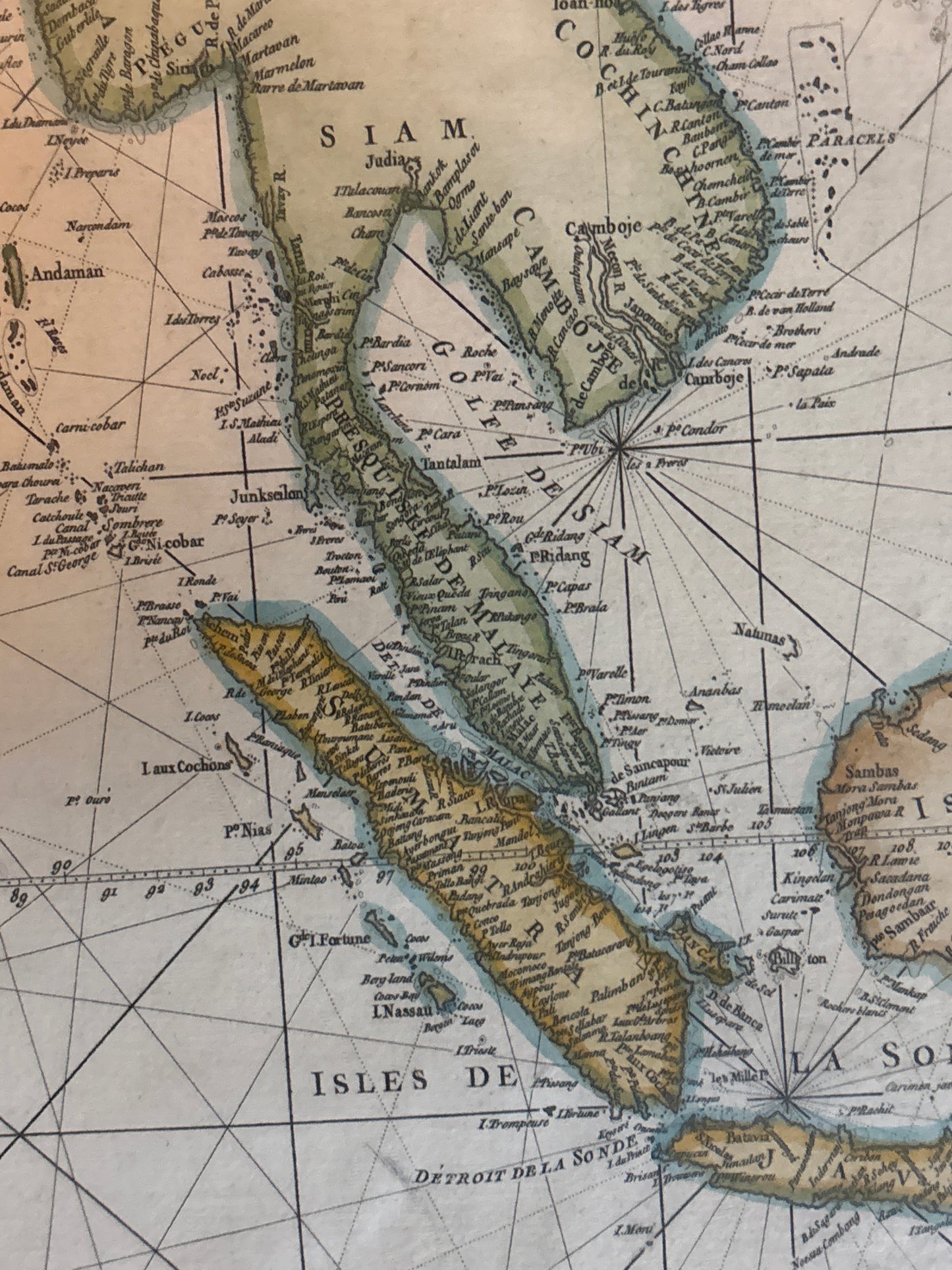
Treasures of the Orient
Carte Réduite de l'Ocean Oriental - Mannevillette 1775
Carte Réduite de l'Ocean Oriental - Mannevillette 1775
Regular price
$4,000.00 SGD
Regular price
Sale price
$4,000.00 SGD
Unit price
per
Title: Carte Réduite de l'Ocean Oriental depuis le Cap de Bonne Esperance jusqu'à l'Isle Formose
Cartographer: Jean-Baptiste d'Après de Mannevillette
Published: Paris, 1775
Technique: Large-format copperplate sea chart
Description: An impressive and expansive sea chart (portolan-style) covering the vast Indian Ocean, from the Cape of Good Hope to Taiwan (Formosa). This chart was part of the Neptune Oriental, the most accurate maritime atlas of its time, used by the French East India Company for navigation. It features a complex web of rhumb lines (navigation paths) centered on a striking compass rose. This map is a functional masterpiece, designed for the high-stakes world of the 18th-century spice and tea trades.