Treasures of the Orient
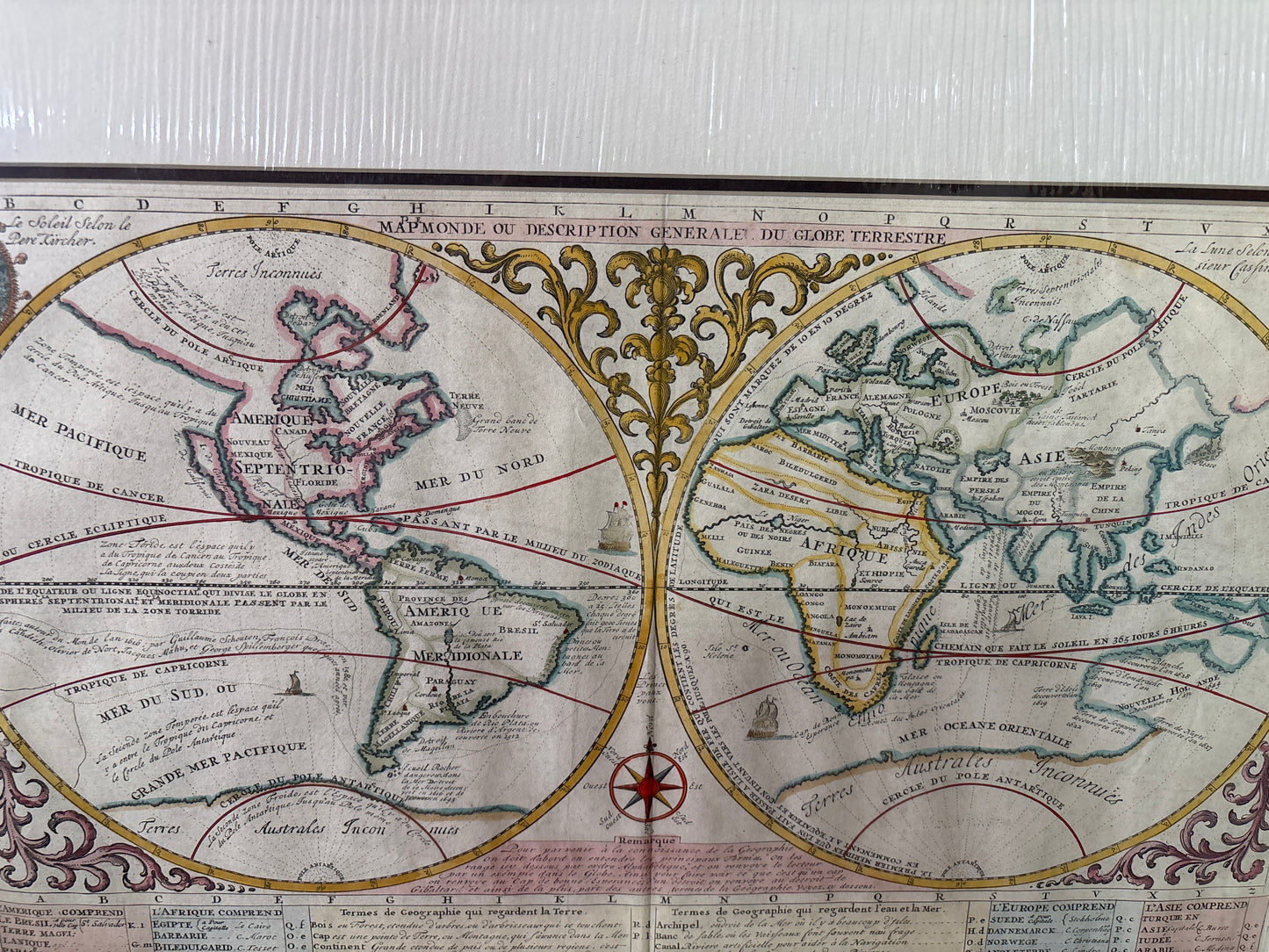
World Map (Map Monde) - Chatelain c. 1705-1720
World Map (Map Monde) - Chatelain c. 1705-1720
Mapmonde ou Description Générale du Globe Terrestre
Drawn by: Henri Abraham Chatelain (1684–1743)
Published in: Amsterdam
Year: c. 1705–1720-
From: Atlas Historique (published by L'Honoré & Chatelain)
Condition: Fine copperplate engraving with vibrant hand-colouring; professionally matted.
A Masterpiece of the Dutch Golden Age
This spectacular double-hemisphere world map is a landmark of historical geography from the seminal seven-volume Atlas Historique. Compiled by the Huguenot pastor Henri Chatelain, this work was innovative for its time, blending scientific cartography with scholarly studies of ethnology, heraldry, and cosmography.
Geographic Details and Period Curiosities
The map is prized by collectors for its inclusion of several classic 18th-century cartographic errors and unique features:
- Island California: California is prominently depicted as a large island off the western coast of North America, a prevailing theory of the era.
- Uncharted Lands: The map features an incomplete "New Hollande" (Australia) and missing parts of New Zealand, reflecting the limits of European exploration before Cook’s voyages.
- Navigational Aids: It includes two astronomical diagrams (solar system and lunar phases), a compass rose, and an extensive table below listing the nations and geographic terms in French.