Treasures of the Orient
Map of Africa - Wells 1700
Map of Africa - Wells 1700
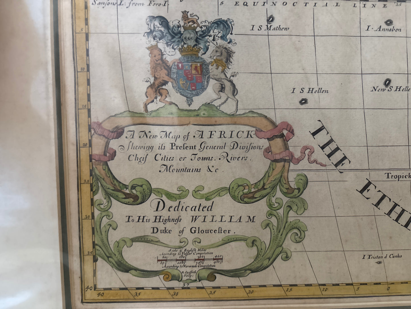
A New Map of Africk showing its present general divisions, chief cities or towns, rivers, mountains &c.
Drawn by: Edward Wells (Engraved by Richard Spofforth)
Published in: London
Year: 1700 (First Edition)
From: A New Sett of Maps both of Antient and Present Geography
Dedication: Dedicated to His Highness William, Duke of Gloucester.
An Educational Landmark of the English Baroque
This 1700 engraving by the distinguished English scholar Edward Wells is a prime example of early 18th-century educational cartography. Wells, a teacher of mathematics and geography at Christ Church, Oxford, designed this map specifically for his pupil, the young William, Duke of Gloucester. The Duke, who was only 11 years old and a student at Oxford, unfortunately passed away in 1700, the same year the first edition of this atlas was published.
Historical and Geographic Narrative
The map reflects the European understanding of the African continent at the turn of the century, characterized by a mix of maritime precision and speculative interior geography.
- Pictorial Geography: Relief is shown through charming, "unsophisticated" pictorial mountain ranges, and the continent’s rivers—including the Nile and Congo—are traced as they were understood by English scholars of the period.
- The "Negroland" Region: A significant portion of West Africa is labeled as "Negroland," while North Africa is divided into its various Mediterranean regencies.
- Decorative Cartouches: The map is anchored by a large, ornate title cartouche in the lower left, which includes a formal dedication to the young Duke of Gloucester, often topped with his royal coat of arms.
A Collector’s Perspective
Wells' maps are highly sought after for their clear, scannable layout and decorative charm. Eschewing the dense, often cluttered detail of contemporary Dutch maps, Wells focused on providing a clean "modern day" counterpart to his ancient geography maps. It remains a definitive record of the era when geography was emerging as a core academic discipline for the British elite.