Treasures of the Orient
Map of the World (Earliest Map of World to Show Currents) - Kircher 1665
Map of the World (Earliest Map of World to Show Currents) - Kircher 1665
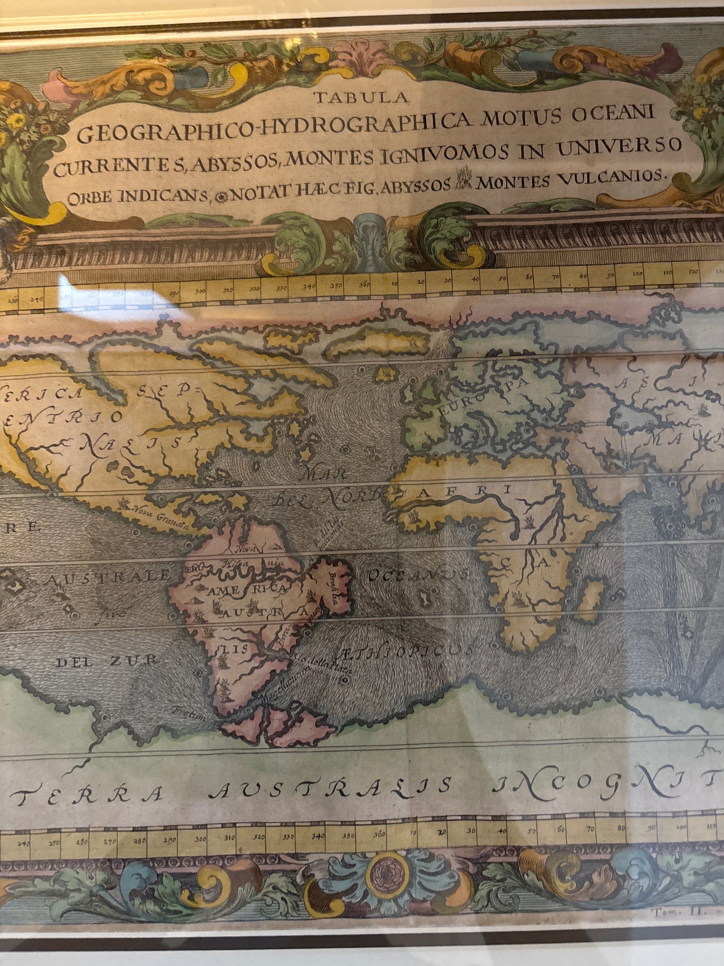
Title: Tabula Geographico-Hydrographica Motus Oceani Currentes...
Cartographer: Athanasius Kircher
Origin: Amsterdam
Date: c. 1665
Technique: Copperplate engraving with hand-colouring
Mapping the Veins of the Earth
In the 1660s, the world was still a place of deep mystery. Athanasius Kircher believed that the Earth was a living organism and that the oceans functioned like a circulatory system. This map tells the story of his "hydrographic" theory: he believed that the world's oceans were connected by a series of subterranean tunnels.
According to Kircher, water was swallowed by a massive whirlpool at the North Pole, filtered through the center of the Earth, and expelled at the South Pole. The swirling lines you see across the oceans are his attempt to visualize the great surface currents that mariners had begun to report. It is a breathtaking intersection of early science, theology, and pure imagination.
Chronicles of the Map
-
The "Unknown Southern Land": At the bottom of the map lies a massive, continuous landmass labeled Terra Australis Incognita. This reflects the pre-Cook era belief that a giant continent must exist at the bottom of the world to keep the planet from tipping over.
-
The Heart of the Whirlpools: Look closely at the coastlines; you will see small "swirl" icons. Kircher used these to mark the locations of massive oceanic abysses and "burning mountains" (volcanoes). He believed these were the intake and exhaust valves of the Earth's internal engine.
-
A Distorted New World: North America (America Septentrionalis) is shown with a curious, widened shape, and California is correctly attached to the mainland—a rare choice for the mid-17th century when many Dutch mapmakers were still depicting it as an island.
-
Baroque Grandeur: The map is crowned by an elaborate title banner supported by two "putti" (cherubs) amidst floral garlands. This decorative flourish is typical of the high Baroque style, signaling that the map was a luxury object for the libraries of the European intellectual elite.