Treasures of the Orient
Mappe Monde - Chatelain c. 1705-1720
Mappe Monde - Chatelain c. 1705-1720
Mappe-Monde pour connoitre les progrès & les conquestes les plus remarquables des Provinces-Unies
Cartographer: Henri Abraham Chatelain (based on earlier plates)
Published in: Amsterdam
Year: c. 1705–1720
From: Atlas Historique
Condition: Hand-coloured copperplate engraving; professionally matted.
A Cartographic Celebration of the Dutch Golden Age
This spectacular double-hemisphere world map is a landmark of historical geography, specifically designed to celebrate the global reach and maritime conquests of the Dutch Republic. Published at the height of Amsterdam's dominance in the map-making world, it provides a fascinating visual record of the territories and trade routes established by the two great Dutch trading giants: the VOC (East India Company) and the WIC (West India Company).
Geographic Details & Period Anomalies
The map is prized by collectors for its inclusion of several classic early 18th-century cartographic errors and unique features:
- Island California: California is prominently depicted as a large island off the western coast of North America.
- Maritime Empires: Detailed text panels and symbols identify Dutch colonial possessions and commercial outposts across the Americas, Africa, and the East Indies.
- Heraldry & Monograms: The top corners feature the iconic monograms of the VOC and WIC, explicitly linking the map to the Dutch maritime companies.
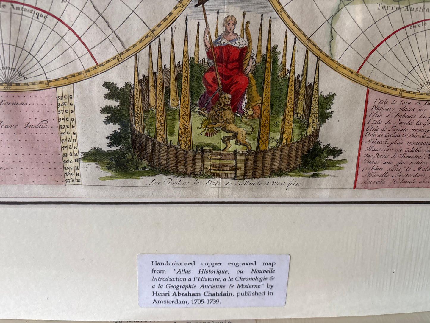
Artistic Grandeur
The map is anchored by a magnificent allegorical vignette at the bottom center. It depicts the Dutch Republic Lion standing at the gateway to a fortified garden, representing the Seven Provinces, while holding a sword and a cluster of arrows symbolizing Dutch unity and strength. This central figure is surrounded by the coats of arms of the various Dutch provinces, further cementing the map as a work of national prestige.