Treasures of the Orient
Moluccarum (Spice Islands) - Jansson c.1633
Moluccarum (Spice Islands) - Jansson c.1633
Title: Insularum Moluccarum Nova Descriptio
Cartographer: Jan Janssonius (Jansson)
Published: Amsterdam, c. 1633–1650
Technique: Copperplate engraving with original hand-coloring
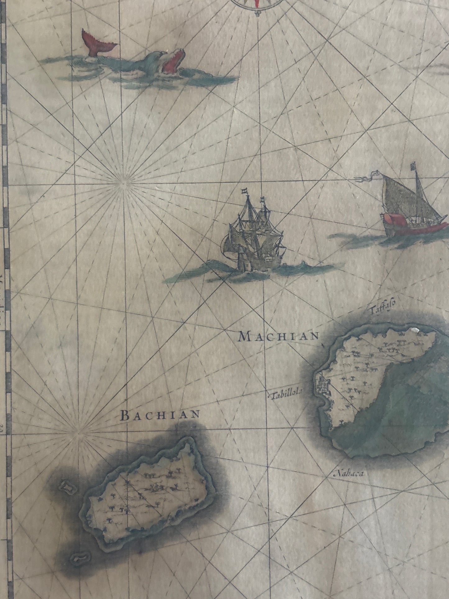
Description: This iconic map is one of the most significant 17th-century depictions of the Moluccas, famously known as the "Spice Islands." It focuses specifically on the islands of Ternate, Tidore, Machian, Motir, and Bachian—at the time, the world's only source of cloves.
The map is a masterpiece of the Dutch Golden Age of cartography. It is oriented with North to the right and features a wealth of maritime detail, including elegant sailing vessels, sea monsters, and two ornate compass roses with radiating rhumb lines. A highly decorative title cartouche at the top and a scale cartouche at the bottom, flanked by local figures, reflect the high artistic standards of the Janssonius workshop. This plate was a direct rival to the Blaeu family’s version of the same region, representing the peak of the Dutch monopoly on both spice and geographical information.
-
Authenticity: Original 17th-century copperplate engraving.
-
Historical Significance: Documents the epicenter of the global spice trade that fueled the rise of the VOC (Dutch East India Company).
-
Decorative Elements: Features classic Dutch baroque styling, including sea creatures and ethnographic figures.