Treasures of the Orient
View of Yunnan Highlands - Delaporte 1873
View of Yunnan Highlands - Delaporte 1873
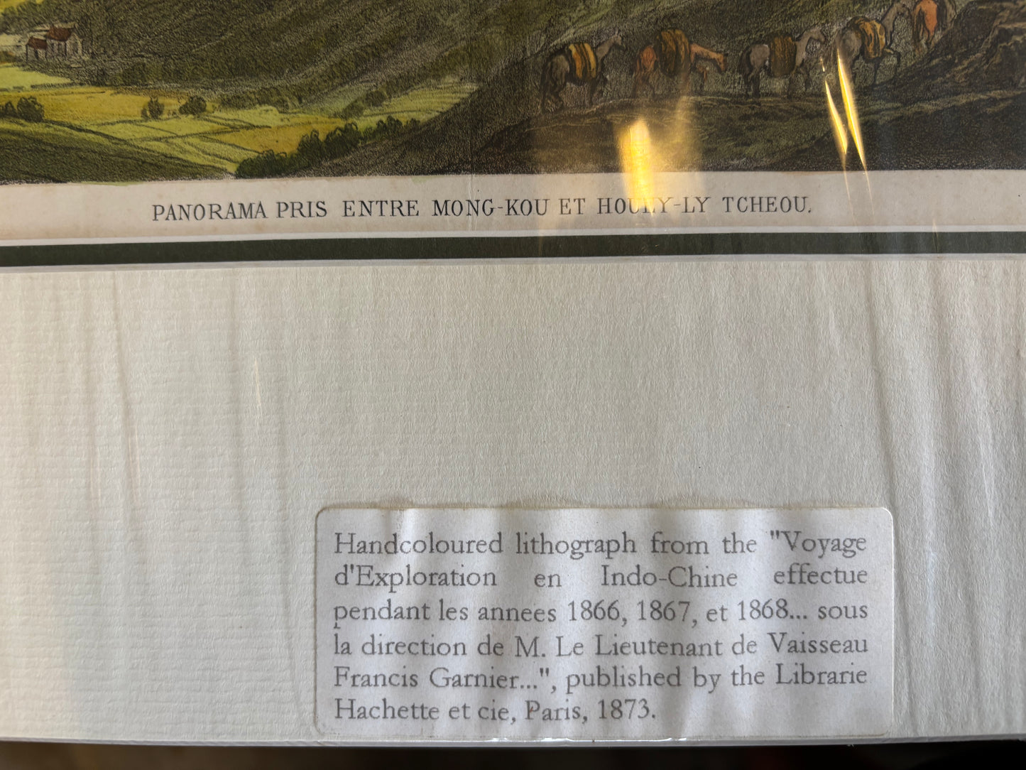
Panorama pris entre Mong-Kou et Houly-Tcheou
Artist: Louis Delaporte (1842–1925)
Published in: Paris by Hachette & Co.
Year: 1873
From: Voyage d’exploration en Indo-Chine (The Garnier/Mekong Expedition)
Condition: Large-format tinted lithograph; professionally matted and framed.
A Sweeping View of the Yunnan Highlands
This grand panoramic lithograph is one of the most visually impressive plates from the official record of the French Mekong Exploration Commission (1866–1868). While many plates in the series focus on individual people or buildings, this "Panorama" provides a vast, strategic view of the rugged terrain between the settlements of Mong-Kou (Mengku) and Houly-Tcheou in Southern China’s Yunnan province.
Historical and Artistic Significance
- Louis Delaporte’s Vision: As the official artist of the expedition, Delaporte was tasked with documenting the "unseen" interior of Asia for the French government. This specific plate showcases his skill in capturing the immense scale and verticality of the Himalayan foothills.
- The Expeditionary Column: If you look closely at the lower right of the print, you can see a tiny caravan of horses and figures winding along the mountain path. This represents the actual French expeditionary party as they navigated the "denuded" mountain ranges between Yunnan and Sichuan.
- The "HIND" of Exploration: Like the military maps of the era, this panorama served as a vital piece of geographic intelligence, revealing the challenging topography that the French hoped might one day serve as a trade route via the Mekong or Red River.