Treasures of the Orient
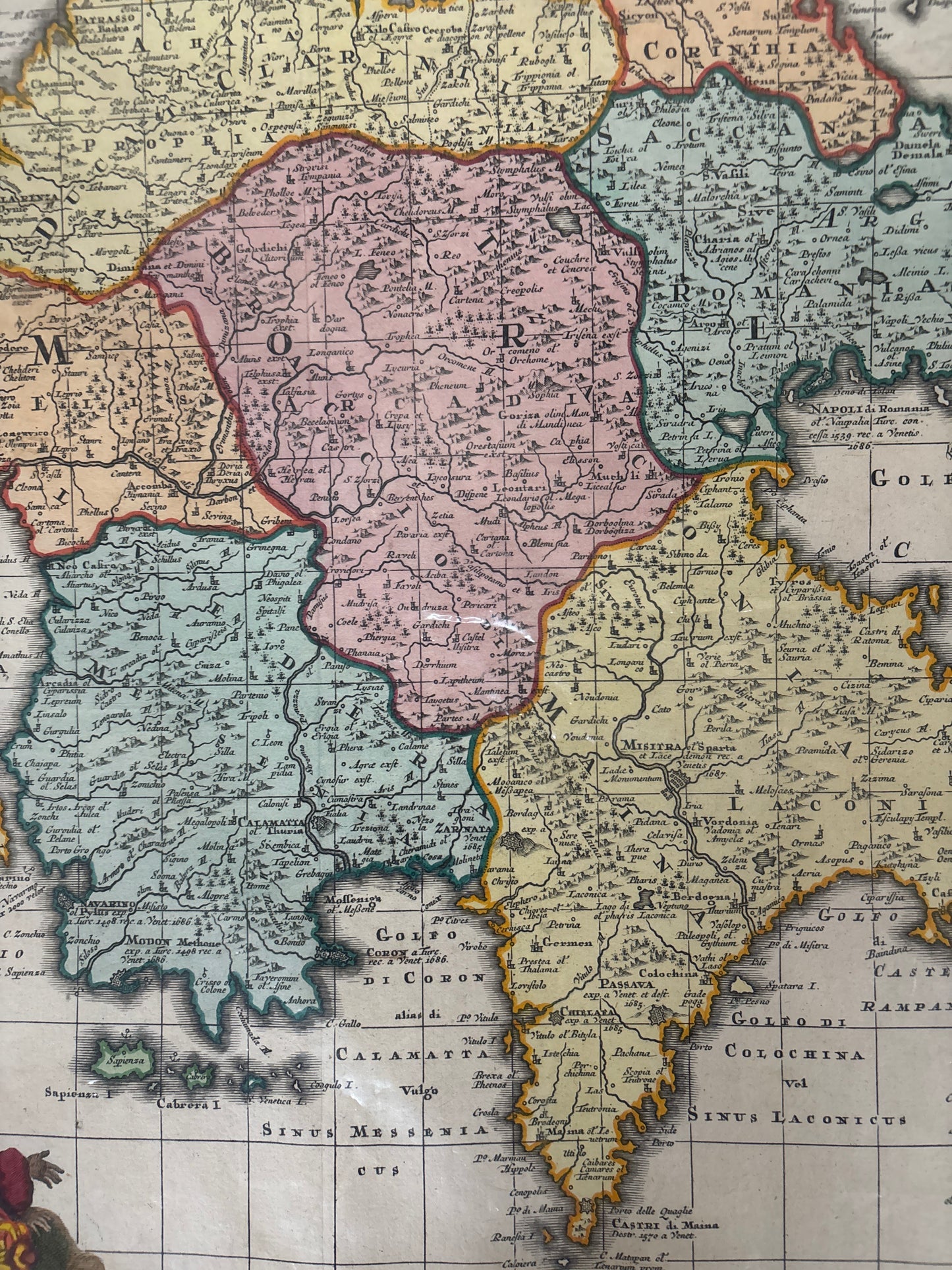
Morea - Seutter c.1730
Morea - Seutter c.1730
Seutter’s Map of the Morea (c. 1730)
Title: Peloponnesus Hodie Morea: Ad Normam Veterum et Recentiorum Mappae Accuratissime Adornata
Cartographer: Matthäus Seutter
Origin: Augsburg, Germany
Date: c. 1730
Technique: Copperplate engraving with original hand-colouring
The Narrative: A Battlefield of Empires
This map tells the story of the Morea (the Peloponnese peninsula) during a period of intense conflict between the Venetian Republic and the Ottoman Empire. By the early 18th century, this region was a primary theatre of the Ottoman–Venetian Wars. Seutter’s map serves as both a geographic record and a piece of political propaganda, documenting the various provinces—such as Arcadia, Messenia, and Laconia—at a time when their possession was fiercely contested.
The map captures the rugged, mountainous terrain of the Greek heartland and its complex coastline, dotted with strategic forts and ancient cities. It reflects a Europe fascinated by the "Classical" past but deeply preoccupied with the contemporary military struggle against the "Grand Turk" for control of the Mediterranean.
Chronicles of the Map
-
The Allegorical Cartouche: The lower-left corner features a stunning, politically charged cartouche. It depicts a Venetian Lion standing triumphantly over a fallen Ottoman soldier and a discarded crescent shield, while a Christian cross radiates light from an altar—symbolizing the victory of the "Holy League" over the Ottoman forces.
-
Provincial Divisions: The peninsula is meticulously divided into its historical and administrative regions, each highlighted with vibrant, contrasting hand-colouring to aid in military and scholarly identification.
-
The Ionian Islands: The map includes detailed renderings of the nearby Ionian Islands, such as Zante (Zakynthos) and Cephalonia, which served as vital naval bases for the Venetian fleet.
-
Seutter’s Precision: As the "Imperial Geographer" to the Holy Roman Emperor, Seutter was known for his dense, information-rich style and high production values, making this one of the most sought-after 18th-century maps of Greece.