Treasures of the Orient
New South Wales & Van Diemen’s Land - c. 1850s
New South Wales & Van Diemen’s Land - c. 1850s
Philip’s Map of New South Wales & Van Diemen’s Land (c. 1850s)
Title: New South Wales [with] Van Diemen’s Land from the Most Recent Authorities and Surveys
Publisher: George Philip & Son
Origin: London & Liverpool, United Kingdom
Date: c. 1852–1856
Technique: Steel engraving with original hand-colouring
The Frontier of the Antipodes
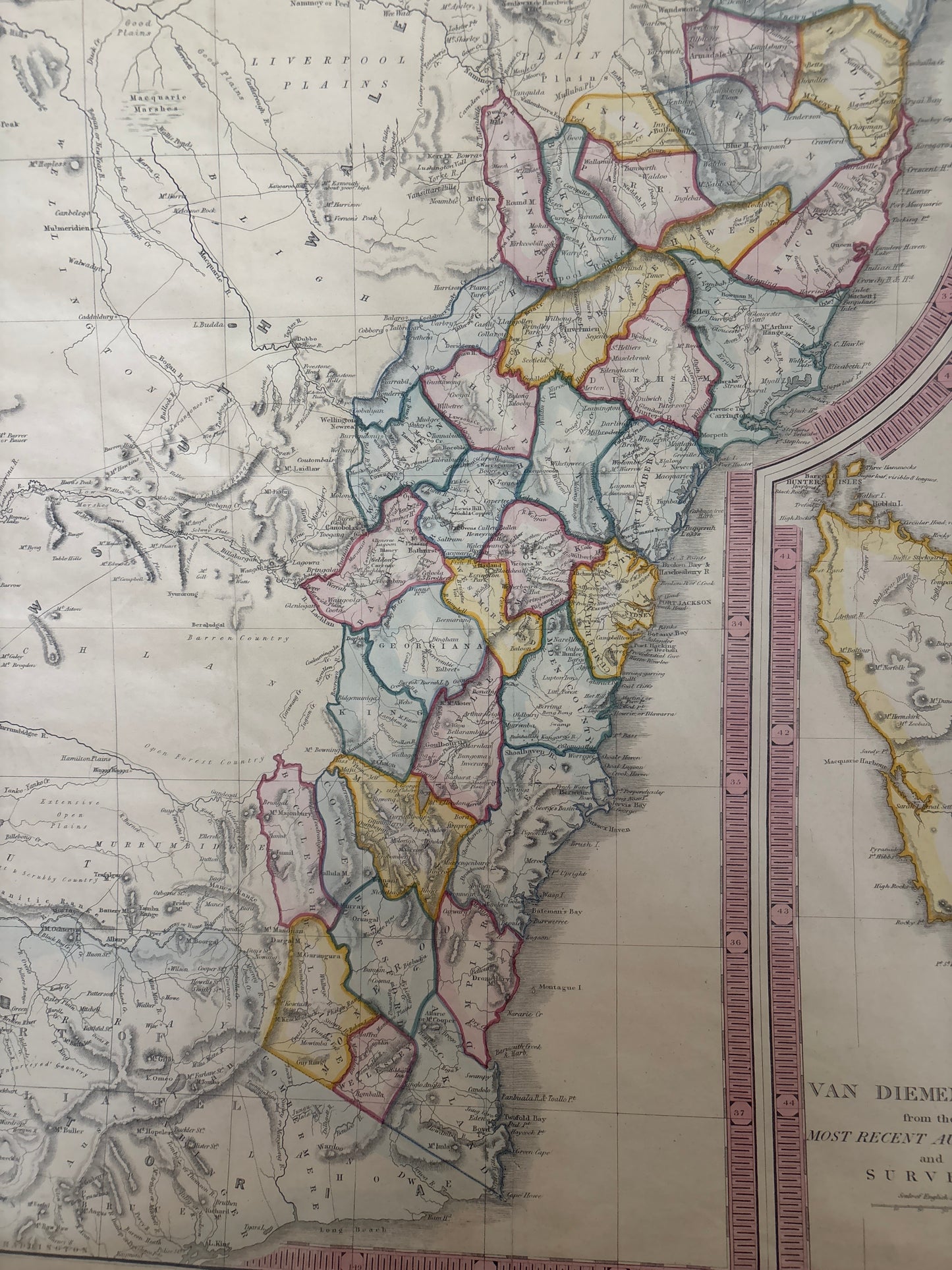
This map tells the story of the Australian colonies at the height of the mid-Victorian era. Published just as the Gold Rush was transforming the continent, this sheet provides a detailed look at New South Wales, illustrating the established counties and the newly surveyed territories stretching toward the Liverpool Plains and the Darling River. It serves as a historical record of the pastoral and administrative growth of the colony, documenting the transition from a penal settlement to a thriving agricultural and mining power.
The inclusion of Van Diemen’s Land (Tasmania) as a large, separate inset highlights the importance of the island colony to the overall maritime and economic network of the region. It is a map of progress, showing the "most recent authorities and surveys" in a landscape that was still being actively defined by European explorers and settlers.
Chronicles of the Map
-
The County System: The map is expertly divided into the original nineteen counties of New South Wales, each distinguished by delicate hand-colouring, illustrating the organized sprawl of colonial governance.
-
Van Diemen’s Land: A significant, full-height inset provides a detailed view of Tasmania, including its early districts and the rugged interior that was a focal point for early 19th-century settlement.
-
Topographical Precision: The map meticulously renders the Great Dividing Range, the intricate river systems of the Murray-Darling basin, and the expansive Liverpool Plains.
-
George Philip & Son Pedigree: Known for producing high-quality educational and commercial atlases, George Philip was a premier name in 19th-century cartography, ensuring that this map was a standard reference for merchants and emigrants alike.