Treasures of the Orient
New Zealand and New Guinea - Johnston 1892
New Zealand and New Guinea - Johnston 1892
Johnston’s Map of New Zealand and New Guinea (1892)
Title: New Zealand / New Guinea
Cartographer: Keith Johnston, F.R.S.E.
Origin: Edinburgh & London, United Kingdom
Date: 1892
Technique: Steelplate engraving with original hand-outline colouring
Defining the Southern Frontiers
This map tells the story of the British Empire’s rapid geographic expansion and administrative formalization in the South Pacific. By the early 1890s, New Zealand had moved past its early frontier days into a period of settled provincial growth, while New Guinea remained a contested "New Frontier". Keith Johnston, a member of the Royal Geographical Society, produced this map to provide the most current data on these developing territories.
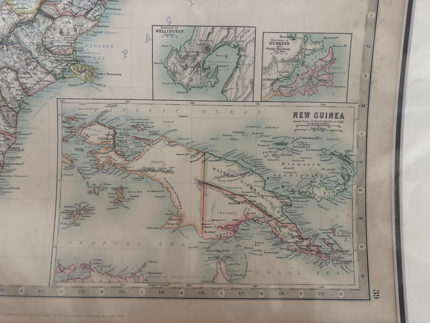
The main map provides a meticulous overview of the North Island and South Island, divided into their respective provinces. It is a record of a transformed landscape, showing the burgeoning rail networks, mountainous terrain, and coastal settlements that defined late-Victorian New Zealand. Below this, the detailed map of New Guinea highlights the geopolitical divisions between the British, Dutch, and German spheres of influence, capturing the island at the height of the colonial "Scramble for the Pacific".
Chronicles of the Map
-
The Johnston Legacy: The Johnston firm of Edinburgh was world-renowned for its "Royal Atlas" series, which set the global standard for clarity and topographical accuracy in the late 19th century.
-
New Guinea Inset: The large inset map of New Guinea is of particular interest to regional collectors, as it clearly demarcates Kaiser-Wilhelmsland (German), British New Guinea, and Dutch New Guinea.
-
Urban Anatomy: The sheet includes specialized inset plans for the critical harbours of Auckland, Wellington, and Dunedin (Otago), illustrating the maritime infrastructure that linked New Zealand to the wider world.
-
Scientific Detail: The map features sophisticated hachuring to represent the Southern Alps and other mountain ranges, combined with a dense network of place names that reflect the latest surveys of the era.