Treasures of the Orient
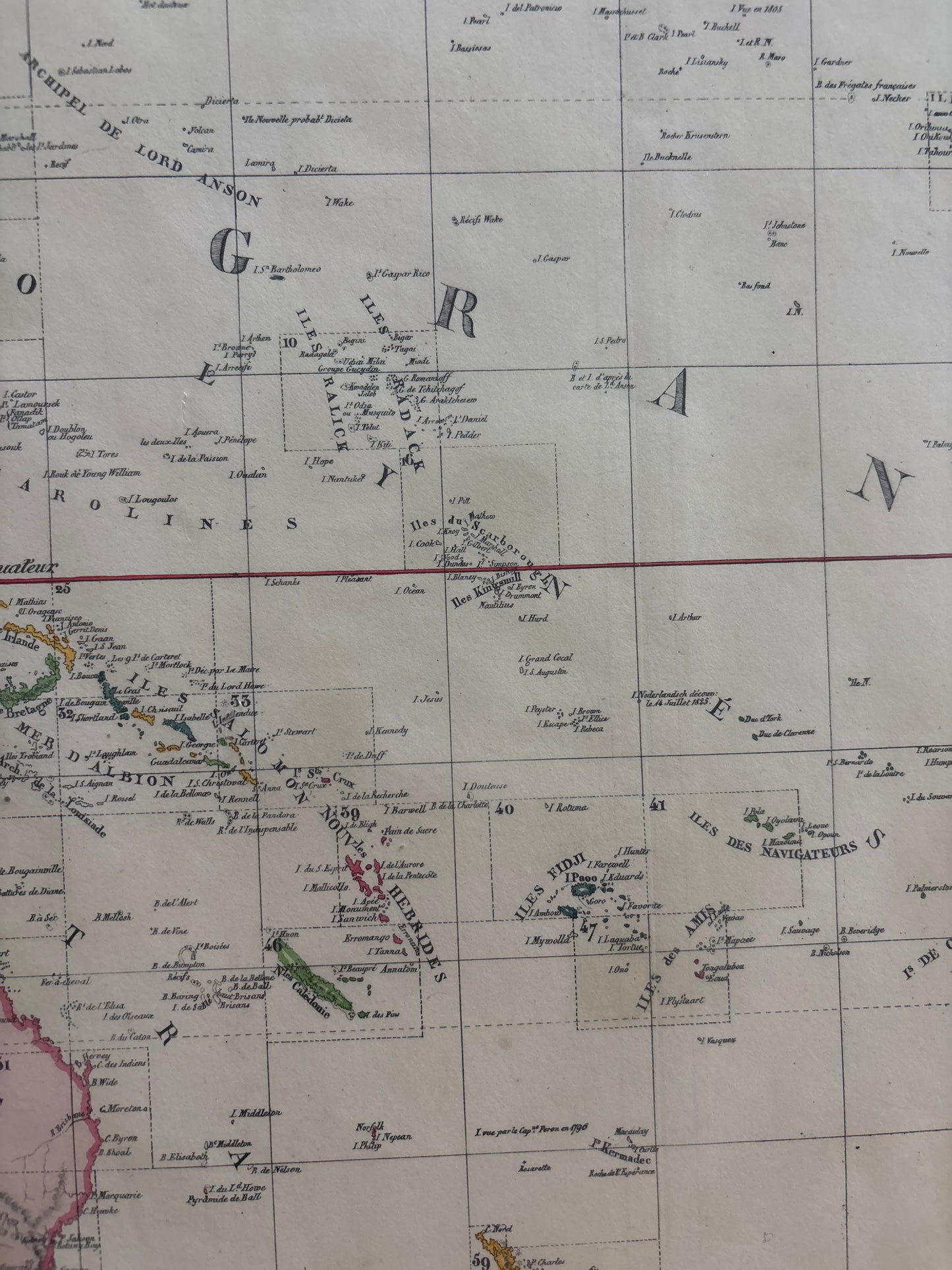
Carte d’Assemblage de l’Océanique - Vandermaelen 1827
Carte d’Assemblage de l’Océanique - Vandermaelen 1827
Vandermaelen’s Index Map of Oceania (1827)
Title: Carte d’Assemblage de l’Océanique
Cartographer: Philippe Marie Guillaume Vandermaelen
Origin: Brussels, Belgium
Date: 1827
Technique: Lithograph with original hand-colouring
The Narrative: The First Great Lithographic Atlas
This map tells the story of a revolutionary moment in cartography. Published in 1827, Vandermaelen’s Atlas Universel was the first atlas in history to be produced entirely by lithography and the first to be designed on a uniform scale. This "Carte d’Assemblage" serves as the master index for the Oceania volume, providing a sweeping overview of the vast Pacific world—stretching from the East Indies and China to the Americas, and from the North Pacific down to New Holland (Australia) and New Zealand.
It captures the Pacific at a time of intense scientific and colonial reorganization. Unlike earlier maps that relied on artistic flourishes, Vandermaelen’s work is a triumph of technical precision. It meticulously plots the countless islands and archipelagos of the "Great Ocean," acting as a key to one of the most ambitious geographic projects of the 19th century.
Chronicles of the Map
-
The Lithographic Revolution: As a pioneer of lithography, Vandermaelen was able to produce maps with a level of clarity and fine detail that traditional copper engraving could rarely match.
-
Nouvelle Hollande & Van Diemen’s Land: The map features an expertly rendered outline of Australia (labeled Nouvelle Hollande) and Tasmania, reflecting the rapid expansion of geographical knowledge in the southern hemisphere.
-
The Pacific Rim: The map perfectly illustrates the connection between the Old World and the New, showing the proximity of China and Japan to the western coast of North America (labeled Amérique Septentrionale).
-
Elegant Simplicity: Characteristic of Vandermaelen’s style, the map uses soft, original hand-colouring—pink for Australia and America, yellow for Asia—to provide immediate visual clarity across the massive oceanic expanse.